Slave to the Game
Online Gaming Community
ALL WORLD WARS
USSR NAVY
by Division of US Naval Intelligence, 1943
Part II
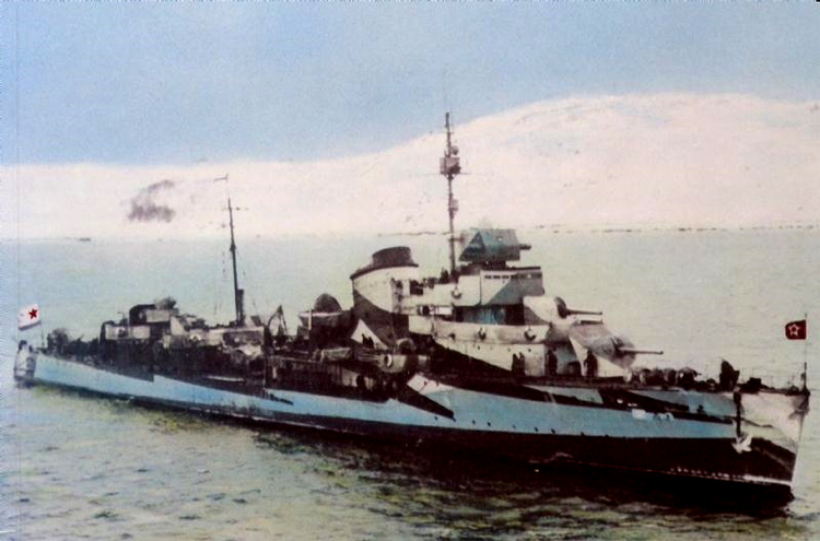
Russian North Fleet Destroyer GORDY Class, circa 1942
CHAPTER VIII. NAVAL BASES AND YARDS
A. BALTIC SEA
For over two years, the chief naval base of the entire U.S.S.R., located at Leningrad and vicinity, has been subjected to almost constant bombing as well as to attacks made on it, from time to time, by land and sea forces.
The position of Leningrad on a number of islands makes its communications system particularly vulnerable5 bridges over the numerous waterways are strikingly few. Connecting the important Vasilievski Island with the rest of Leningrad, for example, there are only five bridges; this island commands the most important point of the entire city.
Probably only the most essential industry is still operating at Leningrad; all the rest has been transported farther to the east. By the summer of 1942, most of the unessential population had been evacuated as well.
Nothing is known of the present-day condition of Leningrad; it is reasonably certain, however, that it is impossible to undertake any degree of shipbuilding here, although occasional reports have stated that the overage battleship GANGUT, as well as various other units of the Baltic Fleet, have been under repair. It is believed that the heavy cruiser MAXIM GORKI was repaired and made fit for action after having been seriously damaged by bombs.
Leningrad was and still is the chief base for the Soviet Baltic
Fleet, which, up to the time of the German attack, was by far the most
important Russian fleet.
The Leningrad Naval Base may be roughly divided as follows:
(a) The city of Leningrad, including nearby islands—the location of
most of the ship building and ship repair facilities of the Baltic
Sea, as well as that of a naval base,
(b) Kronstadt, on Kotlina Island—the chief naval base and naval operating base for the Soviet Baltic Fleet. A few ship building and
ship repair facilities were located here. Kronstadt, together
with smaller nearby islands, contained most of the coastal defense batteries of Leningrad.
(c) Oranienbaum—a subsidiary naval operating base.
(d) Peterhoff—a small naval harbor.
(e) Schlusselburg—the base of the Lake Ladoga Flotilla for the protection of Leningrad from the east and north. A seaplane station
was located here as well as a shipyard capable of carrying out repairs to the local flotilla. No information is available on the
condition of this base since its evacuation by the Germans several
months ago.
Prior to the outbreak of the war, Leningrad possessed the following ship building and ship repair yards
(1) Imeni S. Ordzhonikidze Shipbuilding Yards (at Kronstadt and Leningrad)
This yard was reconstructed between 1936-1939. There was a 6000-ton floating drydock and a graving dock at the Kronstadt section of the yard. The large west slip could build ships which would be up to 820 feet
long and 100 ft. beam; the large east slip could build ships 820 ft. long and 230-260 ft. beam. There were 3 small concrete slips 330 ft. long and 4. wooden slips for building submarines. This yard could construct 2 large vessels and as many as ,12 submarines or 15 small vessels simultaneously. There was a large section for the production of engines and boilers of all types and the yard was important as being the only one in the north which could make round hulls for submarines.
(2) Imeni A. Marti Shipbuilding Works. Number 194. (at Leningrad).
This yard was located on Galerni Island. It was capable of building 2 up-to-date capital ships and about 8 smaller vessels or submarines -simultaneously. The north and south concrete slips could build ships 770 ft. by 105 ft.; it could be converted into 2 tracks for building 4 ships 3^0 ft. by 55 ft.; there were in addition 15 wooden slips. Associated engineering- works constructed engines, boilers, and auxiliary machinery for all tjrpes of smaller vessels. There were two graving docks and on« floating drydock of 4000-ton capacity,
(3) Sodomekh Shipbuilding Works. Number 196 (at Leningrad)
Prior to the outbreak of the war, this yard was reconstructed and fitted but for building submarines. There were two enclosed slips 360 ft. long and 65 ft. wid«, 2 open slips 520 ft. long and 90 ft. wide, as well as a. certain number of wooden slips.
(4.) Imeni A. Zhdanov Shipbuilding Yard. Number 190 (at Leningrad).
This was formerly Putilov Works;, it was capable of building 2 3000-ton destroyers and about 5 small vessels (or of assembling 5 submarines) simultaneously. It could not build submarines complete but assembled them from parts supplied by th« Ordzhonikidze Yards. Associated engineering works constructed engines, boilers, and auxiliary machinery for all types of smaller vessels. There were 9 concrete slips to take-ships from 330 ft to 550 ft. long and a wooden slip for the simultaneous construction of 28 trawlers. The latter occupied an area of 690 by 350 ft. There was 1 6000-ton floating drydock.
(5) Izhbrski State Works (at Kolpino, southeast of Leningrad)
This yard was located at Kolpino on the Izhora River. It was capable of building 4- destroyers and of assembling 4- submarines simultaneously. This yard specialized in the production of armor plating.
(6) Admiralty Dock Yard (at Kronstadt)
Up to the time of the war, this yard undertook no construction but only repaired submarines and was the location for the "Kirov" Submarine School. There were 2 small floating docks of 2000-ton and 700-ton lifting capacity, respectively, 2 graving docks and several cranes; the salvage ship "Kommuna11 was normally stationed here.
(7) Okhtenski Shipbuilding Yard (at Leningrad).
At one time, this yard constructed destroyers and assembled submarines, but at the time of the outbreak of the war, built only minesweepers, small river steamers, and lighters.
(8) Imeni Lepse Shipbuilding Works. Number 5 (at Leningrad).
If planned reconstruction was completed at this yard, it was capable of building small destroyers and assembling submarines; there
was, however, nothing to indicate that submarine construction was carried on. There were 4 slips from 60 to 400 ft. in length.
(9) Pebrovski Shipbuilding lard (at Leningrad).
This was a newly-built yard and constructed and made repairs to motor torpedo boats and glisseurs.
(10) Schlusselburg Shipbuilding Ya.rd (at Scnlusselburg)
This yard was capable of carrying out necessary repairs to units of the Lake Ladoga Flotilla.
(11) Imeni Karakozova Shipbuilding Yard (at Leningrad).
This yard built wooden launches and boats.
Defenses:
No Information is available on defenses of Leningrad and its environs.
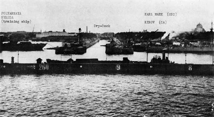
LENINGRAD
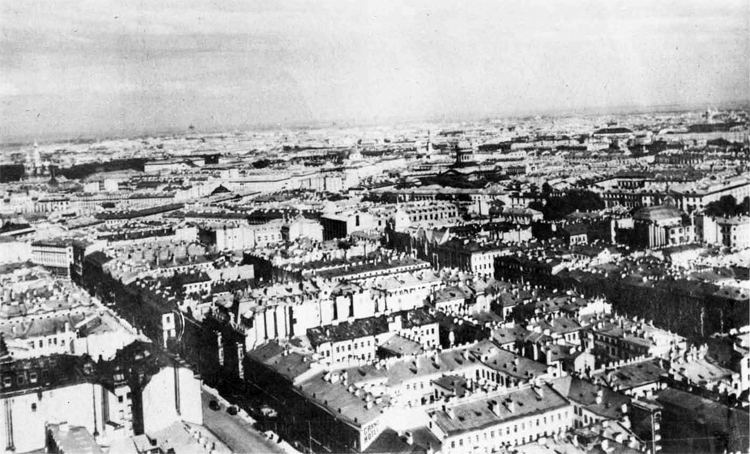
City of Leningrad.
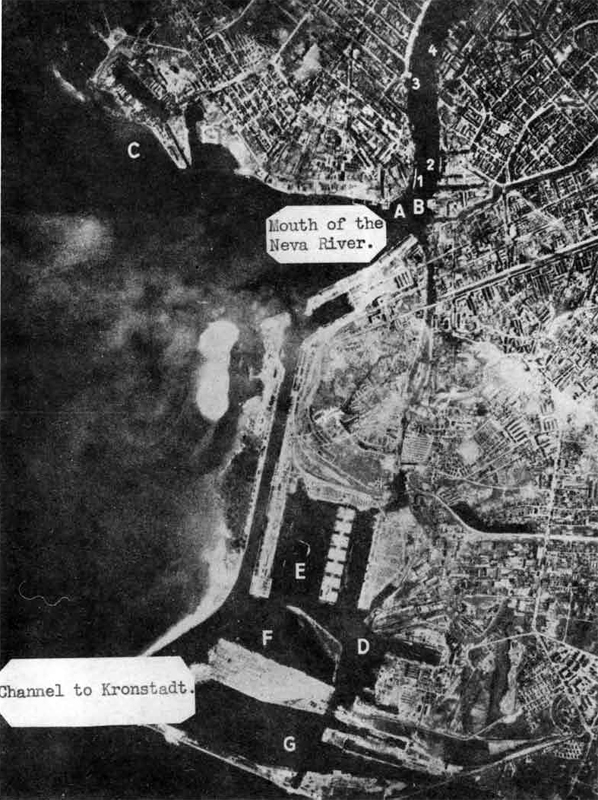
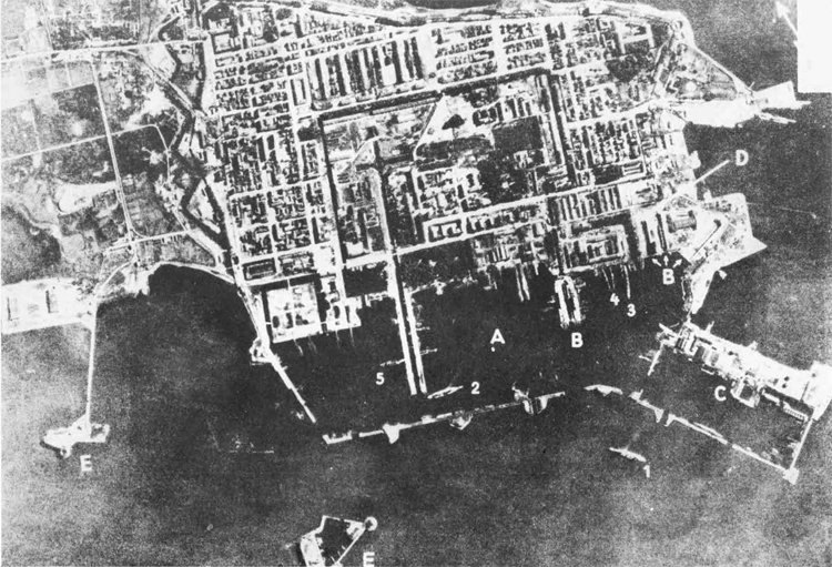
LENINGRAD (photograph taken August, 1941)
A = Baltic shipyards with ons battleship, one heavy cruiser, and
several destroyers under construction.
B = Marti Shipyards.
C = Wharves.
D = Zhdanov Shipyards with several destroyers under construction.
E = Anchorage with 9 freighters, totalling 20,000 tons.
F = Grain mole with several destroyers and one heavy cruiser under
construction of 4,500 tons.
G = Coal harbor with one dismantled battleship, and several destroyers.
1 = CA PETROPAVLOVSK (Ex German LUETZOW, Hipper Class) under construction,
2 = CA of the KIROV Class under construction.
3 = Floating drydock. 4 = Icebreaker
LENINGRAD
KRONSTADT (59°59'N., 29°46'E.)
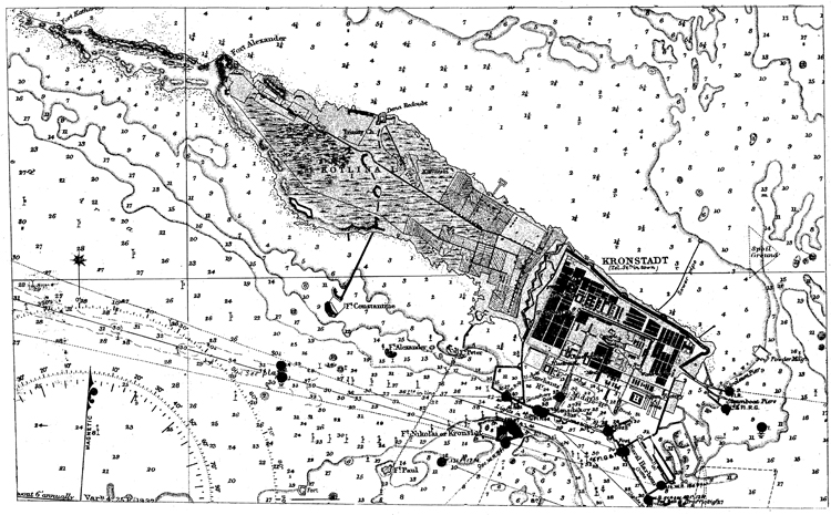
PETERHOFT
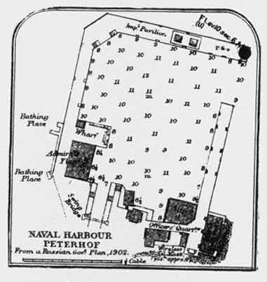
(59°53'N.( 29°55'E.)
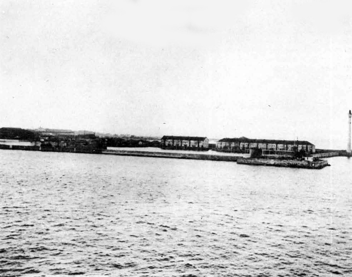
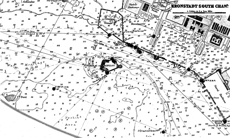
KRDNSTADT
KHONSTADT Photograph taken July, 1941
A. = Naval Base.
B = 4 drydocks
C - Arsenal.
D - Shipyard.
E = Coastal batteries.
1 = OBB GANGUT
2 = OBB PETROPAVLOVSK
3 = Damaged heavy cruiser
of the Kirov class.
4 = Tiro destroyers.
5 = Merchant ressel.
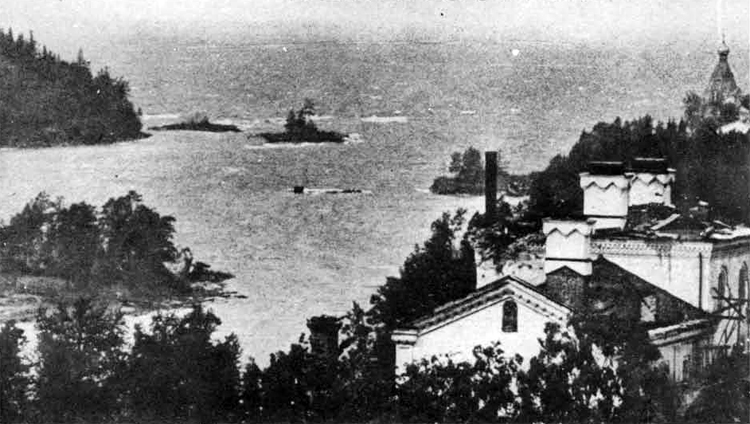
Shore of Lake Ladoga.
0RANIENBAUM (59°53'N., 29°51'E.)
Photograph taken August, 1941.
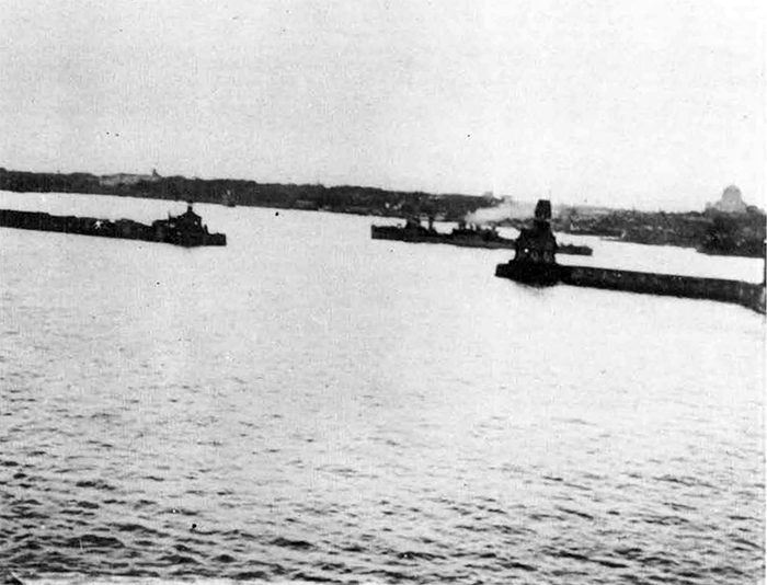
A = Harbor with the OCL AURORA, ons deatroyer, on« patrol vessel, 3 minesweepers, 2 submarines of the SCHCHUKA class, one freighter, and various coastal vessels.
B = Small boats harbor
B. BLACK-SEA
I. In General
ALTHOUGH the Germans
have been completely expelled from the
Caucasus, it is probable that the Russians are still compelled to use
the unsutable and ill-equipped bases of Poti and Batum. Before the
Germans evacuated the once important base of Novorossisk, they probably destroyed as many of the installations as they could; therefore,
it should be considered as impotent for some time to come. Despite
these facts, the Soviet Black Sea Fleet is exercising some of the advantages of sea power. Poti and Batum contain not only the greater
part of the Soviet Fleet but also all the remaining Black Sea Russian
merchantmen and tankers* It is fortunate indeed that the German threat
to the Caucasus lias been removed since this considerable amount of
shipping is very much congested and insufficiently dispersed against
any determined large scale bombing attack. The Soviet commander-in-chief must also be relieved to know that the Axis have no heavy naval
forces in Black Sea waters*since the dockyard facilities at his new
bases would be quite unable to cope with any large-scale damage after
a heavy Fleet action. In this connection, it is understood that at Batum
there are no docking facilities of any description and rather meagre
limited repair shops Poti, the manganese port some 30 miles to the
northward, is better off in this respect since it possesses two floating docks capable of taking any modern destroyer and some efficient
workshops, but it seems unlikely that either of these docks can accommodate a cruiser. A third floating dock was still beached at Sukhum
in July, 194-3• The modern 8,000-ton cruiser M0L0T0V has been lying disabled at Poti with her stern completely blown off since September, 194-2,
and so far no repairs have been effected. On the other hand, a complete
new bow has been fitted to a destroyer casualty which does prove that
major repair work can be carried out on smaller craft. The Fleet is
further handicapped by having no permanent ariffiiunition stowage, food
and supply yards. Russians, when pressed, are exceedingly capable improvisers,and it seems as if the Fleet is now sufficiently supplied
with ammunition and torpedoes. Hiere should be no lack of submarine
spare parts since, as an emergency measure, -it-would be feasible to
assemble spares from the nine Caspian Fleet submarines. With the threat
to Baku removed, there is no longer any function for these boats to perform. Between these two bases, the follov/ing naval vessels were berthed
in July, 1943.
Two modern cruisers (one damaged); two old cruisers; one old dreadnought battleship; one Flotilla Leader; six/seven modern destroyers (two damaged), two/three old destroyers and about 40 submarines of various classes, including large 750-ton boats, medium 550-ton class and some 12/13 baby 200 tonners.
In addition to this Fleet, there are also two modern cruiser hulls (KUIBYSHEV and FRUNZE) which were successfully towed away from the MARTI yard at NIKOLAEV prior to the German, occupation of that important Black Sea naval shipbuilding yard on the River BUG. There is also the hull of an uncompleted Flotilla Leader, ERIVAN, lying in BATUM
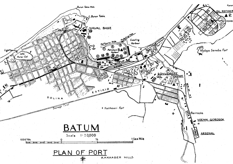
II. Batum (41°39'N., 41°38'E.)
Before the outbreak of the Soviet-German Jar, Batum was of strategic importance as a secondary base to Novorossisk for submarines and surface craft operating in the eastern part of the Black Sea. Batum anchorage is important as being easily the best in the southeastern portion of the Black Sea, but the great depths in the bay make it inconvenient; ships usually anchor close inshore y/ith their sterns secured to
bollards on shore. The prevailing wind is ^quthv/est,-and the port is ice-free all the year around. Batum Road affords shelter from all winds from east to northwest; the only winds to be feared are gales from the north which are rare. It is very seldom that vessels with their sterns moored to the shore have to haul off.
There is a current of from 1 to 1 1/2 knots for about 4 miles off-shore; this is caused by the out-flow of the Chorokh River.
The poart of Batum consists of three harbors: the Nyeft or Oil Harbor, the Kabotazh or Coastal Harbor, and the Harbor on the western side of Batum Bay. The whole of the western shore of the Bay consists of a natural quay or esplanade, alongside which there are depths of 23 l/2 ft. Oil Harbor lies in the southwestern corner of the Bay; in 1940> there were depths of 32 ft. at the Petroleum berths and 26 ft. in the other berths at this .harbor. Kabotazh Harbor lies southward of a mole which extends about 1 1/2 cables east northeastward from the elbow of Nyeft mole. This harbor has silted up ano^ in 1940,was too shallow to be of use.
At the commercial port there are five berths with a depth alongside of 32 feet, six berths with a depth alongside of 25 feet, two berths with a depth alongside of 23 feet, as well as eight wooden piers for small coastal craft, two of which serve as stations for NKVD coastal patrol boats and launches.
At Batum, there are berths for one or possibly two large cruisers, as well as for two destroyer or submarine flotillas.
At the naval base, there are buoys and a small slip for light craft just south of Cape Burun Tabie but no facilities for larger ships. This slip is complete with ship repairing workshops and a drydock, 100 feet long, 20 foot beam, and 12 foot depth.
Defenses
Little recent information is available on the defense system of Batum, During 1942 balloons were observed around the harbor and along the coast in the vicinity of the harbor. Only about twelve guns , were seen in action during enemy reconnaissance sorties; at that time, anti-aircraft guns were apparently of small calibre.
Work on the airport was in progress. Two asphalt runaways, northwest-southeast and northeast-southwest, were completed. The airport is "considerably longer than 900 yards" according to the same source, who saw biplane fighters on it.
During the flatter part of 1942, it was reported that a marine brigade was stationed at Batum.
BATUM
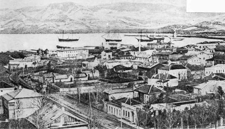
BATUM
BATUM
Photographs taken April, 1942
A =» Petroleum harbor.
B = Arsenal.
1 = Heavy cruiser of the Kirov class
2 = Tralning ship KOMINTERN.
3 = A destroyer leader.
A = Three incomplete destroyers.
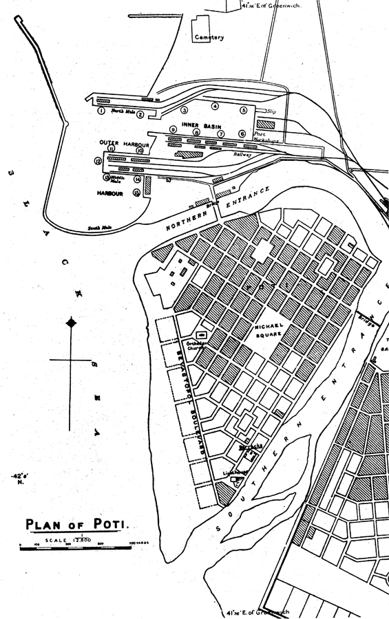
III. POTI
Prior to the outbreak of the war, the importance of Poti lay in the export of manganese ore, of which there are large deposits of very good quality in this area.
Poti Harbor is entered between 2 moles of which the southern forms an extension of the northern bank of the northern branch of the Rion River for about 2 3/4 cables in a westerly direction and thence for about 6 1/2 cables in a northerly direction. In 1938, there were depths of from 26 to 28 ft, inside the harbor. Northwesterly gales occasionally caused silting in the entrance and basins, decreasing the depths by as much as 1 l/2 ft. It is necessary to employ dredges constantly to remove this silt. The harbor is accessible throughout the year except during winds from the west or northwest when the backwash from the shore raises a heavy sea off the head of the southern mole. The harbor entrance is kept dredged to 29 ft., and vessels of 10,000 tons can be berthed alongside the quays. There were 3 wharves with a depth alongside of 25 ft., 6 with a depth alongside of 23 ft., 5 with a depth alongside of 20 ft., and 1 with a depth alongside of 16 ft.
Little information is available on repair facilities at Poti. It is known that two floating drydocks are available here and that each can accommodate two destroyers or submarines-simultaneously. In addition, small repairs can be carried-out at the port workshops and there is a small slip with a lifting capacity of 500 tons,
Poti can accommodate one or two cruisers and two destroyer or submarine flotillas. In July, 1943 > the following units were at this base: the overage battleship SEVASTOPOL, the badly damaged heavy cruiser M0L0T0V, which was still waiting for suitable docking facilities for repair to her stern', the hulls of the two incomplete cruisers, FRUNZE and KUIBYSHEV, were lying in the outer harbor and no progress on either vessel had been made, the overage heavy cruiser KRA3NY KAVKAZ, two destroyers in one floating drydock and two submarines in the other, the submarine tender VOLGA, with an undetermined number of submarines, (in October, 194-2, three divisions of submarines, consisting of 8-9 boats each were stationed here), various motor torpedo boats, coastal motor boats, minesweepers, harbor craft, etc.
Poti also serves as headquarters for the commander, submarines Black Sea, Rear Admiral Bultonov and his staff and as the headquarters for the commander, cruisers, Black Sea, Vice-Admiral Basisty and his staff. Admiral Basisty uses the OBB SEVASTOPOL as his headquarters and from there commands the cruisers and the destroyer leader KHARKOV (in October, 194-3, the Germans reported flat this last mentioned unit had been sunk). Poti also serves as headquarters for the naval Lieutenant General Kumanin, in command of all coastal defense from Sukhum to Batum.
Defenses
Between October, 1942, and July, 1943, improvements were made in the defenses of the harbor. The breakwater in the outer harbor was extended and a boom of Anti-Torpedo nets was laid across the entrance to this part of the harbor. A similar boom is still in use across the entrance to the inner harbor. The OBB SEVASTOPOL was lying alongside a jetty port side-to, in July, 194-3, and had torpedo nets along her starboard side which was open to the entrance. The old cruiser KOMINTERN no longer exists and the hull now forms part of the extensions to the outer breakwater.
There is a seaplane base on Lake Poleoston with an airfield for land aircraft alongside, with hangar repair workshops and fuel stores. The surface is fairly good, but unserviceable in winter and in bad weather.
It was reported in 1942 that M.B.R. 5's carry out continuous coastal patrols from this seaplane base go .ing as far north as 'Tuapse and as far south as Batum, and that they carry neither bombs nor depth charges, but upon sighting enemy submarine, do signal the coastal defense batteries which open fire according to these signals.
At the mouth of Khopi River, located about 15 miles north of Poti, a small naval base has been built. Little is known about this base, but there is a jetty on the southern shore of the river at which a destroyer can lie. In July, 1943, dredging appeared to be continuously in progress at the mouth of,the river. There is a bar at this point, which is liable to shift. The current in the river attains a rate of as much as 6 knots at times, making the bar dangerous and causing heavy breakers with any onshore sea or swell. In general, the river can only be entered when there is no swell. The area off the northern side of the moutti is very shallow; beyond the bar, the depths are "considerable" for several miles upstream.
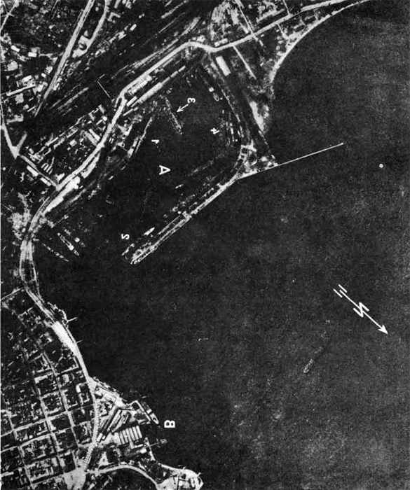
POTI HARBOUR
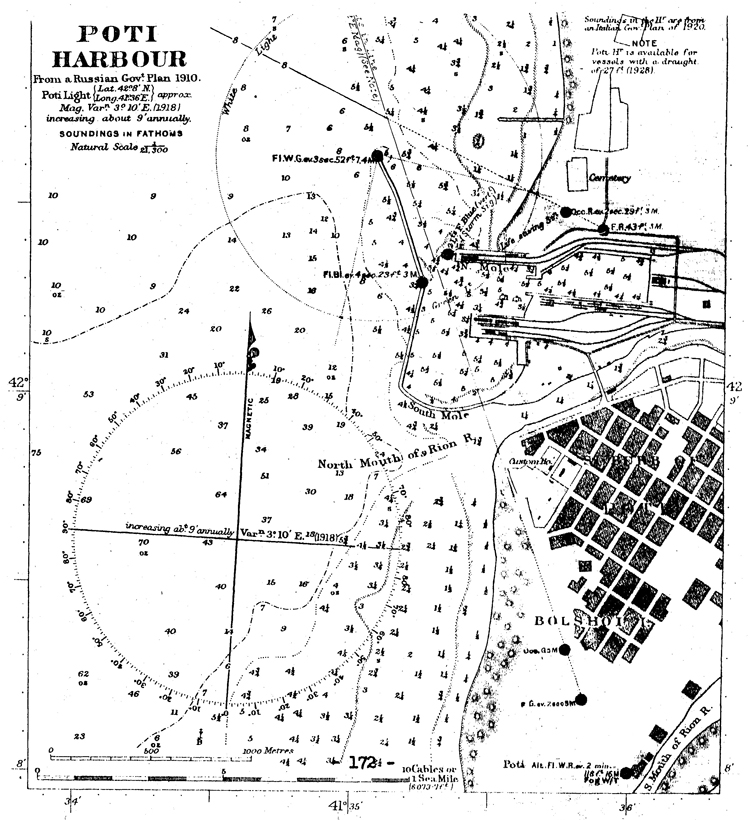
PLAN OF POTI.
POTI
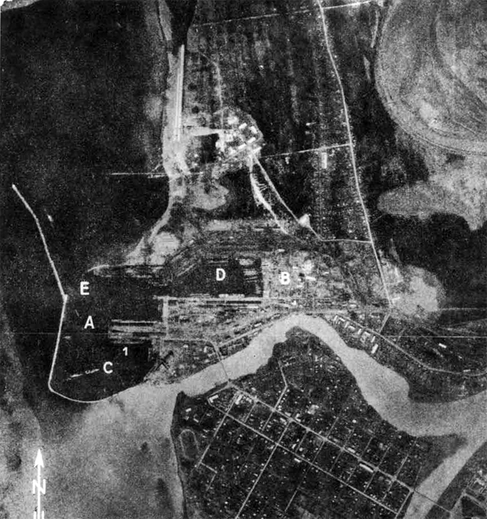
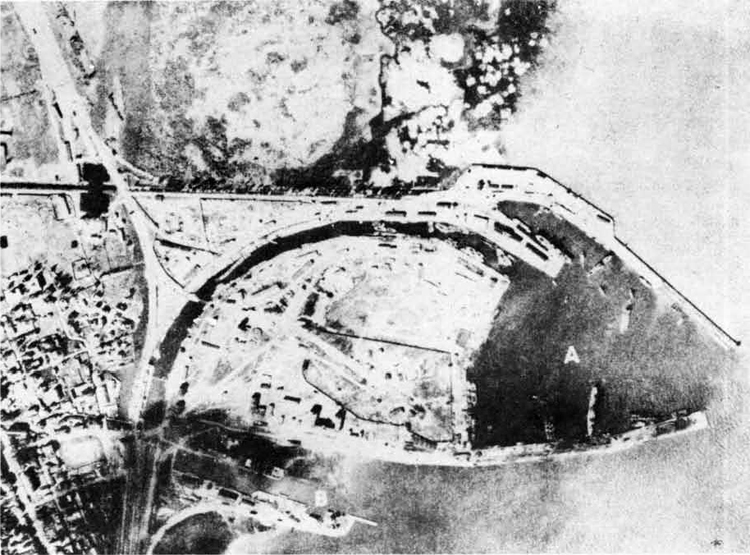
Photograph taken April, 1942
A = Naval Base.
B = Yard installations.
C = Floating drydock with OCA KRASNY KAVKAZ
D = Floating dryttock with one destroyer and one submarine.
E - Anti-submarine net.
1 = Heavy cruiser of the Kirov Class.
IV. Novorossisk (44°40'N., 37°49'E.)
No information is available on the condition of the naval base of Novorossisk since its recapture by the Russians in September, 1943. However, after the evacuation of Sevastopol by the Soviet Black Sea Fleet in the spring of 1942 until it was captured by the Germans in September, 1942, it was the main base for the larger units of the fleet; prior to the outbreak of the war, it was employed as a subsidiary base to Sevastopol and ordinarily accommodated submarines and light surface craft,
Novorossisk is a good, entirely sheltered harbor large enough to accommodate the entire fleet. The entrance to the bay is between Sudzhuk Point and Doob Point, about 4 3/4 miles apart. The bay is 3 1/2 miles long. The anchorage, at the head of the bay eastward of the town is considered dangerous during the autumn and winter months because of the prevailing northeasterly winds; these winds often increase to gales and even to hurricane strength during this period of the year. Novorossisk harbor never freezes.
Prior to the outbreak of the war, this harbor was the best-equipped port on the entire Caucasian coast. Small castings and repairs to machinery could be carried out. More extensive repairs could be effected at a motor works. There was a patent slip for small craft.
Before the Germans evacuated Novorossisk,they doubtless destroyed all defense equipment as well as port installations. However, prior to the outbreak of the war, the commercial port of Novorossisk possessed 10 wharves with a depth alongside of 30 ft., L, wharves with a depth alongside of 29 ft., 5 wharves with a depth alongside of 28 ft., 2 wharves with a depth alongside of 25 ft., 5 wharves with a depth alongside of 2U ft., 2 wharves with a depth alongside of 23 ft., 2 wharves with a depth alongside of 20 ft., and 1 v/harf with a depth alongside of 17 ft.
There were three large floating drydocks at Novorossisk prior to its occupation by the Germans; two of these drydocks are now at Poti, and the third is beached at Sukhum.
Defenses
It was observed that during their occupation, the Germans did not try to use the harbor of Novorossisk, as Soviet naval coast batteries shelled German positions very successfully. Coastal defenses between Novorossisk and Tuapse were very strong and well camouflaged in 1942. Exposed portions of the beach were protected by single fences of double-apron barbed wire. Defensive works were constructed principally of wood, stone, and earth, little concrete being used. There were many small machine gun positions and small excavations where individual riflemen could take cover, and, at the same time, procure a field of fire. No anti-tank blocks were seen on the beaches, although roads were often trenched and planked over in defiles and placed where diversion from the road would be difficult.
NOVOROSSISK
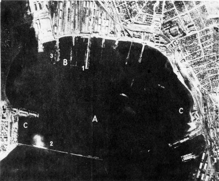
NOVOROSSISK
Photograph taken October, 1941.
A = Commercial Port.
B = Wharf installation under construction.
C = Two ahip repair shops.
1 = A heavy cruiser of the KIROV Class.
2 =» A cruiser hull.
3 = An icebreaker.
Port of Novorossisk.
Port of Novorossisk.
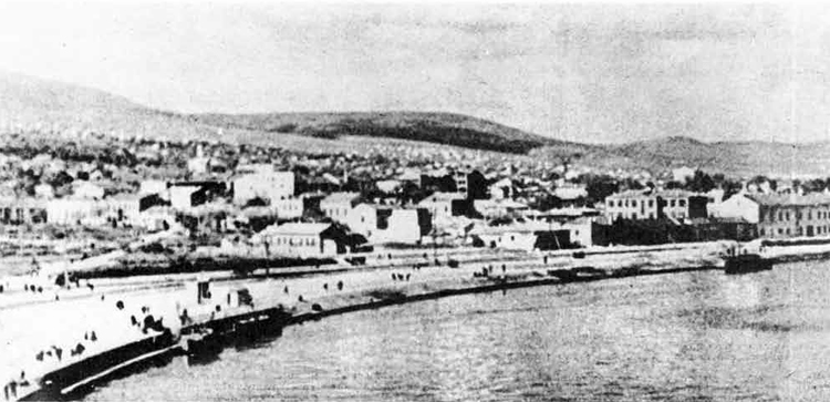
V. Tuapse (44°40'N., 37°49'E.)
In peacetime, Tuapse was not intended to be a naval base, and is not suitable as one, but was almost entirely used as a petroleum port depot for the Maikop oil fields. However, when the Soviet Black Sea Fleet was compelled to evacuate its base on Sevastopol in the spring of 1942, the headquarters of the Gommander-in-Chief, together with some units, came here. Repair facilities are not extensive; minor repairs can, however, be carried out, and warships can self-refit. In August, 1942, there was a small floating drydock, with a capacity of probably not more than 4^00 tons, and a factory, where mechanical repairs could be carried out. These installations have undoubtedly suffered from aerial bombardment, but the machine factory is believed to be still intact. Naval stores are kept on the wide mole. These facilities, which are ordinarily engaged mainly in making repairs to tankers, could carry out repairs to hulls and machinery.
The greater part of the Black Sea Fleet could*by carerul berthing, be accommodated here, but^because of the narrow harbor entrance, movements in and out of it would be a slow and difficult process. The harbor is well-sheltered and practically free from swell; the coastal current, setting northwestward, is much felt in the vicinity of Gape Kodosh at the entrance to the bay.
The port of Tuapse consists of 2 harbors: Old Harbor, v/hich is known as Government Port, in the western part of the bay, and New Harbor, also known as Rail Harbor, in its eastern part; these two harbors are separated by Shiroki Mole. This mole,over 1000 ft. long;,had a depth alongside in, 1938 of 18 ft. to 30 ft. A quay,which extends northwestward from the root of Shiroki Mole, has depths of 18ft. alongside. The Petroleum pier, which lies parallel to and about 1 l/2 cables within the innershore part of the southern mole, had depths in 1938 of 32 ft. alongside. In 1938, alongside the berths on the ?/estern side of the broad part of the southern mole, there were depths of 30 ft.
Defenses
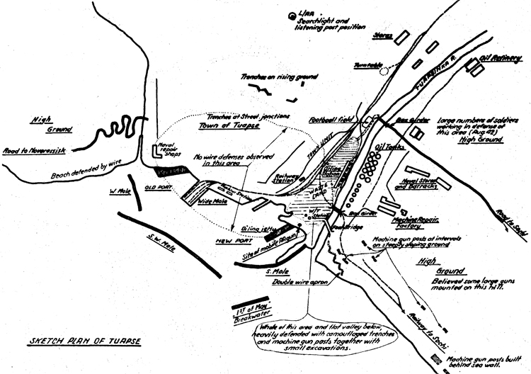
In 1942, the town of Tuapse was heavily defended by antiaircraft batteries which fired at sight and searchlights which seemed to work efficiently*but independently of the guns. Standard recognition signaling appeared to be in operation between light fighters and ground defenses.
In July and August, 1942, defenses in the wooded valley of the Tuapse River consisted of numerous machine gun posts at all strategic points; in certain positions, trenches were constructed between the strong points.
In October, 1942, the front came so close to Tuapse that the headquarters of the fleet were moved to Sukhunw In January, 1943, when the Germans had retired to Novorossisk, they were again moved northward to Makopse, about 10 miles southeast of Tuapse.
TUAPSE
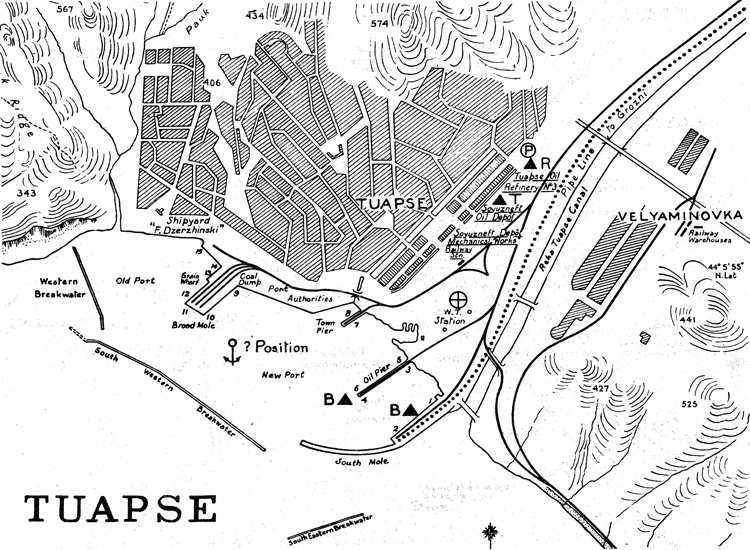
SKETCH PLAN OF OF TUAPSE
TUAPSE
Riotograph taken March, 1942.
A = Commercial port.
B = Naval araenal and navy yard
with 8 submarines tied up alongside.
1 = A heavy cruiser of the Kirov Class.
2 = A heavy cruiser of the Kirov Class
fitting out.
3 = Three destroyers.
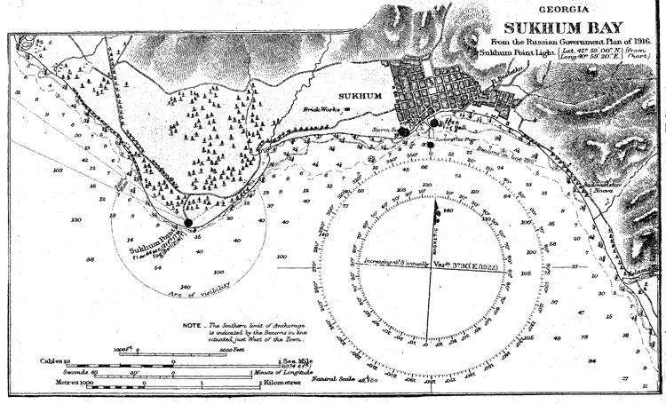
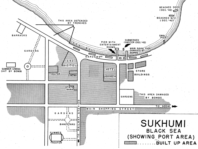
VI. SUKHUM (42°59'N., 40°59'E.)
From October, 1942, until January, 1943, until it was moved to Tuapse for the second time, Sukhum, formerly a seaside resort, served as headquarters for the High Command of the Soviet Black Sea Fleet. It was housed in the."Second Hotel" (see chart).
Port facilities consist of a large open roadstead which provides difficult anchorage in rough weather, three piers, at least one of which has been damaged by bombing, and including one small fishing pier, and some warehouses.
The entrance to Sukhum Bay is about 9 l/2 miles wide. Safe anchorage can be obtained in the bay in depths of from 18 to 20 fathoms, on the line of the light structures of the old fortress. The depths increase very rapidly a short distance south of this line so that care should be taken not to anchor south of it/ Small craft can obtain anchorage near the town.
There are three piers abreast of the town: the first of these, the most westerly, is 973 ft. long. There are depths on its western side of 30 ft. near its head, 23 ft. near its center, and 19 ft. near its inner end, and on its eastern side depths in the same positions are 30 ft., 23 ft., and 16 ft«, respectively. The other two piers have depths of 12 3/4 and 8 ft. respectively at their outer heads.
One of the three large floating drydocks, which were evacuated from Novorossisk, was beached at Sukhum in July, 194-35 whether it is in a usable state; at the present time, is not known.
Defenses
Little information is available on the defenses of Sukhum. During July and August, 1942, it was observed that anti-aircraft defenses were inadequate, but that they were later strengthened by mobile anti-aircraft guns which were placed in the valley around the town; by December, 1942, this same observer stated that Sukhum was reasonably well defended by anti-aircraft positions.
In 1942* it was observed that southeast of Sukhuin, where the road and railroad cross a river, on the southern bank of the river and on both sides of the railroad, there was a very large dump of war materials consisting of much inflammable stuff; it was not camouflaged or dispersed. Near the dump*there was a well camouflaged bomb dump.
There were reported to be, in 1942, one aerodrome and three landing fields in the vicinity of Sukhum. The aerodrome was located northwest of the town and was reportedly used by four-engine bombers. There was a,landing field near the town. About 10 miles southeast of the town, there was a landing field which was used extensively by transport planes; about 12 miles southeast of Sukhum, the re was an operational bomber and fighter landing field.
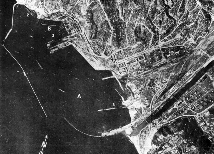
Sukhum Bay
SUKHUMI,
BLACK SEA
(SHOWING PORT AREA)
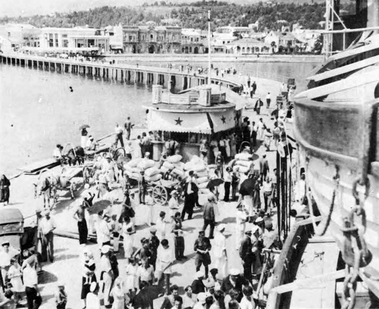
Sukhum - view of pier.
Sukhum - view of pier
1 VII. Ochemchir (42°44'N., 41°25'E.)
Ochemchiri is a very small port; it has a pier 160 feet long, with 13 feet of water at its seaward end. Both northward and southward of this pier, coastal flats are said to be forming due to deposits brought down by the river. There is a small breakwater at either side of the entrance to the harbor, and a boom of anti-torpedo nets has been placed between them. Apparently, there are few warehouses near the port, although it was observed in Octobar, 1942, that some wooden buildings were under construction. There are no drydock facilities, but there is a small boat slip, capable of taking motor torpedo boats; . there are few, if any, repair facilities. In 1938, the entrance channel had a depth of 21 feet.
The anchorage is located about 2 1/2 miles southeast of the harbor; it is an open roadstead, exposed to southerly and westerly winds, and ia dangerous during the winter months.
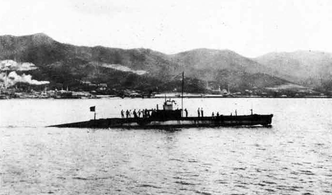
Ochemchiri is used as a base for one division of submarines; in July, 19-13, it was observed that 6 tlalodka (200 tons) class submarines and one overage Bolshevik class submarine were in port, together with the submarine tender Elbruz and a small coastal steamer, which serves as an overflow ship for submarine crews.
There is a landing field and a seaplane station located here. In 1942, there were numerous shore batteries between Ochemchiri and Sukhum, which were observed firing at night.
OCHEMCHIRI
Photograph taken April,1942.
A = The harbor.
VIII. Gelendzhik (44°33'N., 38°04'E.)
Gelendzhik may no longer be used as a naval base, nor that Axis forces have been expelled from the Caucasus. In December, 1942, it was observed that it was the most advanced unloading base for supplies with which to attack Novorossisk$ it was also used as a base for motor torpedo boats, motor minesweepers, coastal pat-rol vessels, and seaplanes. It was also observed at that time that there was no boom defense ab the entrance to the harbor. Because of almost constant bombing by the Germans during the siege of Novorossisk, it is impossible to estimate existing port facilities or coastal defense emplacements.
The town is situated on a round bay, with a fairly wide entrance. This entrance is about 1 mile in width. Anchorage can be , ' ' obtained in a depth of 5 1/4 fathoms in the southeastern corner of the bay. The bay is exposed to winds from the southwest and northeast, and winds from seaward send in a heavy sea. In normal summer weather or during southerly winds, a fairly strong current sets northeastward across the entrance to the bay.
There were several piers at Gelendzhik but none of them had sufficient depths alongside to be of naval use. Near the lighthouse., however, there were the foundations of a pier, unfinished in 1938, consisting of 3 large dolphins. The outermost of these dolphins lies about 1 cable off-shore with a depth of 3 1/2 fathoms alongside and had a mooring bollard on it. There was a small jetty in the northern corner of the bay.
C. NAVAL BASES IN THE FAR EAST
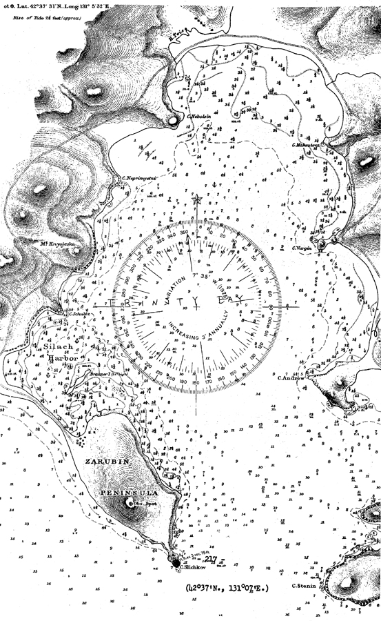
I. Vladivostok (43°05'N., 131°51'E.)
Vladivostok is the mostfc important city and port of the entire
Soviet Far East as well as having been and perhaps still being the chief naval base and shipbuilding yard. Because of the fact that in case of war with Japan, Vladivostok would doubtless become completely cut off, if not actually occupied by Japanese forces, the Soviet authorities have been developing the naval installations at Petropavlovsk with a view to making it supplant Vladivostok altogether. It is not known whether Petropavlovsk has?, as yet, supplanted Vladivostok as the primary Soviet naval base in the Far East, although construction started at Petropavlovsk as early as 1940. It is known, however, that the headquarters for the Soviet Pacific Fleet are still at Vladivostok.
Vladivostok has a fine natural harbor, and although this area is covered by ice for about 2 months a year, a channel is kept open at least as far as the commercial harbor by port ice breakers. The inner part of Golden Horn Bay is frozen on an average of 86 days a year, starting toward the end of December. The maximum tidal range at Vladivostok is.2-1/2 ft., and the bottom is mud, giving good holding ground. The harbor is completely protected in bad weather, but during the summer months, the approach is complicated by fogs which are particularly prevalent during June, July, and August, and which average 51 1/2$ foggy days. During the 9 months of open navigation,this average figure is 21%.
Vladivostok is a highly developed shipbuilding and ship repair yard as well as being a naval operating base and strongly fortified zone. The shipbuilding and ship repair facilities are mostly located in Vladivostok Harbor itselfj in the eastern reaches of Golden Horn Bay; naval operating bases are scattered throughout the various bays and inlets in the vicinity*
Commercially, Vladivostok is the most important port in the Soviet Far East. In 1943, the Russians officially stated that this port could accommodate 35 ships simultaneously and that depths alongside the wharves ranged from 25 ft. to 30 ft.; they added that* together with neighboring ports, 200,000 tons of freight could be handled monthly here.
It has become a fairly well-established fact that the entire Soviet Pacific Coast is tinder the control of the navy; this indicates a very great departure from the usual Russian custom of placing the navy in a very subservient position to that of the army. In 1941 > it was seen that the navy had its own telephone and power lines; sailors were observed doing all manner of work, such as working on the beach, on overhead power lines, in manholes on the telephone lines, etc. Due to the shortage of automobiles, the navy used many horses and carts for transportation at Vladivostok, and sailors were seen taking care of their own horses and stables. The navy had its own dance hall, restaurants, movie houses, and swimming beach. In October, 1943, it was stated that naval headquarters were located in the extreme northwestern corner of Golden Horn Bay. There is a naval academy for the purpose of training officers for the Far iikstern Fleet; it is located near the mouth of First River (North of Vladivostok). There are also two naval training schools for specialists1 ratings; one of these is located in the northeastern corner of Golden Horn Bay,
according to a report of April 1943. According a report of October 1943, the naval receiving station in the barracks are located in this same area.
Vladivostok is a heavily fortified zone. Information concerning its defenses is necessarily incomplete and of old date. Fortifications observed in 1941 have doubtless been enlarged and many others have been constructed; therefore, no attempt is made in the following paragraphs to estimate the strength and size of these fortifications. Since the beginning of the war, stone and wood fortifications, as well as other types of defenses, have been continuously under construction. These fortifications are believed to be of considerable size.
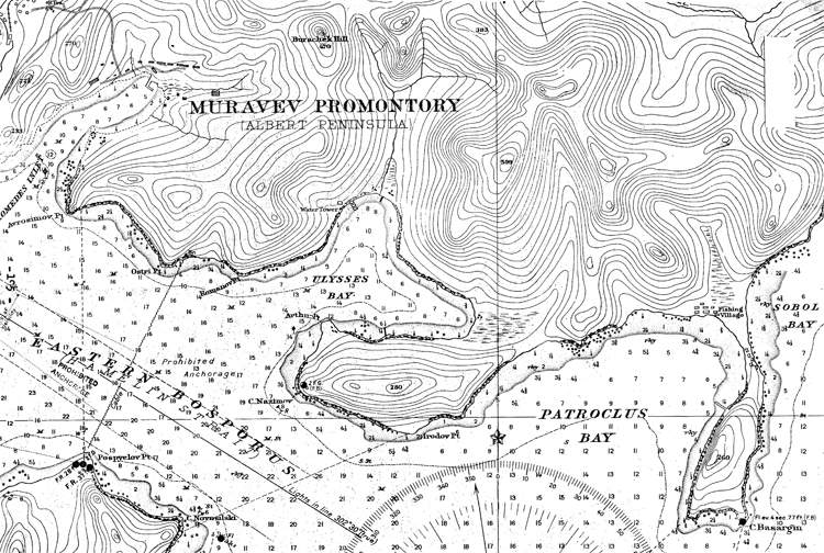
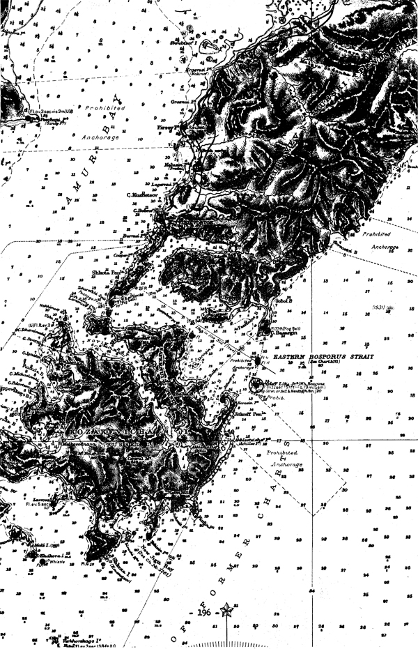
In 1941, three anti-submarine nets were observed guarding the entrances to Vladivostok Harbor. The first of these was stretched from Zhitkov Peninsula (Russki Island) to Cape Basargin (Muraviev Promontory) It ran from the shoals of Zhitkov Peninsula approximately northeastward to the shoals off the northwesterly end of Skriplev Island; from here, it ran in a northerly direction to the westerly end of Gape Basargin. The gate/which was located at approximately 43°02f 30lftand 131° 57%was marked on the south side by a red buoy and on the north side by a green buoy. The second net was stretched between Cape Novosilski (Russki Island) and Cape Nazimov (Muraviev Promontory); the gat£ was located at Cape Ndvosilski. The third net was stretched between Cape Bezimyanrii (Russki Island) and Cape Tokarevski (Shkota Peninsula); the gate to this net Was located at the northern end. It may have been that the first and second nets mentioned never operated at the same time, but that when one was working, the other was inoperative.
The area around Vladivostok is hilly and rugged, and a great portion of it is covered by a forest. Coastal defense batteries and antiaircraft emplacements are to be found on most of the numerous hills, and smaller mobile batteries have been placed in the forests. In 1941, on the southern portion of Shkota Peninsula, coastal artillery and anti-aircraft batteries had been constructed on the slopes of the four hills, the most northerly of these being Mt. Krestovaya. Farther to the north, at Mb. Tigrovaya, large caliber long-range guns were located; in June, 1941, three heavy high-altitude guns were seen at this point. On the western shore of Shkota Peninsula, anti-aircraft batteries were . seen near Cooper Point; a minimum of eight batteries were' also seen in the immediate vicinity of Coastal Trade Harbor. North of Vladivostok city, heavy coastal artillery guns as well as anti-aircraft batteries were seen from a distance on Mt. Klichkova and on Mt. Visokaya in June, 1941. Along the southern shore of Golden Horn Bay, many anti-aircraft batteries were observed, notably to the east of Point Klet.
In the eastern half of Golden Horn Bay, which area is reserved exclusively for naval use, there are a minimum of three graving docks and one and possibly more floating drydocks. The two graving:docks known as Eastern Drydocks,. located in the northeastern comer of the bay, . have a length overall of 635 1/2 ft., a length of blocks of 618 1/2 ft., and a breadth of entrance of sill at water level of 90 ft,, and a depth of sill at H.M.W.S. of 34. 1/2 ft. Farther to the west, it was reported in October, 1943, that Old.Drydock had been restored to use and is in good working order. This dock has a length overall of 573 ft., a length of blocks of 512 ft., a breadth of entrance of sill at water level of 90'ft., and a depth of sill at H.M.W.S. of 30 ft. There may be two additional graving docks, one in the commercial port and the other near Old Drydocks, but there is no confirmation of this fact. The chief floating drydock was reliably reported in 1940 as being able to accommodate a 10,000-ton cruiser; it is possible, however, that this dock has been transferred to Petropavlovsk.
In October, 1943, it was reported that there was a military post on the northcentral shore of Golden Horn Bay. Within this post are an arsenal and Old Drydock. East of this post and extending to and including Eastern Diydocks^ are the Vbroshilov Shipbuilding Yards. Within this enclosure are located four submarine ways, as well as ways capable of constructing destroyer leaders of the Leningrad Class (2900 tons); in March, 1941 > two such units were observed under construction. In September, 1941, it was observed that,on the southeastern shore of Golden Horn Ba.y, a large community with many new installations had sprung up5 it was believed to be purely naval. It was reported in April, 194-3, that submarines are shipped to Vladivostok in parts and are assembled there.
In October, 194-3, it was reported that,at Point Egersheld, there was a fuel oil bunkering depot for both naval and commercial craft, equipped with oil tanks; oil is loaded on board by means of lines which are extended from the shore on partly submerged barges. The same informant stated that a large naval fueling station was located on the southwestern shore of Transit Harbor, He added that in the nameless bay between Point Klet and Cape Goldobin there was a fueling station to which many submarines had been observed approaching the shore; many pipes were seen here. This source stated that there were twelve large oil tanks located at the mouth of First River (North of Vladivostok).
In addition to the above mentioned installations, the Assistant Naval Attache at Vladivostok stated in July, 194-3, that there were five . regiments of NKVD (secret police) troops stationed here. Two of these, the 70th and 117th, are railway troops. Two more, the 189th and 198th, are communications or signal corps troops. The fifth regiment, the 241st, serves as guards for political prisoners. He added that there were one coast guard unit, one salvage unit of the EPRON, and a munitions works (number 92) for the manufacture of army field pieces.
In October,194-3, it was reported that a railroad has been constructed from the center of Vladivostok, extending along the entire
coast as teas Patroclus Bay, serving Diomedes Bay, Ulysses Bay, and
Patroclus Bay.
Diomedes Bay was formerly a fishing port, but it has been converted for naval and military use and the trawlers and seiners stationed here were taken over by the navy. In 1941, guns were visible on the immediate banks of Cape Goldobin and Abrosimov Point which command the entrance to Diomedes Bay.
Ulysses Bay was always used as a naval operating base for submarines and, to a lesser degree, for small surface craft. In 1941, it was observed that a new naval base was under construction, and that there were oil tanks on the southern and eastern shores; several destroyers and eleven submarines were seen in the bay at that time. In 1941, permanent anti-aircraft batteries were seen at Ostri Point, and many mobile batteries were observed among the trees farther inland.
Patroclus Bay is a former fishing port and was converted for military and naval use in 1941 according to a report of September, 1943, and trawlers, and seiners stationed here were taken over by the navy. In 1941, a modern seaplane base was observed here with anchors on the neck of land at the western end of the bay.
Kozakevich (Rasski)Island is located due south of Vladivostok and is a restricted zone; no unauthorized persons are allowed to go
there. In October, 194-3, it was reported that extensive fortifications had recently been built here and that "twelve small masts, presumably radio antenna, were visible. The same informant stated that a submarine and torpedo boat base is located in Novik Bay and that the entire bay is used for the shelter of naval units. In April, 19-4-31 it was reported that a torpedo station and training base was located at Doronin Point in Novik Bay. This informant added that the old fortress on Russki Mountain had been abandoned and that it was being used as a decoy.
In March, 1941, anti-aircraft batteries were seen on the hill due east of the Torpedo Boat Canal, north of Novik Bay. In November, 19-40, other anti-aircraft emplacements were observed from Babkin Hill on the northwestern corner of the island.
It was estimated in August, 194-3, that the following fixed coastal defenses were in existence in the area between Posiette Bay and America 'Bay: 15 heavy artillery 2-gun batteries, 30 152 mm. 4-gun batteries, and 30 76 and 85 mm. 4-gun anti-aircraft batteries; this would indicate that a total of 11,250 officers and men ware employed on fixed coast defenses of this area.
Vladivostok - Churkin Point near entrance to Golden Horn Bay.
Vladivostok - Coastal Trade Harbor in Amur Bay.
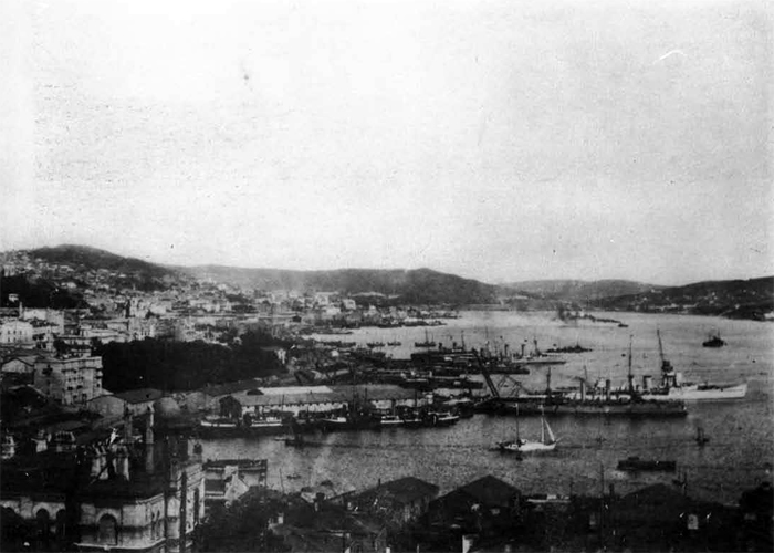
Vladivostok - Naval Base in Golden Horn Bay.
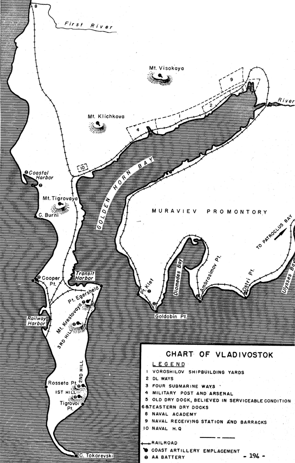
CHART OF VLADIVOSTOK
VLADIVOSTOK AREA
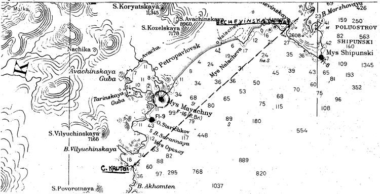
II. Petropavlovsk (53°00'N., 158°38'E)
Petropavlovsk is the second most Important, if not the most important, Soviut naval base in'tHe^eirttrs^Far East; it is the center and headquarters for the defense of all northeastern Siberia. As early ns 1940, it was reliably reported that construction on a lu.i\;e naval base was well on its way, with naval quays having been built on the eastern shore of Petropavlovsk Inner Harbor and that the naval port (on the southern shore of Rakovaya Bay) had already been equipped with a small repair yard, electrical workshops, and laboratories and a telegra; h station. YJhether Petropavlovsk is ca-able of accommodating the entire Soviet Far Eastern fleet, at the present time, is not known, as the Soviet authorities have consistently refused to allow our attaches accredited to the U.S.S.R. to inspect naval bases, or, for that matter, to even visit any portion of the Kamchatka Peninsula.
Although there is no confirmation of the fact, the chief naval base is probably located at Tarya (Tarinski) Bay, or more exactly, in Yagodnaya Bay (Wie easternmost extremity of Tarya Bay) . This is the only place in Avacha Bay which has a combination of a sufficiently large area, sufficient water, and which is adequately isolated from the corjnereial port. In September, 1941) it was reported that there was a submarine base on the northwestern shore of Yagodnaya Bay, equipped with five finger piers. It is believed that a breakwater has been built across the entrance to this large, well-sheltered harbor to further protect it from swells and to insure a quiet and secure anchorage.
Ice conditions in Tarya day are exceptionally favorable. ,Vhen the other bays within Avacha Bay are icebound, Tarya Bay is usually open because of the warm water rivers and lakes which surround it.
At I'arya Bay, the chief seaplane bases of the Soviet Kar i&stern fleet are located (in Seldevaya Bay and Yagodnaya Bay).
It is possible that one of the floating drydocks reported to be in iiakovaya Bay is in Tarya Bay. Three shipways have been reported here, with large machine shops and ship chandlery establishments at each.
General view of Tarya Bay and Island Khlebalkin. Looking east.
Northwest coast of Tarya Bay and Kozak Cape.
Lower left—eastern part of L. Blizhneye. On the right parts of Tarya Bay and Avacha Bay. In the background, the spurs of Klkhchik Mountains.
Hakovaya Bay contains the major shipbuilding and repair facilities of the port. The Kamchatka Shipbuilding and Ship Repair Yard is located on the northeast side of the Bay. The repair section with the usual shops was completed in 1937, but the shipbuilding section was still under construction in 1941, and its completion has not been determined. At that time, a ship repairing slip with lifting apparatus and three building slips were given as part of the facilities.
Of the three floating drydocks which scanty information indicates may be at Petropavlovsk, it is likely that the largest is installed at Rakovaya. A minimum of one is known to be in operation, large enough to accommodate at least a vessel of 3.211 tons light, and of 442 feet in length. This is probably the welded dock which was built by the Marty Shipyard at Nikolaev (on the Black Sea) and towed from that port to Petropavlovek in 1938. Specifications published at that time were:
Capacity 5,000 tons; Length 420 feet; Beam 100 feet;
Upon its arrival at Petropavlovsk, the official Soviet press announced that it had been placed under the administration of the People's Commissariat of Food Industry.
Another floating dock of 5,000-ton capacity and a third of 1,000 tons, transferred from Vladivostok, have been reported here.
It has been reported that the seaplane base of the Kamchatka Naval Frontier Guard is located at the northeastern end of the Inner Harbor of Petropavlovsk port, with hangars, oil, and other stores, repair shops, and even with facilities for assembling aircraft and that naval quays line the eastern side of Inner Harbor; due to the obvious congestion of th« port, it seems hardly likely that these installations still exist at that location.
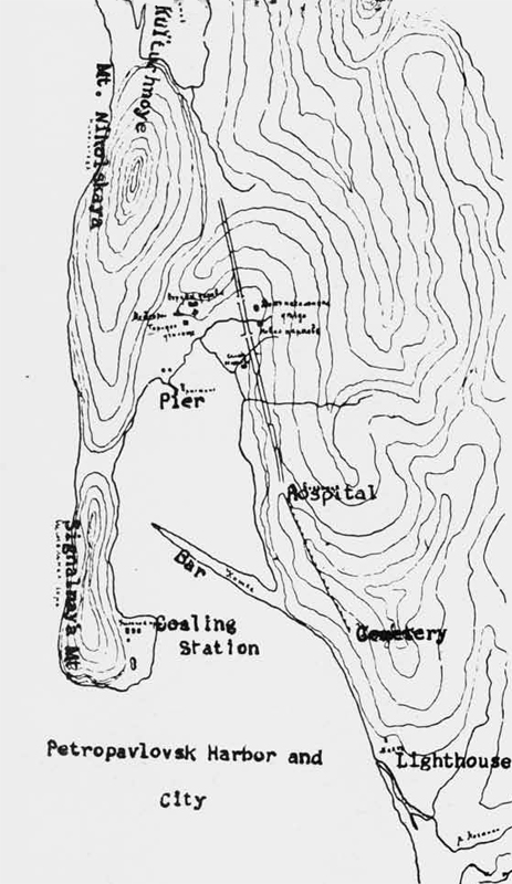
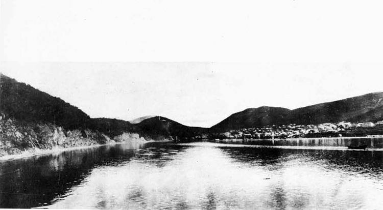
Petropavlovsk Harbor and City
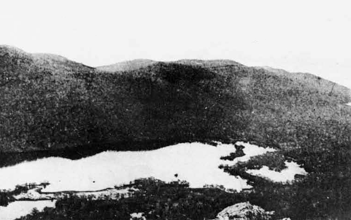
Petropavlovsk. Petrovakaya Mt. on the background, Signalnaya Mt. on the left.
One source, in September, 1943, stated that a submarine base is located in the area between the mouth of the Avacha River and the village of Mokhovaya in the northern reaches of Avacha Bay; this is the first indication of a submarine base in this area.
Several sources report the existence of a boom defence barrier at the entrance to Rakovaya Bay; a similar barrier may have been placed at the entrance to Tarya Bay. The entrance to Avacha Bay has been mined.
The primary military base on Kamchatka is located in the area of Petropavlovsk. It is estimated that at this base there are five heavy artillery (2-gun battery) installations, twelve 152 mm. (4-gun battery) installations, and six 76 and 85 mm. anti-aircraft (4-gun battery) installations. This would mean that 3,4-50 officers and men were employed in coast artillery emplacements at Petropavlovsk.
It has been definitely confirmed, that coastal artillery positions are located at the following places: Cape Sarannyi, Starichkov Island, Cape Bezymyanyi, Cape Srednyi, Stanitskii Point, Cape Uglovoi, Izmennyi Bay, Cape Vertikalnyi, and two emplacements north and south of Cape Pervyi. There are probable coast artillery positions in the following areas, although their existence has not been confirmed: Cape Opasnyi, in the fortified zone north northwest to south southeast on the hills east of Petropavlovsk, and at Cape Nalacha.
As far as is known, there are no installations, as yet, on Cape Mayachny (the northern entrance point to Avacha Bay). It was seen, however, that on May 28, 1943 some construction work was underway. Three large trenches had recently been builtj their positions command a view to the southeast. The exact functions of these trenches could not be determined, but it may be that the Soviet authorities are intending to emplace additional coast artillery turrets in them. They are connected with the beach and village northwest of Cape Mayachny by a newly made, low standard, unsurfaced road; there may be another road to Rakovaya Bay, although the terrain through which it would have to pass is prohibitive.
In addition, the entire area of the coast line from Bechevinskaya
Bay northeast of Petropavlovsk to Cape Krutoi to the south is a fortified area. Petropavlovsk is the base for the 101st Infantry Division,
the 1st Independent Kamchatka Coast Artillery Brigade, the 60th Frontier
Guard District Headquarters (of Battalion strength), a Frontier Guard
Regional Headquarters (of Company strength), as well as being the most
important naval base on Kamchatka and a frontier guard patrol base.
In the area of Petropavlovsk there are two airdomes and three sea
plane bases.
III. Komsomolsk (54°34'N., 137°00'E)
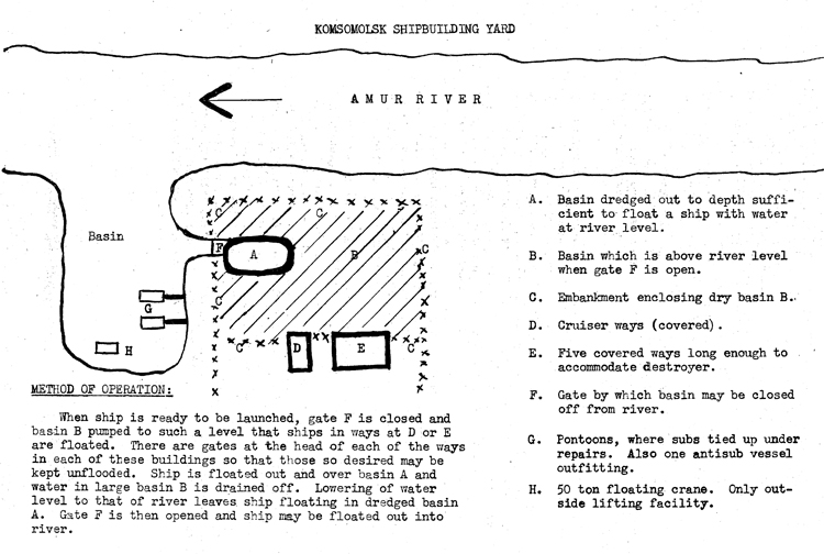
a. In General* Although Komsomolsk is probably used to a certain degree by the Amur River Flotilla, its chief importance as a naval base is that of a shipbuilding and ship repair yard; units up to 8,000-ton heavy cruisers are built here.
Construction first began on Komsomolsk in 1932 at the site of the old village of Permskoye, about 230 miles down the Amur River from Khabarovsk; at the present time it has a population of about 110,000. Komsomolsk was built because,in case of war with Japan, the chief Soviet shipbuilding yard in the Far East at Vladivostok could quite easily be entirely cut off, if not actually captured. In addition, this city was founded to tap the rich natural resources of the surrounding area of gold, coal, iron, timber, fishing and furs. It was also the plan of the Soviet authorities to develop,in this area,a self-sufficiency for the Soviet Far Eastern forces. The most important industry here is the iron and steel mill known as Amurstal. The construction of this mill, about 5 miles from the city, began in 1935 and the plant has a planned capacity of 400,000 tons of pig iron annually. Other industries,, reportedly here, are several machine building plants, a cement works, paper and cellulose factories, a railway car repair shop, 2 brick factories, etc.
b. The shipbuilding yard was commenced about six years ago and has had greater emphasis placed on it since the outbreak of war, due to the exposed positions of the shipbuilding facilities in western Russia.
As might be expeeted, the city and the shipbuilding yard with all its adjuncts have been thrown up in a gimcrack fashion even for the USSR, due to the lack of materials and the urgent need for haste. Conditions for the workers are most primitive and would be considered little less than savage by American standards. For Russian workmen, they are bearable, there being no alternative, and work goes on, although at a much less efficient pace than would be the case in a similar American establishment.
The buildings of the shipyard are of locally made brick, plastered and painted white outside. The buildings are well spread about, two to three hundred yards apart»in some cases. Roads are dirt or cobblestone. Railway spurs run into or alongside all the large shops* A great quantity of material, evacuated from the western areas,is lying about in large piles, much of it junk and*little of it usable in a shipyard. The manager remarked that the selection of material for evacuation was made amid bursting bombs and in face of imminent capture by the Germans. It was very much like the frantic householder, rescuing his belongings from his burning house, throwing the chamber pots out the window and carrying the pillows downstairs in his arms.
Windows of all buildings, after the Russian custom, are double, to keep out the 40-50 degree winter cold. Buildings ways are covered so that work may continue 12 months a year. They are steam heated, from a central plant.
It is probable that no ship launching could be made between the end of December and the 1st of March, due to the freezing of the basin and the Amur River. Freezing of the river at Nikolaevsk (the mouth) commences on the 1st of November and ice breaks up about the 15th of May.
The manager of the yard said they receive steel plate and similar material from sources outside Komsomolsk. In September, 1943, there was a rather considerable supply of plating, flat sheets 30 x 81, thicknesses 4 to 10 mm, stacked outside the rolling mill* There is a railway spur near the yard, along which were about five hundred or more six foot plugs of slag, several feet thick, apparently off the top of a ladle of hot metal, in September, 1943, probably a product of the Amurstal steel works.
In one of the machine shops, a small number of lathes and shapers were in use for other than shipbuilding work. Several hundred cases for 100 lb. bombs were being turned from steel castings, made in the foundry. A small amount of chain for harvesting combines was being made. They accepted such small orders in view of the lack of enough materials to keep the plant fully employed on shipbuilding and also in the interests of efficiency in supplying local demands for small articles in small quantities. This may indicate a lack of other machine shop facilities in Komsomolsk.
Personnel at the yard numbers 5,000, 50% of which are women; about 10% of the men are 16 to 20 year-old boys. Those departments requiring heavy labor, such as foundry, plate mill and work on board the vessels building are staffed largely by men. Operators of small machine tools, office employees, and others engaged in light labor, are principally women or boys. Workers live in houses and "apartments" (little more than barracks) which are not more than a kilometer from the yard; Many have small vegetable gardens in which they grow a scrubby variety of cabbage, potatoes or tomatoes during the short summer, to augment their poor rations Recreation facilities are meagre. There is a small park with a rattletrap dance pavilion and a movie theatre.
There are two shifts of twelve hours each in those few plants which work 24 hours a day. During the middle of each shift, 1 1/2 hours are taken out for rest and eatingj the plant is idle during this period* About 30% of the plant works two shifts (24 hours daily); the rest of the plants have one 12 hour shift daily* Lack of material and labor is probably the reason for lack of full time operation.
As a whole, the labor may be classed as inefficient and unintelligent. Judging from the amount of activity in the various shops and the number of idle machines, it is estimated that the entire yard is working at not more than 20% of the capacity it would be capable of with efficient planning, good workmen and ample material* Three destroyers (40$ complete) and two escort vessels (50$ complete), have been on the ways over three years, one light cruiser (75$ complete) about 5 years. In addition to these, a small number of very small vessels have been completed or are building. For a yard employing 5,000 workmen, this is not an outstanding record, and as the shops are well equipped with a wide variety of British and American machinery, it is indicated that labor and planning are chiefly at fault.
c. Shipbuilding ways: there is a total of six, all enclosed in two brick buildings with very large glass skylights and windows. There is very little shop equipment in these buildings other than cranes and portable gear for fitting out ships. In one building, there are two ways, one approximately 650 ft. x 80 ft. and the other approximately 450 ft. x 80 ft. The heavy cruiser KAGANOVICH is in the larger of these and six steel antisubmarine vessels, about 210' x 17' each,
are in the smaller one. The secona building contains four ways, one 250' x 501 and three each 350f x 801. The smallest of these is empty; one of the larger ways contains the escort vessel, ALBATROSS, another contains one destroyer, and the last one contains two destroyers. All of the ways are made of concrete, with ends closed by a steel gate. Launching is done by flooding the ways.
No railway cranes were noted inside the covered ways, and it is believed that all handling is don© by overhead cranes; there is one of these over, each way.
d. Fitting out basin; It is probable that ships are almost entirely completed while in the ways, as the fitting out basin has no facilities other than a fifty ton floating crane. There is not even a suitable pier. Due to the fluctuations in river level, ships are tied up to pontoons.
e, Shops:
1. Mould loft; About 700 by 80 ft., without any pillars or such obstructions. It is very well lighted by large glass double windows and by electricity. There is an elaborate heating installation. No project was in evidence in September, 1943, but a number of battens were lying around.
2. Sheet mill: There are six radial drills here for boring rivet holes in plates and two very large sets of rolls for shaping and curving plates, about twenty-five feet long; there are two smaller such rolls. There is a lathe for turning propeller shafts. One of the two shafts, for the cruiser KAGANOVICH, was in this lathe, but no work was being done on it; its length is about 150 feet; estimated diameter is about one foot. Two 3 bladed bronze one piece propellers for the KAGANOVICH were being machined. The manager of the plant said they had been cast elsewhere. Destroyer propellers were the largest one-piece propellers that could be castad-here. All heavy machinery in this shop is British made. About 50 four to six foot lathes, shapers, and screw cutters were in the same shop; they were practically all American made. There was little activity in this shop, with the exception of several special jobs being done on the smaller lathes, and several plates being bored for riveting.
3. Galvanizing shop; It is connected to the above shop, and is fitted to electroplate pieces up to 30 x 31 x 21. It is said very little galvanized material is used in any part of the ship. No galvanized parts on any of the ships tuilding were observed in September, 1943.
4. Foundry; About ten gas furnaces of small capacity, possibly 1,000 pounds, were being,used in September, 1943, for casting large bearings, bomb cases and ship fittings; there was one electric furnace of several ton capacity, but it was not being used. There was sand in moulds tamped with an electric tamper; this sand is locally obtained and appears to be of exceedingly poor quality. There is a mixer and grinder for renewing and reworking old sand and for conditioning new sand, as well as about six steam hammers, operated by women with the work being handled by men. There is one fifty-ton hydraulic press.
5. Machine shops; They are contained in two buildings, about
400 fx 175!, floor space being filled with lathes, milling machines, and similar small machine tools. A separate room, attached to one of these building, contained about six large grinding machines, the only ones seen in the yard in September, 1943.
About fifty percent of this machinery is operated by women. Seventy five percent of the machines were idle. Practically all of the
machinery was American.
6. Carpenter shop; It is engaged mostly in manufacturing a small
amount of wooden furniture and wooden cabinets, apparently for use
in the ships. One not particularly well built 18' cutter had just
been completed; the shop was almost entirely idle.
7. Stock rooms; They are contained in a very large building, about
250f square. They are filled with ship fittings, valves, pumps,
linoleum, wire, cable, boatswain's stores, machine fittings, sheet
metal, pipe/ small electric motors, condenser tubing, fans, boiler
spares, diesel generators and spare parts. The manager of the
plant complained of a lack of small fittings, such as valves,
screws, bolts and electrical fittings. The problem caused by a
lack of standardization due to the influx of foreign equipment was
a very troublesome one.
f. Shipbuilding; The hulls, decks and superstructure of all ships,
including the cruiser, antisub, destroyers, submarines, and subchasers are all riveted. No welding could be seen topside other
than several deck seams on the forecastle of the KAGANOVICH and
the very seams on the KAGANOVICH and destroyer deckhouses. On the deck of the KAGANOVICH,there were about fifteen welding machines, with wires being led below decks, indicating that the interior construction includes a considerable amount of welding. Even the small topside fittings like ladders, stanchions and deck fittings were made of castings and were riveted in place. In most new construction, the bare metal remained, without any protecting coat of red lead or otter preservative; consequently, there was a considerable amount of superficial rust of all metal surfaces, except on the guns, as a result.
g. Prefabrication; The KAGANOVICH1 s after deckhouse was being as
sembled on the main deck aft abaft number three turret in September,
1943, and was to be lifted into position by the overhead crane when
ready for installation.
h. Protection of the Yard; The yard is fenced with barbed wire and passages through the gates are guarded by civil employees. There are no troops stationed in the compound except a small detachment of 50 sailors manning multiple machine gun anti-aircraft installations. The total guns seen in September, 1943, were about six quadruple 30 cal. (approximately) Maxims. One quadruple mount was carried on a truck. Some of these sailors were working in an excavation near one of the covered ways and may have been preparing a position for a larger gun. There is no blackout at Komsomolsk and no provisions for it yet installed in the buildings. There is no camouflage except the painting of some of the buildings white to blend in with the winter snow.
It seems strange that there is not more adequate protection for Komsomolsk, which is, of course, within easy bombing range of Manchuria. Any knowledge of Soviet facilities or shipbuilding would be of considerable interest to the Japanese, or to any other potential enemy. This, coupled with the Soviet fetish for secrecy,
has closed the majority of the Far Eastern Territories to foreigners
for some years.
i. Policy; It appears from the lack of material furnished this plant that maximum effort is being lavished on the equipping of the army, allowing construction in the fleet to languish. This is reasonable, in view of the preponderance of allied surface sea power and the small difference the addition of a half dozen small ships would make in the balance of world sea power, particularly in the Far East.
The yard will be available for ship construction on a moderate scale when materials are obtainable, but certainly will not be as overall a desirable location as some of the western shipbuilding areas. Raw materials must be carried from a great distance• Labor will remain a problem due to the small local production of consumers1 goods and food. The limiting depth of the Amur River to Komsomolsk will adversely affect both inbound shipping and the launching and sending to sea of large units in the completed state. As a supplement to the western building yards, Komsomolsk may eventually be useful in producing small ships such as tugs, fishing boats, river vessels, barges and gunboats for use in the Pacific.
KOMSOMOLSK SHIPBUILDING YARD
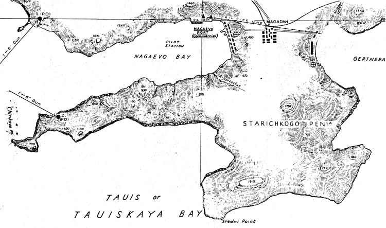
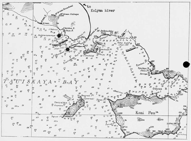
IV. Nagaevo (59°31'N., 150°35'E.)
Nagaevo, the only navnl base of any consequence in the Sea of Okhotsk, is classed o.s an MiirT anchorage. It is easy of access, and fog, which is often dense at the mouth of Tauisk Bay, is usually light and thin in the harbor. Although the presence of ice ^enernlly closes Nagaevo to navigation from December until April or May, it is possible that it could be kept open most of the year by the use of ice breakers. The depth of water at the entrance of the harbor is 18 fathoms. This depth decreases to 10 fathoms at the head of the bay, the shores of which are steep-to. There is a tidal ran^e of 10 to 16 ft.; a small tidal current runs west to east.
Soviet authorities stated in 1943 that commercially, iJa;:aevo could handle 75,000 tons of ftvight a month between raid May and mid December. The chief commercial importance of ilapaevo lies in its being an oil storage port and the port serving the extensive gold fields of the Kolyma Valley.
Machine shops and a small drydock are available at Nagaevo. There is also a small shipbuilding yard, reportedly capable of constructing motor launches and tugs and equipped with 3 slips, 2 160 ft. long and 1 65 ft. long. Little information is available on the naval base at Nagaevo, although it is believed that this port is used as the chief base for the Sea of Okhotsk Flotilla, as well as for an operational base of the Far Eastern fleet proper. In 1941, the naval base existed along the southern shore of Nagaevo Bay; as many as 2 or 3 destroyers and half a dozen submarines were seen there at that time. Reports indicated in the past that the Russians were going to move the naval base to Gertnera Bay on the other side of Staritski Peninsula, thereby insuring complete secrecy of the movement of naval units; this seems hardly feasible, however, because there are shoals approaching the entire coast of Gertnera Bay. Nagaevo is also a Frontier Guard patrol base.
It is estimated that Nagaevo is defended by two heavy artillery (2-gun battery) emplacements, four 152 mm. (4--gun battery) emplacements, and four 76 and 85 mm- anti-aircraft (4-gun Battery) emplacements. Nagaevo is within a fortified area; this area extends from about Ostrovnoi Point in the west to Kharbi2 Point in the east. Military strength in the area consists probably of one composite brigade, which operates along the highway which extends northward to the Kolyma River; it also operates at Ola, as well as at Magadan. In addition to the brigade, there are two Frontier Guard detachments, one of battalion and one of company strength, two aerodromes, and one seaplane base. Two coast artillery battalions are probably stationed here. There is one Frontier Guard detachment of company strength at Ola and another (5-40 men strong) on the northern coast of Adyan Bay, southeast of 0la.
Nagaevo Bay
Nagaevo
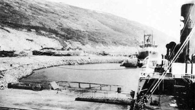
Nagaevo - Commercial port {east of oil port).
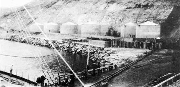
Nagaevo - Western Portion of Oil Port.
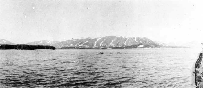
Tauisk Bay.
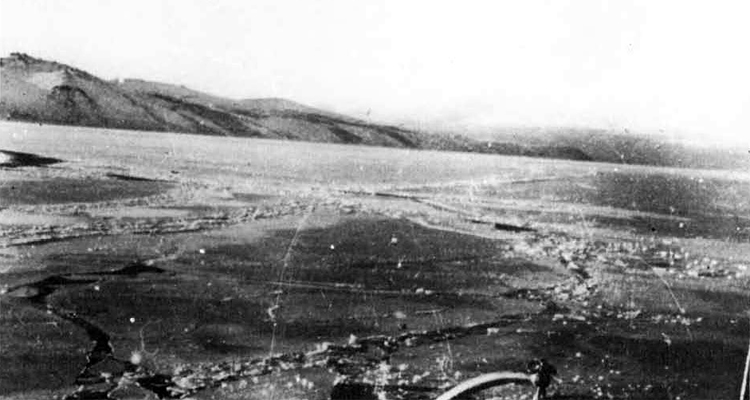
Nagaevo Bay - Ice forming in November.
Nagaevo - Kolyma River Highway.
7. Naval Bases of Secondary Importance in Maritime Province.
(a) Posiette Bay is located about 60 miles southwest of Vladivostok, not far from the Korean frontier. It is the only bay of consequence on the Soviet Far Eastern coast, which is open to navigation all the year round. It is about fifteen miles wide in an east and west direction, from which lin« it extends northwestward for about eighteen miles. Fogs are more frequent in spring and summer, June and July-being the worst months. There are two naval bases in this bay, on* in Novgorod Bay, in the western part, and the other in Trinity Bay, in the eastern part.
1. Novgorod Bay is about 6 1/2 miles long. The naval base, which is used operationally by submarines and motor torpedo boats, and perhaps by larger units, is believed to be located in Postova Bay near the entrance to Novgorod Bay on its northern short. There is a depth of five fathoms in the entrance and 3 1/2 fathoms farther in; its western half is occupied by a shoal bank, iteports indicate that it is equipped with quays, repair shops, a power station, a W/T station, and the buildings of the headquarters of the base. This naval base is connected with Krasklno, a major fortified center, off the northern coast of Expedition Bay, by a motor road; Kraskino has railway connection with the main Trans-Siberian system.
There are a naval seaplane and a commercial seaplane port in Postova Bay, the former being northeast and the latter southeast of the naval base. There are many land based air bases and landing fields here, the most important one being at Kraskino.
Expedition Bay, just southeast of KPASKINO
Probable position of Naval Base at Postova Bay
2. Trinity Bay, whose entrance is nearly 1,800 yards wide, recedes about three miles to the northward. It serves as an anchorage for submarines and coast patrol craft. It is believed to possess strong defenses and to be equipped with anti-aircraft ins (.allatioi^ as well as to have three searchlights placed on the cape at its head.
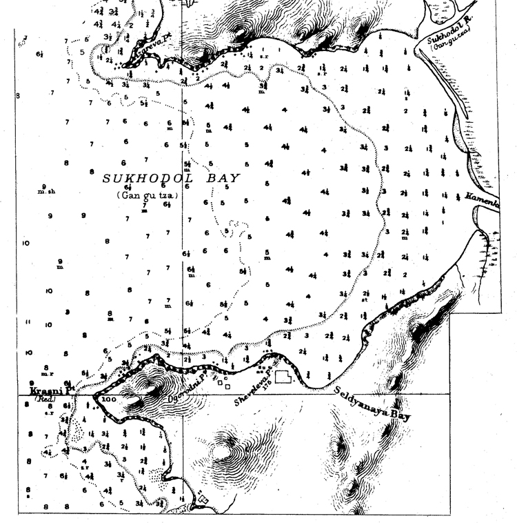
(b) Usauri Bay is a large bay located due east of Vladivostok, where there are tiro minor naval operating bases; one of these is located in Mnravinaya Bay, in the northern reaches of Ussuri Bay, and the other in Sukhodol Bay, on the eastern shore of Ussuri Bay.
1. MuraTinaym Bay is a minor submarine and motor torpedo toat operating base equipped with some repair facilities; its defenses probably Include coast artillery and anti-aircraft batteries, but their location and extent are not known. The center of a major fortified area is located at Shkotovo, on the northeastern shore of this bay.
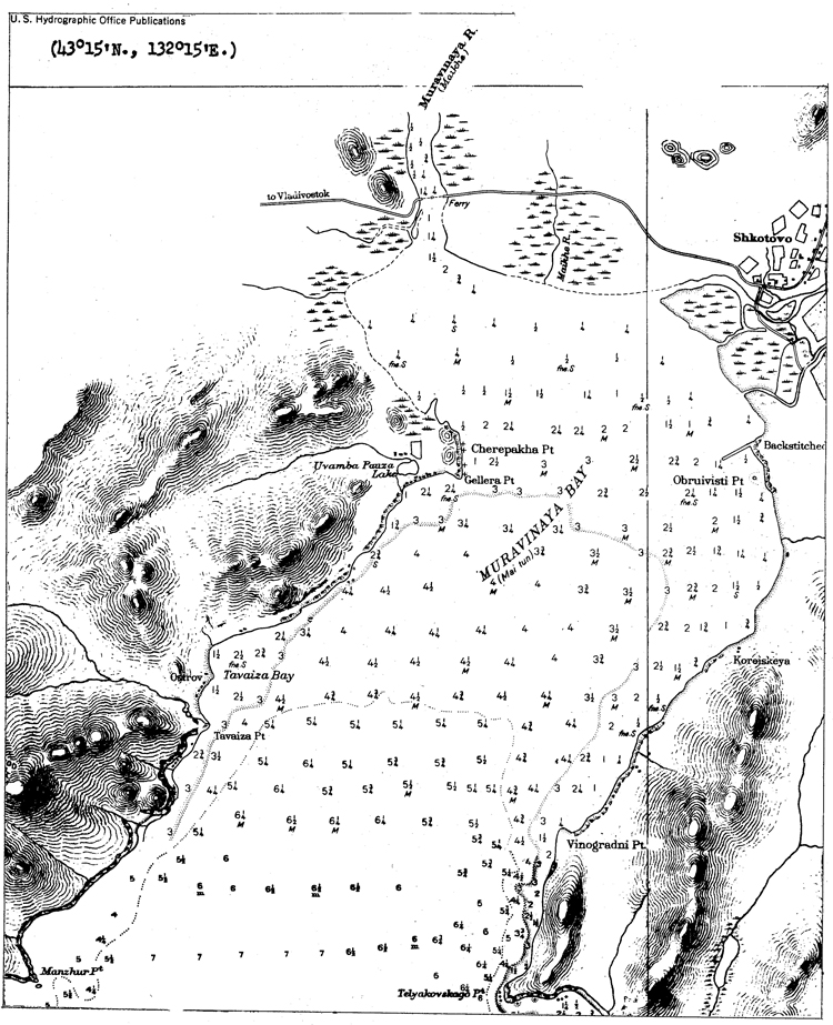
2. Sukhodol Bay is a minor operating base for submarines and motor torpedo boats, located abont 25 miles northeast of Vladivostok^ it can probably undertake minor repairs only. Its defenses possibly include coast artillery and anti-aircraft emplacements, but their location and extent are not known.
(c) Strelok Bay is located due east of Ussuri Bay; it is about 6 1/2
miles Hong. Fogs are frequent at the entrance to the bay but seldom
ex-bend to its northern reaches. Strelok Bay only freezes at its northern end, and then, for only about 2-3 weeks a year during the most intense cold. In March, 1941 it was observed that this bay was apparently being used as a destroyer operating base; at the same time, much
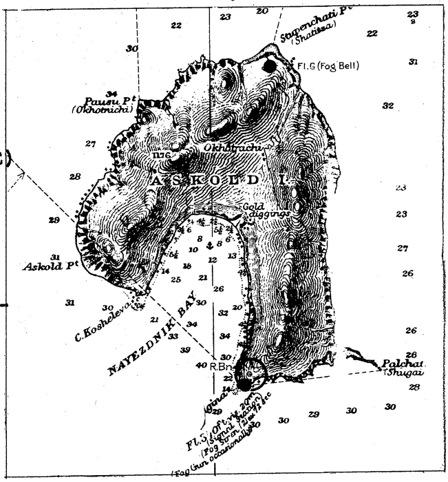
activity was seen on Askold Island south of Strelok Bay and that there
was a destroyer operating base or dock in Nayezhdik Bay on its southern shore. Askold Island is believed to be heavily fortified with coast
artillery emplacements.
(d) Vostok Bay is located about 7 1/2 miles east of Strelok Bay, and is 3-4 miles wide. It has a depth of 11 to 15 fathoms of water at its entrance and 5 to 6 fathoms near its head; it is completely open to southerly winds. In Karch, 1941, it was observed as being used as a destroyer operating base.
(e) America Bay, which is located about 5 miles east of Strelok Bay, is 6 to 7 miles wide. It is open to southerly winds in summer, which throw in a considerable swell. There is a tidal variation of about 2 ft. Nakhodka Bay is located in the 'northwestern portion of America Bay; it is about 2 l/2 miles long. It is a narrow inlet, surrounded by hills, and is generally frozen over from December until March, but is almost entirely free from fog, however. There is good anchorage here at all times; it has depths of 3 1/4 to 4 3/4 fathoms of water.
Commercially, Nakhodka Bay is important as a subsidiary port of Vladivostok, landing Lend-Lease supplies destined for the Russo-Ger-man front. It has recently been connected by rail with the Trans-Siberian system.
Nakhodka Bay is a submarine and torpedo boat operating base. In 1941, it was reported that America Bay was apparently being used as a destroyer operating base; it was also believed that it was protected by an anti-submarine net. Eeavy fortifications exist at Povorotni Point, probably at Kruilov Point, and in the Arsenya Mountains northeast of America Bay.
There is a seaplane base on the southeastern shore of America Bay with an alighting area of 2400 yards by 1200 yards, equipped with hangars, workshops, barracks, and stores. There is a landing field in the northwestern corner of America Bay.
(f) Olga Bay is located about 120 miles northeast of America Bay. It is classed as a "C" anchorage, with 11 fathoms of water over mud bottom. Fogs are prevalent here from March until the middle of July, particularly at night, but the area is frequently clear during the daytime. The Inner Harbor (Tikhaya Pristan) has a narrow entrance only 1/2 cable in width and with a depth of 5 fathoms of water; it can accommodate about 8 800-ton ships. Olga Bay is frozen over for an average of 160 days a year, from mid November to mid April, but the entrance keeps ice-free all the year round; there is an anchorage in 4 to 6 fathoms of water in Inner Harbor.
In October, 1943, it was reported that there is a submarine base at Olga Bay; it is also believed to be a minor operating base for surface craft. It is reported, that there is a permanent anchorage here for launches of the NKVD Naval Frontier Guard, and also that there is a military station with barracks, a garrison, a small pier and signal station at the northern end of Inner Harbor,
There is a seaplane base at Olga Bay. It was built between 1932 and 1935 and has hangars, workshops, fuel and equipment stores. Its. dimensions are 3600 x 1500 yards. There are two landing fields in the vicinity.
OLGA BAY
TIKHAYA PRISTAN HARBOR
Olga Bay.
Olga Bay.
(g) Tetyukhe (Tyutikhe) Bay is about 50 miles northeast of. Olga Bay.
The anchorage here is a poor one and is open to eastward, affording no
protection between April and October, when northeasterly and south
easterly winds prevail, and even during the winter, when offshore winds
might be expected; the bay is ordinarily frozen from December until
February. .
The chiei importance of Tetyukhe are the zinc, copper, and lead mines located about 26 miles from the bay. Tetyukhe is connected to these mines by a railroad. There is a pier on the northern shore of the bay, but depths alongside it are only 5 to 6 ft.; therefore all ships must load by means of lighters.
A report in October, 1943> stated that there was a submarine and military base here with considerable army personnel; this seems hardly likely, in view of the lack of a good harbor.
Along the coast between Vladimir Bay, south of Tetyukhe Bay, and Plastun Bay, north of it, it.is estimated that there are 3 152 mm. Z.-gun batteries and 3 76 and 85 mm. 4-gun anti-aircraft batteries.
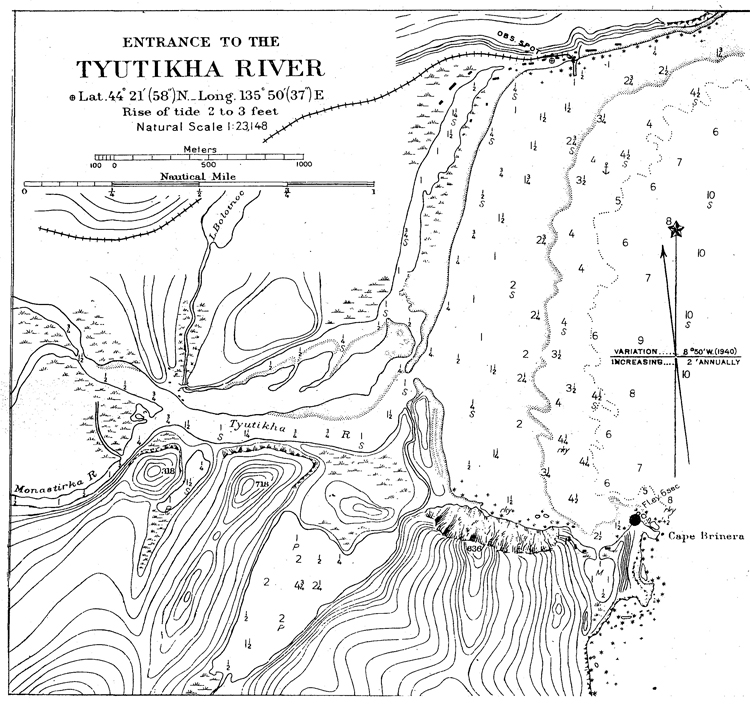
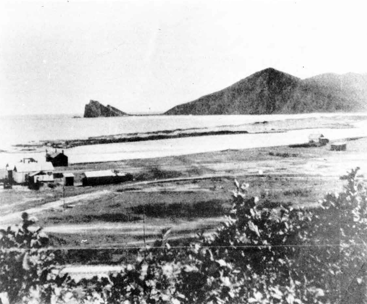
Entrance to the Tetyukhe Harbor.
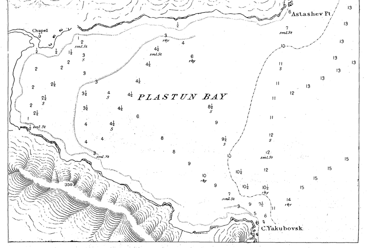
(h) Plan bun Bay. A renort dated October, 1943, static that there is a submarine base in rtuinda Gulf, about 30 miles nor*h of Tetyukhe; this ip the first indication of any naval installations at this point.
In Ruinda Gulf there fire two bays, Plastun on the western coyst and Dzhigit Bay in the northfirn reaches. Although eithier could be used as a submarine operating base during the summer months, it appears that Plastun Bay would be preferable. Here there is an anchorage, sheltered from westerly and southerly winds, in depths of from 6 to 15 fathoms over a rocky bottom, which is thickly covered with seaweed. KLastun bay has a diameter of about 1 1/2 miles.
(i) Grossevich Bay is located about 550 miles northeast of Vladivostok; it is sheltered by Krestovozdvizhenski Point, and provides good anchorage with a sandy bottom. Large vessels anchor in 7 fathoms of water at about 1 mile off the mouth of the Botchi River, or closer in about l/2 mile east northeastward of Krestovozdvizhenski Point; smaller vessels anchor in 3 3/4 to 4 1/2 fathoms of water, about 700 yards from th® river mouth. This bay is open to north and southeast winds, which are very strong in autumn and winter.
Although there is no confirmation of the fact, it is believed that Grossevich Bay is used as a base for motor launches of the NKVD, which patrol the coast in this area, and also as a summer operating base for submarines and motor torpedo boats. There is also thought to be a small anchorage for units of the fleet equipped with piers, protective moles, barracks, living quarters, warehouses for equipment and fuel, ammunitions duifrps, and small workshops for repairs to submarines and motor torpedo boats.
It is estimated that Grossevich Bay is defended by 2 152 mnu 4-gun batteries and 2 76 and 85 mm. 4-gun anti-aircraft oatteries; these batteries are probably located in the vicinity of Krestovozdvizhenski Point.
It. has been reported that a seaplane base is located about 2 miles northeast of Grossevich Bay hear the mouth of the Ribnaya River at l&° 00f N and 139° 30' E, and that it includes hangars, workshops, equipment and fuel stores, and has the necessary facilities for one squadron. It is reported that in 1937 this base was enlarged, 2 new hangars and increased store accommodation being added. The scale of reconstruction suggests that an air brigade will be stationed here. It was reported that by the end of 1937, 20 seaplanes of the NKVD were stationed here, one-half of which were long distance reconnaissance bombers. This seaplane base is probably intended to be a subsidiary base to Soviet Harbor base for coastal defense. There is also believed to be an airfield here, but no details are available.
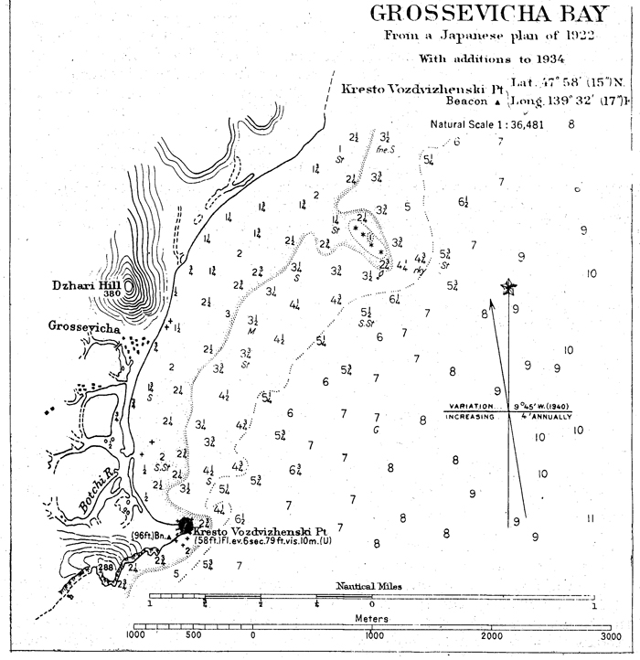
(j) Soviet Harbor (Sovietskaya Gavan) is the most important naval base and shipbuilding yard on the coast of Maritime Province north of Vladivostok. It is classed as a B anchorage, and is one of the best ports in the entire Soviet Far East. There is good anchorage in all three arms of the harbor in from 5 to 12 fathoms of water, mud bottom. Soviet Harbor is frozen over from November until April, although it may be possible to keep it open all the year round by the use of ice breakers. During May, June, and July, thick fogs are almost continuous.
Commercially, Soviet Harbor is important as an export port for timber and fish; rich coal fields are also said to be present in the neighborhood. There is a backwater for small fishing craft on the east side of Zapadnaya Bay. It is supposed that a naval operating base for both underseas and surface craft has been built, probably in the southwestern arm of Okocha Bay. Facilities here probably include bases for seaplanes, submarines, motor torpedo boats, and moles for berthing larger ships, barracks, and equipment, fuel, and war materiel.
It is not believed that Soviet Harbor has any overland means of communication with the interior.
Soviet Harbor can accommodate a fleet of any size. Large numbers of naval personnel are said to be stationed here.
In October, 1943, it was reported that the main use of Soviet Harbor is that of a fitting out basin for ships constructed at
Komsomolsk, and that a large drydock had been transferred from Odessa, in 1936, for this purpose. There is no confirmation of this fact, but the limiting depth of water between Komsomolsk and the open sea would probably make it necessary for the larger units constructed there to be completed elsewhere. in addition, no fitting-out dock was observed by U. S. Naval Attache, Moscow, when he visited Komsomolsk in September, 1943. There is no information indicating the location of this yard, but it may be either in the southeastern arm of Okocha Bay or in Yaponskaya Bay, at the mouth of the Chabakai River. As early, as the spring of 1939 it was reported that it was to begin assembling tugs and other auxiliary craft for the port of Soviet Harbor. This same report states that, by the end of 1939, it was to be capable of assembling engines, diesels, electric turbines, auxiliary parts, steel boilers, machinery, etc.
Soviet Harbor is a prohibited zone. In 1936, a prohibited water zone marked by buoys was established, running from a point 984 yards south of Cape Olginski to a point on the shore, about 1 1/4 miles west of Cape Mariiski. It is estimated that defenses of Soviet Harbor include 4 heavy artillery 2-gun batteries, 6 152 mm. 4-gun batteries, and 6 76 and 85 mm. 4-gun anti-aircraft batteries 1 this vrould mean that a total of 2,400 officers and men would be detailed on defense duties. The exact location of these batteries is not known, but in 1940 it was believed that there were 12 coast artillery emplacements, and that anti-aircraft batteries were placed on the heights surrounding Yaponskaya Bay and on the heights north of Zapadnaya (see chart on following page) Bay.
There may be a large naval seaplane base at Soviet Harbor, probably in the southwestern arm of Okocha Bay. It has been reported that there is an airfield with one hangar situated close to Zapadnaya River at 49° 08' N and 140° 14' E. This same report indicated that work was in progress for the extension of this airfield, and construction will include additional hangars, workshops, and buildings for personnel.
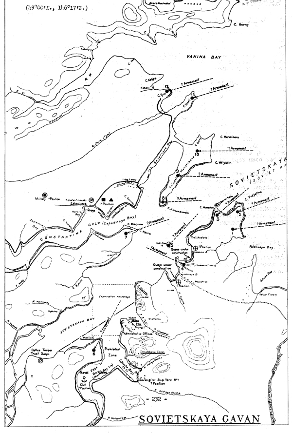
SOVIETSKAYA GAVAN
(k) Castries (De Kastri) Bay is located at the southern end of the Straits of Tartary. Its entrance is about 3 l/2 miles wide; the bay recedes for about 4- miles. There are depths of 6 to 9 fathoms in the outer part of the bay and 3 to 5 fathoms in the inner part. It is open to navigation Srom the beginning of fey to the middle of November, and often longer. Anchorage is difficult, and during easterly winds, there is little shelter to be found except for small vessels. Depths close to the shore are shallow.
Castries Bay is probably used as a submarine and motor torpedo boat operating base; however, due to the shallow water close to the shore, it must be of comparatively minor importance. The port is said to be located on the north shore of Somonsk Bay, and to be equipped with concrete berths and repair workshops, including torpedo, mine, and artillery workshops. The commercial port is east of this point in the area of Alexandrovski Road. The berths of the fleet are located south of the naval port. A submarine base is possibly located east of the fleet berths. There are said to be shipyards for ordinary repairs, a small dock, and naval storehouses at this base, as well as repair shops, barracks, an accumulator-charging station, and fuel and lubricant stores. It has been reported that U or 5 700-ton submarines are stationed here.
To the east of the submarine base,there is a seaplane base with 2 large hangars capable of accommodating 50 to 60 machines, barracks, workshops, and stores for fuel and equipment. One squadron of short-range reconnaissance machines and one squadron of fighters are said to be based here. On the western shore of Tigil Bay, there is said to be an anchorage for NKVD seaplanes, equipped with two large hangars and small workshops, serving 8 to 10 short-range reconnaissance machines. There is an airdrome in the vicinity.
The entrance to Castries Bay is said to be mined. It is estimated that this base is defended by 2 heavy artillery 2-gun batteries, 4 152 mm. 4-gun batteries, and 4 76 and 85 mm 4-gun anti-aircraft batteries. The exact location of these emplacements is not known. It is probable that 2 battalions of coast artillery troops are stationed here to command the guns.
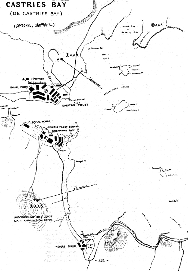
CASTRlES BAY
(DE CASTRIES BAY)
VI. Naval Bases on Sakhalin Island
(a) General. According to a report dated 193&* the Island of
Sakhalin was declared a prohibited zone in 1932$ a fortified zone
12 miles deep along the Japanese frontier was also established; in
this area, it is estimated that there are 4 to 6 frontier guard detachments, composed of 5 to 40 men each. There are no good harbors
on the island, but some of the more important anchorages serve as
naval operating bases for underseas and surface craft, which patrol
the coast during the summertime. Most of the waters in the area of
Sakhalin Island are ice-bound from the first of November until the
first of June.
(b) Alexandrovsk is the administrative center of the Soviet portion of Sakhalin Island, as well as being the chief port for the
export of coal mined in the vicinity; it has a population of 18,000
people. The town is located about 1 l/2 miles up the Alexandrovka
River.
Approach to the port presents no difficulty in clear weather; dense fogs are prevalent, however. The water begins to freeze during the last part of November at this port. Although it breaks up during the first part of May, there have been many instances where piled-up drift ice has lasted as long as th« latter part of June. The wind is4 strongest in October, and weakest in February. A south-southeast wind prevails throughout the year, and rainfall is comparatively great during July, August, and October. The great amount of rainfall comes in August, when it averages about 175 mm. There is a good anchorage in 6 fathoms of water, mud bottom, 6 cables from , the end of the pier. This anchorage is good during the summer, protected from southern and southeastern winds, as well as those from seaward; however, from September on, it is exposed to the wind and sea, and great care must be taken. In order to develop the local coal-mining industry, construction of a new port on the site of the existing one was begun in 1936. It probably was never completed, and reports indicate that no work is being done on it at the present time.
Alexandrovsk acts as a naval operating base for submarines and surface craft, which patrol the coast during the summer months; no information is available on installations there.
There are both an airdrome and a seaplane base at Alexandrovsk. The seaplane base is located at the mouth of the Alexandrovka River, and is equipped with a small temporary hangar for 2 or 3 seaplanes and gasolin stores in metal drums. The airdrome, which is in the vicinity of the seaplane base, is reported to have hangar accommodations for 50 machines and to have large stores for fuel and bombs.
The entire coast, from Arkova in the north to Due in the south, (a distance of about B miles) is a heavily fortified area. Alexandrovsk is the headquarters of the 79th Infantry Division which operates as far south as Onor and as, far north as Viyakhtu on the west coast and Niuvo on the east coast; it is also the headquarters of the 52nd Frontier Guard Battalion, and probably of two coast artillery battalions. In this area, it is estimated that there are 2 heavy artillery 2-gun batteries, 4 152 mm. 4-gun batteries, and 4 76 and 85 mm. 4-gun anti-aircraft batteries.
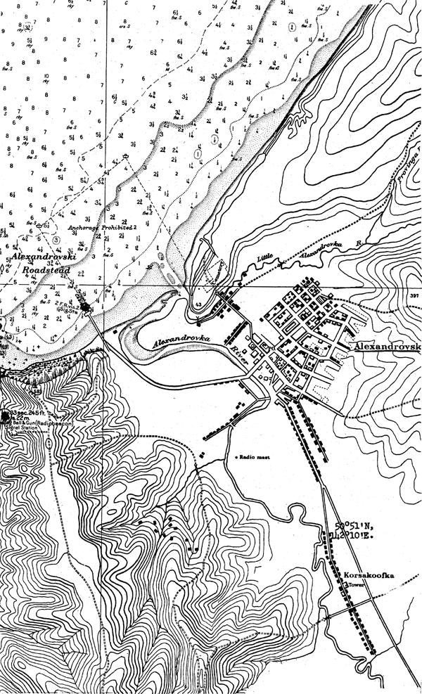
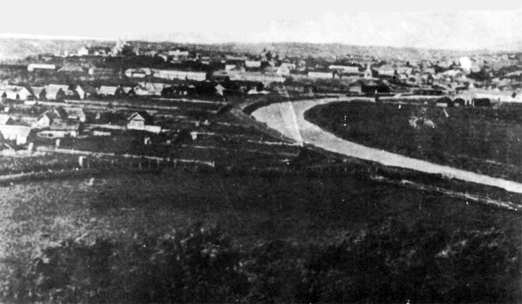
Alexandrovsk - Town.
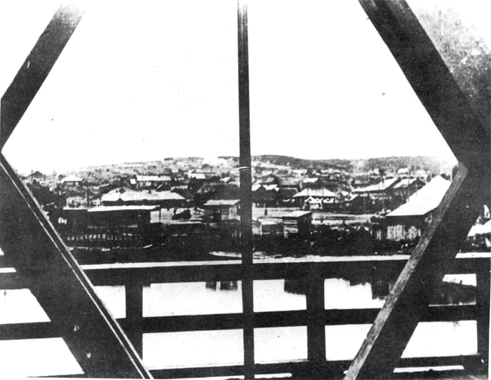
Alexandrovsk - Port.
(o) Viakhtu is located at the south of the Viakhtu River and is used as an operating base for motor torpedo boats; "because of the shallow water at this point, it cannot be used by any larger units. The bay even dries at low water except in its three narrow channels. It is reported, that, at the naval bass, 8 to 10 motor torpedo boats of 16 to 18 tons each can be accommodated; this base is said to be equipped. with workshops and stores.
There is a seaplan base at Viakhtu which, it is reported, was enlarged in 1937 with workshops, hangars, and fuel stores; it has accommodation for 30 seaplanes. Five or six high-speed motor boat launches are attached to this station. There is reported to be an airfield in the vicinity, but there is no confirmation of this fact.
It is estimated that in the area between Viakhtu and Pogibi (to the north of Viakhtu on Tartary Strait) there are 2 152 mm. 4-gun batteries and 2 76 and 85 mm. 4-gun anti-aircraft batteries. The coast on either shore of Tartary Strait is heavily fortified, and it is believed that a coast artillery battalion is stationed there,
(d) Moskalvo-Okha-Urkt Area is located in the narrowest portion of Sakhalin Island near its northern end. In this position, the rich Soviet oil fields are situated. Moskalvo is the oil port on the western coast of the island; it is connected with the oil fields at Okha by rail. Moskalvo is a new port, built in about 1932. Entrance to the bay is made by a natural channel, which has a minimum depth of 25 ft., there are 30 ft. of water alongside the wharf. There is a tidal range here of about 6 ft.
There are no naval bases in this area, but there are a seaplane base and airdrome at Moskalvo, a second seaplane base at Urkt, and a second airdrome at Okha. The seaplane base at Moskalvo is located on Baikal Bay 5 or 6 miles south of the port. It can accommodate about 40 seaplanes; it has two hangars, repair shops, fuel supplies, radio, and probably telegraph. The seaplane, base at Okha is on Urkt Bay, several miles from the town. Depths at this base are 8 to 11 ft.; it is protected by a sand neck. It has one large hangar, repair facilities, fuel supplies, radio, and probably telegraph. Small tenders are attached to this base. The airdrome at Moskalvo is located two miles northeast of the town on Baikal Bay. It has hangar accommodations for 15 planes, repair facilities, fuel supplies, and a radio beacon. The one at Okha has little or no facilities. This entire area is heavily fortified, and defense installations are strong. It was estimated in July, 1943, that it is defended by 4- heavy artillery 2-gun batteries, 6 152 mm. 4-gun batteries, and 6 76 and #5 mm 4-gun anti-aircraft batteries. In addition, 2 coast artillery battalions are stationed at Moskalvo, and 2 at Urkt. One source believes that there is a guard force of 3,000 men in the vicinity of Okha.
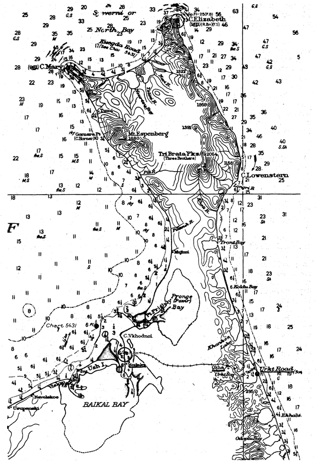
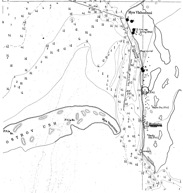
(e) NYyivo-(Hivo) is located on the eastern shore of Sakhalin Island, on Plastun Peninsula. It is not a naval base, but a military base. The 79th Infantry Division operates in the area of Nyivo, which is a fortified zone. It is estimated that this strategic area is defended by two 152 nun. 4-gun batteries, and two 76 and 85 mm. 4-gun antiaircraft batteries. One frontier guard detachment of 5 to 40 men, and perhaps one coast artillery battalion, are also stationed here.
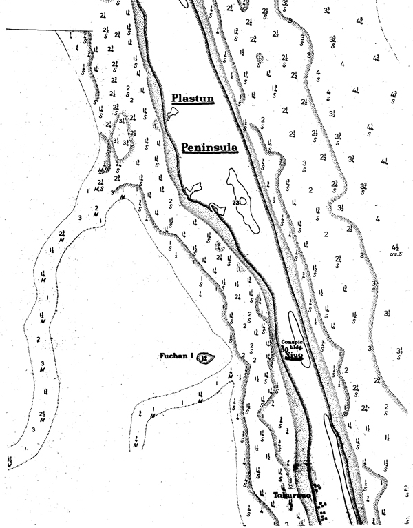
VII. Naval Bases of Secondary Importance in the Sea of Okhotsk
Although Nagaevo is believed to be the only naval base of any importance in the Sea of Okhotsk, the following are worthy of note:
(a) Okhotsk is located on the western shore of the Sea of Okhotsk. An entirely unprotected anchorage may be had at Okhotsk Road in 5 fathoms of water 1 1/4 to 1 1/2 miles offshore. There is a tidal range of 3 meters; a strong tidal current sets east and west and becomes exceptionally strong before aid after change.
It is believed that Okhotsk is being used as a subsidiary naval operating bas« for submarines and surface craft, which patrol the coast during the ice-free season; there are probably little or no facilities here.
There is a seaplane base and an important aerodrome at Okhotsk. Frontier Guard Headquarters with two companies of troops are believed to be stationed here.
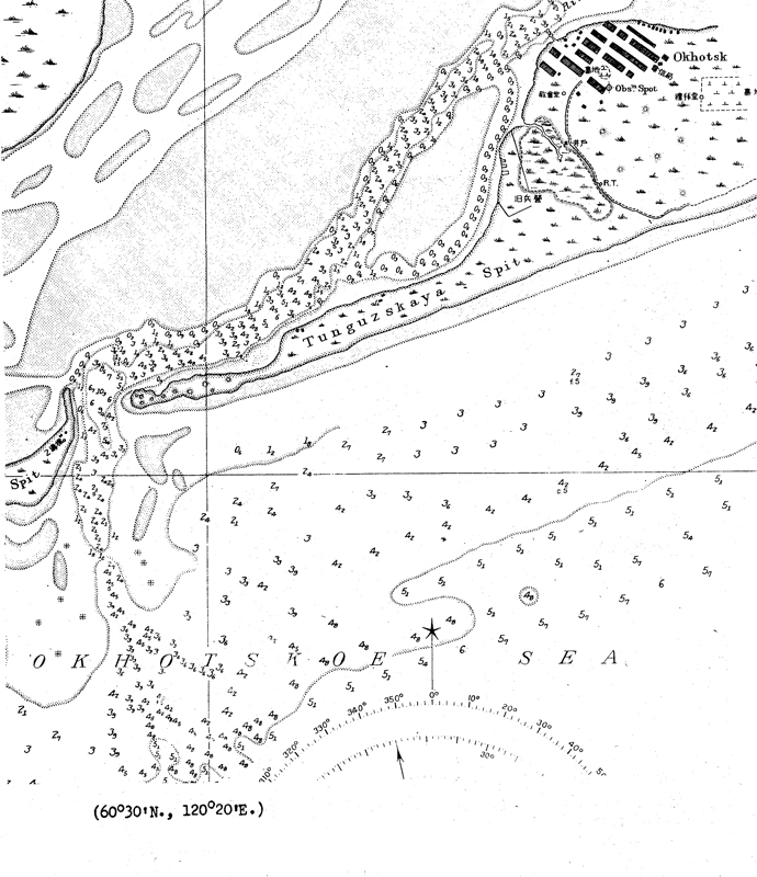
OKHOTSK ROAD
(b) Ayan is located southwest of Okhotsk. There is a naval base, and a seaplane base here; it is classeed as a forbidden area. On company of troops is stationed at Ayan.
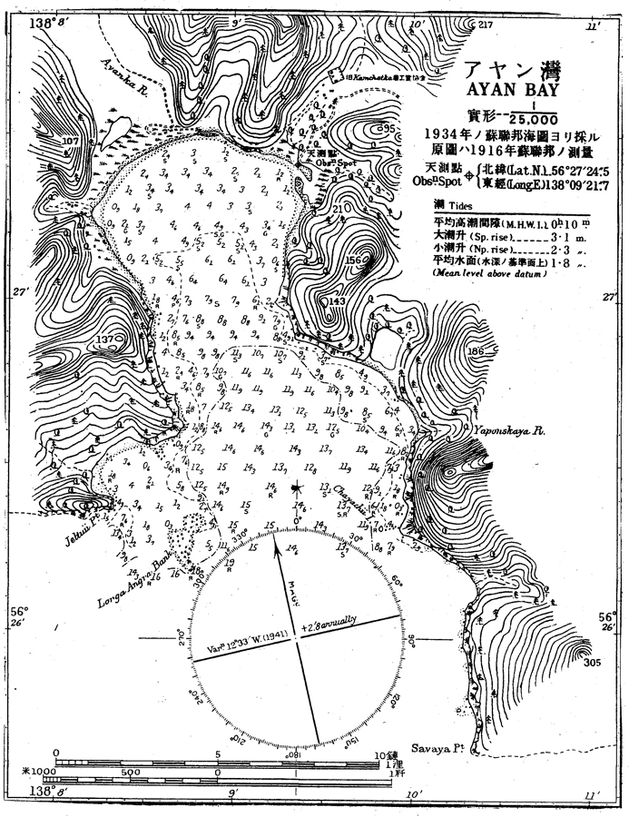
(c) West Coast of Kamchatka. There are probably no naval bases on the west coast of Kamchatka, because, the coast being very little indented, there are no anchorages worthy of the name. In 1941 it was reported that a naval base was located at Ust-Bolsheretsk; this seems hardly possible, because there are no sheltered anchorages in the area, and because the water is very shoal near the coast. There may be a small Frontier Guard patrol base here, however. Reports also indicate the existence of a similar base at the mouth of the Ozernaya River, south of tlst-Bblsneretsk. Small boats, drawing up to 3 ft. of water, can cross the bar of this river.
Ust-Bolsheretsk is a fortified area. A Frontier Guard detachment of one company in strength is stationed here. The 101st Infantry Division, which maintains headquarters at Petropavlovsk operates in the fortified zone of Ust-Bolsheretsk. There are a seaplane base and a landing field at Ust-Bolsheretsk. A seaplane anchorage is located at Bolsheretsk, up the Bolshaya River.
VIII. Naval Bases of Secondary Importance on the Bering Sea Coast
(a) Kommandorski Islands. Reports from various sources indicate that there is an advanced submarine base on these islands. Although its exact location is not known, the two most likely positions for such a base would be at Nikolskoe (on Bering Island) or at Preobrazhenskaya Bay (on Medny Island). In May, 1943, there was no evidence of any naval activities at either of these ports, but inasmuch as Soviet subsidiary operating bases ordinarily are kept open during the summer months only, this fact is not conclusive evidence that no naval base exists in the Kommandorski Islands.
In order to establish a permanent naval base at Nikolskoe, it would be necessary to construct a breakwater and to dredge out a basin, as a heavy swell enters the roadstead during all winds from the third and fourth quadrants.
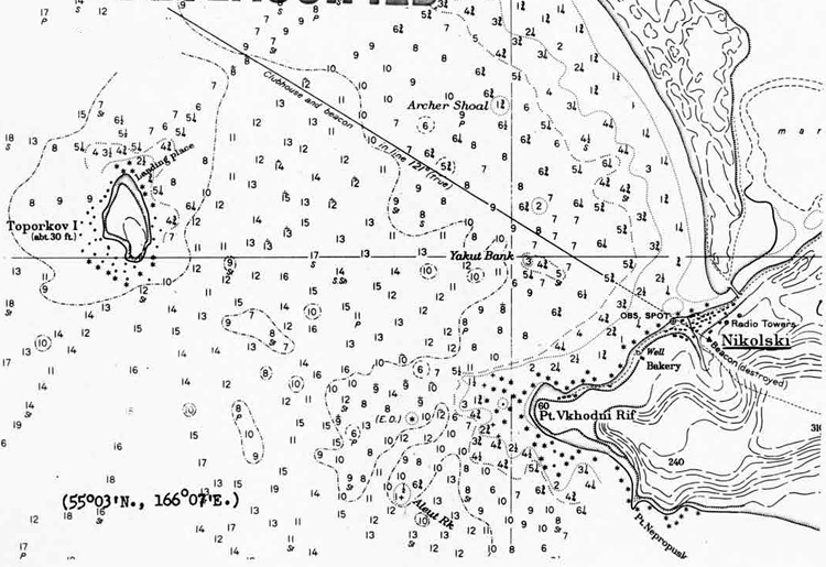
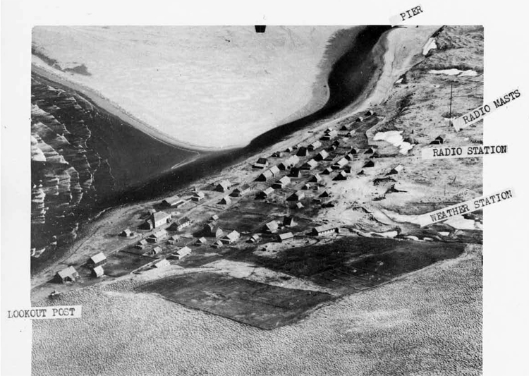
Nikolskoe Village.
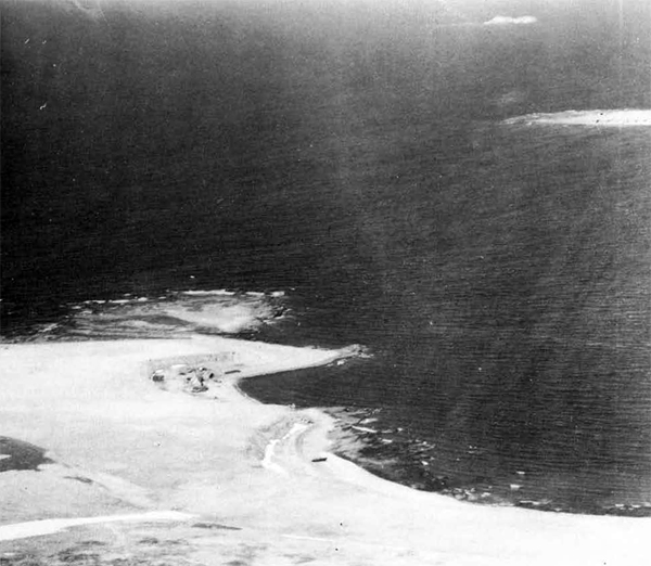
Vkhodny Point, southwest of Nikolskoa Village.
Preobrazhenskaya Bay is a small bight about 300 yards wide at its entrance and about 4-00 yards long. Submarines can anchor here in three fathons of water, in its entrance. A good scope of cr.ble is required during northerly winds, as the outlying rocks do not completely protect the bay.
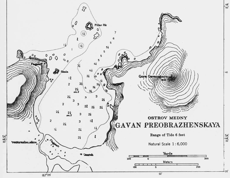
OSTROV MEDNY, GAVAN PREOBRAZHENSKAYA
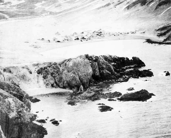
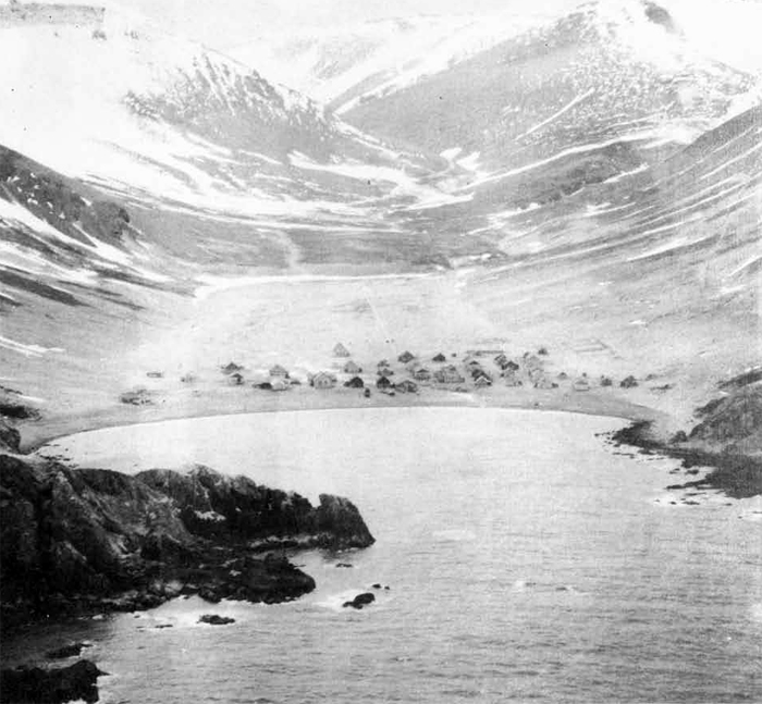
Preobrazhenskaya Bay.
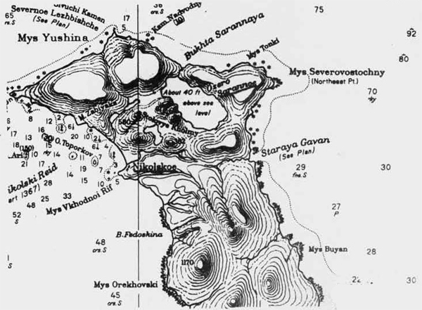
A large seaplane base has been reported on Saranno Lake, northeast of Nikolakoe. The shores of tMs lake arc precipitous except in its southeastern portion. It is reasonably certain, therefore, that the portion of the lake, shown in the nrxt photograph, is that used as a seaplane base, if reports claiming its existence are correct.
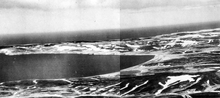
Southeastern shore of Lake Sarannoe, with the Boring Sea In th« background.
Bering Island is a fortified area. It is estimated that Nikolskoe is defended by two 152, 4-gun batteries and two 76 and S5 mm. 4-gun anti-aircraft batteries. A frontier Guard detachment, one company in strength, is stationed here; one coast artillery battalion is also probably on Bering Island. Medny Island is a forbidden area; it is probable that a Frontier Guard detachment, one conpany in strength, is stationed here.
(b) Ust-Kamchatsk is located at the mouth of the hanchatka River. In 1941, it v:as reported that a small naval station existed here; this hardly appears feasible, because of the complete lack of anchorages in the area. Ust-Kanchatsk, however, is a fortified zone. A Frontier Guard detachment, one company in strength, is stationed here. The 101st Infantry Division, with headquarters at Petropavlovsk, operates at Ust-Kamchatsk and at Klyuchi (up the Kamchatka River). There are a seaplane base and a landing field at Ust-Kamchatek. There are also a seaplane landing and a second landing field at Klyuchi.
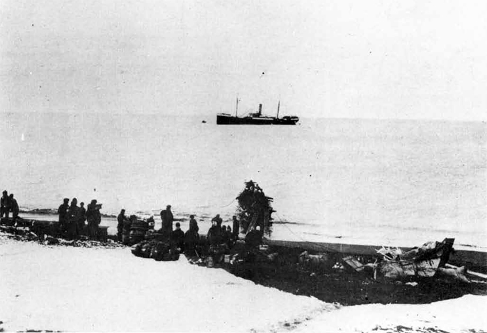
Bering Sea Coast at Ust-Kamchatsk.
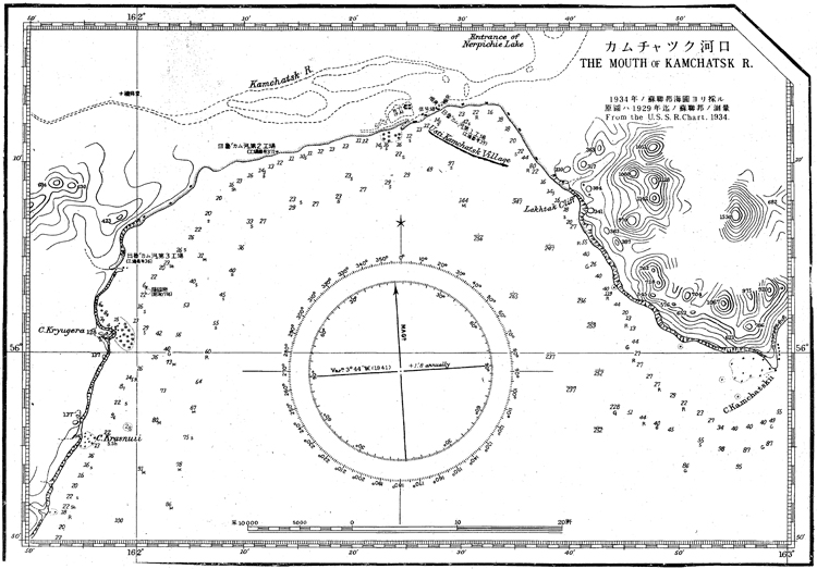
The mouth of Kamchatka River
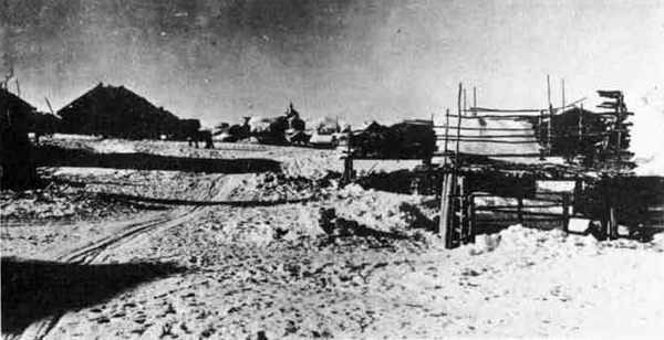
Klyuchi.
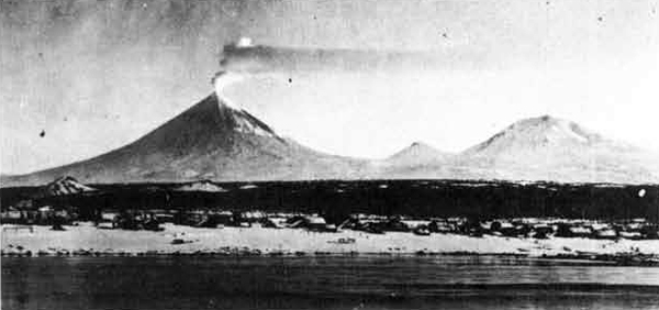
Klyuchi.
(c) Karaga Harbor is located across Litke dtrait from Karaginski
Island. An excellent naval summer operating base for submarines and
light surface craft could be built here, because, due to the proximity of Karaginski Island, it is well protected from winds. Jt the
village, on the northwestern coast of the bay, the water is as much
as 16 feet deep.
Karaga Bay is a restricted area; a Frontier Guard detachment, one company strong, is stationed here.
(d) Karaginski Island. A submarine patrol base has been reported
on this island; if existent, this base is probably located in
Lozhnikh Vestei Bay on the weati-rn const, because this bay constitutes the only sheltered anchorage on the island. There is a land
ing field near Loshnikh Vrstei Bay; a frontier Guard detachment,
one company in strength, is stationed here.
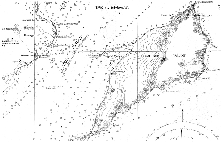
(e) Korff Bay is probably a stumer naval operating base for submarines and surface craft. This bay is 38 miles wide at its entrance and recedes north-northeastward for about 45 miles. It narrows gradually to its head, where the width is about six miles. Depths in the bay decrease gradually from about 4-0-50 fathoms of water at the entrance to about 15 fathoms, about 8 miles from the head. The best anchorage for vessels drawing not more than five fathoms is to be found in Skoboleva Harbor, This harbor, which is the largest inlet in Korff Bay, is exposed to north and northeast winds, which create high waves, but they have little effect on larger vessels that take anchorage east of the spit, where good ho]ding ground of rud and sand is to be found. It has been stated that Skoboleva Harbor can accommodate about 50 ships. Korff Bay does not froze during the winter, but, depending on the currents and wind, is periodically packed with draft icej sometimes it is completely clear of ice, however. Vessels with strong hulls and powerful engines are able to navigate in the bay throughout the entire year.
Korff Bay is a highly fortified area; it is estimated that its defenses consist of two 152 nun. 4-gun batteries and two 76 and 85 mm. 4-gun anti-aircraft batteries. One company of Frontier Guard troops are stationed at Tilichiki, on the northwestern shore of Korff Bay, as well as probably one coast artillery battalion.
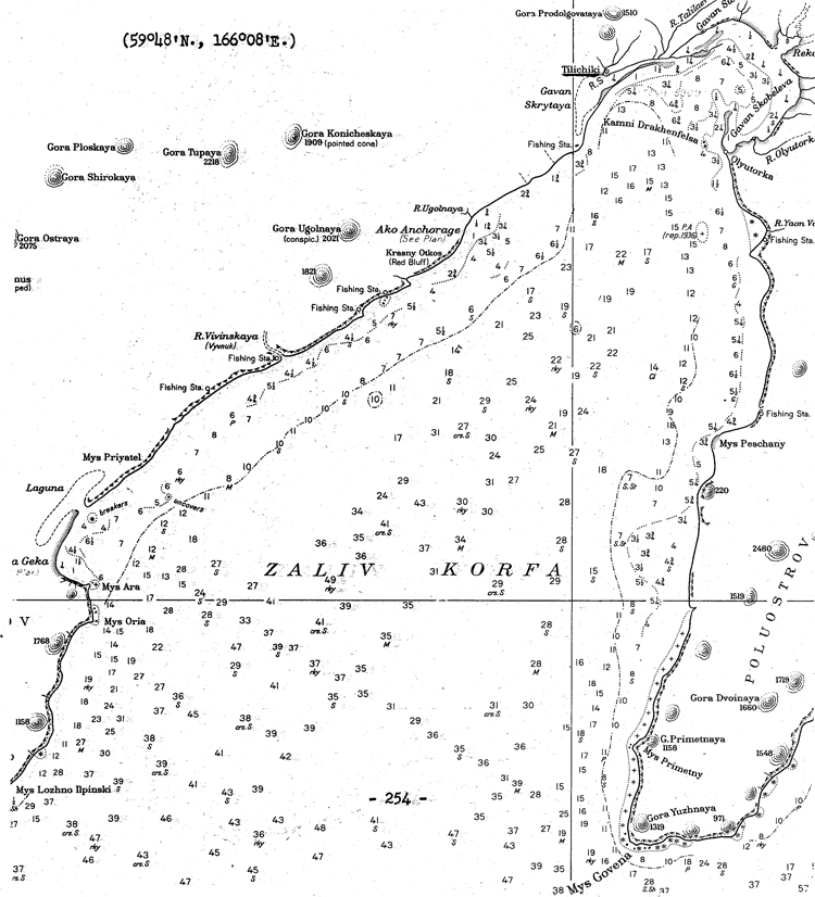
(f) Anadyr Bay. Various reports indicate that Anadyr Bay has been developed into a seaplane station, as. well as into a summer naval operating base for submarines and surface craft, which patrol the north Siberian coast during the ice-free season; this base is probably located at Klinkowstroero Bay in the northeastern reaches of Anadyr Bay. Seaplanes can land at Anadyr, itself.
The village of Anadyr (Novo Mariinski) is not far from the mouth of the .Anadyr River; it is the administrative center of the Chukhotsk National District; anchorage can be had at this point 300 to 400 feet offshore.
There is an air base at Anadyr. The conditions of the field are poor, as it was reported in August, 1943, that although C-47's could be landed without difficulty, A-20's cannot always land; the location of this airfield is stated to be excellent. At Markovo, about 200 miles up the Anadyr River, which can be reached by river craft drawing 4 to 4 1/2 ft. of v/ater, there is an important air base. The field here is unsurfaced and very rough but with good approaches; the runway is 3,775-ft, long and 200 ft. wide, with a 315-foot-parking strip.
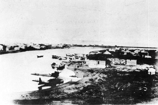
Village of Anadyr.
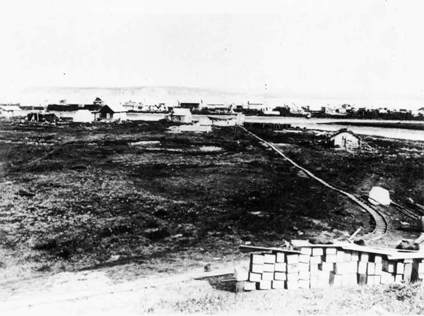
Village of Anidyr.
(g) Providence Bay is situated on the southern shore of the Chukhotski Peninsula, south of Boring Strait, and opens into the Gulf of Anadyr. It is a fjord-like bay with mountainous sides; it is 18 miles long and avarages about two miles in width. Plover Hay, a small bs.y on its southeastern side, just within the entrance to Providence Bay, is 16 to 20 fathoms deep, while Emma Bay, farther to the north, has a depth of 16 to 18 fathoms at its entrance, decreasing to b fathoms in parts of the boy. Providence Hay :is frozen over for nearly 8 months a year, generally from October to May, although the navigation season way be slightly prolonged by the use of icn breakers.
Commercially, Providence Bay is important as the starting point for convoys which, during the summertime, go through Berlng Strait and along the Northern Sea Route.
For come years, reports have stated that a "naval base" has been built at Providence Bay. This bay probably consists of an anchorage, used by submarines and surface craft, which patrol the coast during the four ice-free months every year; there are probably other "bases" of this type along the coast.
It is estimatod that at Providence Bay there are two 152 mm. 4-gun batteries and two 76 and 35 mm. 4-gun anti-aircraft batteries. Providence Bay is classed as a major fortified center.
There is a seaplane anchorage at providence bay located at 64°
20' N, 173° 19' W; this anchorage is used during the summer months. There may be a landing field in the vicinity.
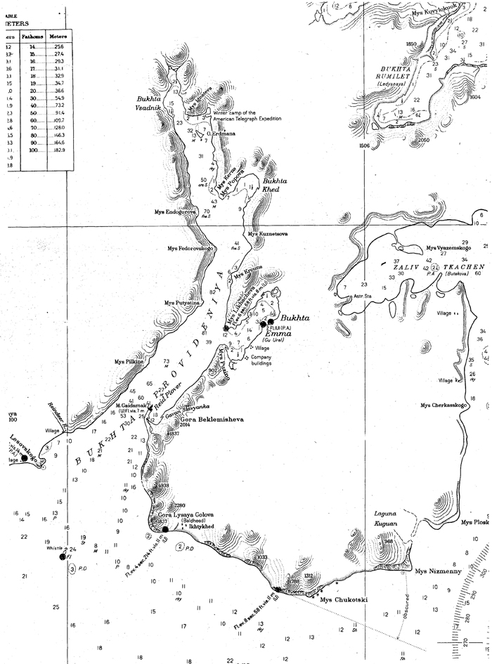
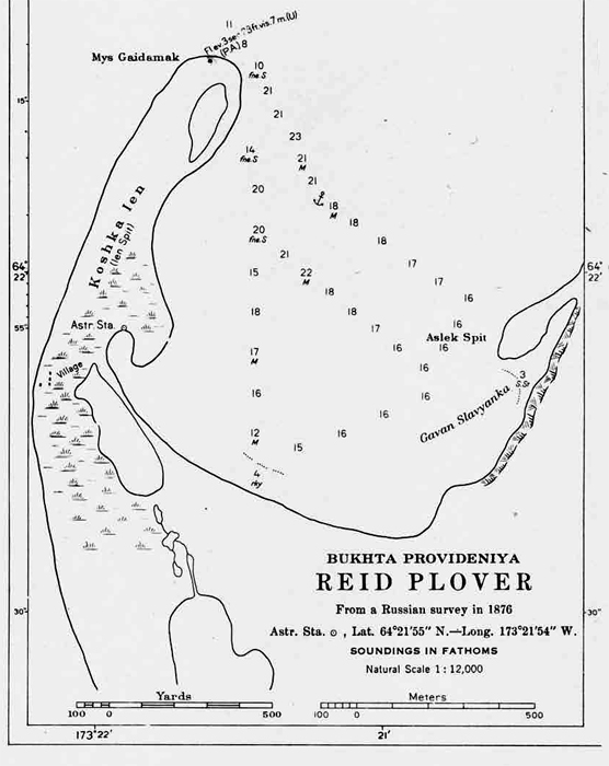
Providence Bay
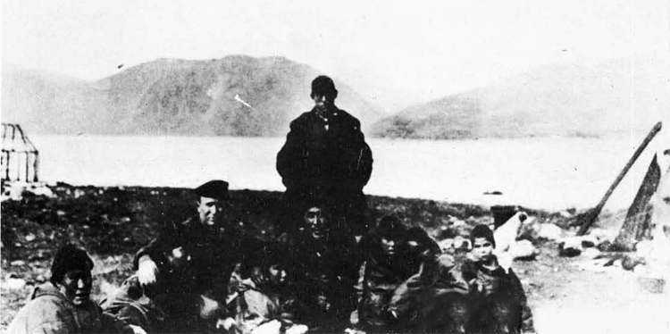
Providence Bay - Photograph taken from a sand spit at the southern entrance to Emma Bay.
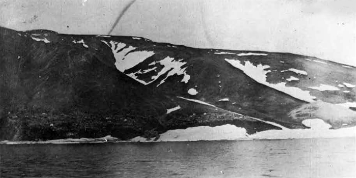
Village at East Cape - most easterly point of the U.S.S.R.
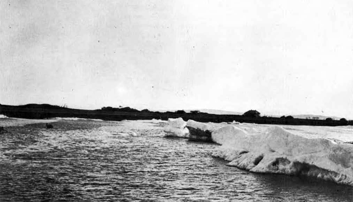
Village of Uellen, northeast of Providence Bay.
IX. Military and Air Strength in the Far East.
It is believed that all military strength, including Army, Navy, and Air Force, is under the command of the Navy, with headquarters at Vladivostok. Army forces in southeastern Siberia are roughly divided between the First and Second Red Banner Armies. The First Red Banner Army commands all forces south of the 46th Parallel, while the Second Red Banner Army commands forces north of that point, including the Amur River Basin, Khabarovsk Province,- and Northern Sakhalin; it also commands forces in the Amur Military District, In addition, one composite brigade is stationed at the Kolyma River, and one Infantry Division (the 101st), with headquarters at Petropavlovsk, is responsible for the defense of Northeastern Siberia.
Army ground forces in Eastern Siberia number approximately 250,000 men, divided as follows:
| Region | Units | Men |
| 1st I.R.B. Army | 7 Inf. Div. (15,000) | 135,600 |
| 3 Inf. Brig. (5,000) | ||
| 1 Mtzd.Brig. (3,000) | ||
| 3 Tank Brig. (2,000) | ||
| 1 Cav. Div. (6,000) | ||
| Khabarovsk Krai | 5 Inf. Div. (15,000) | 85,600 |
| 2nd I.R.B. Army | 2 Tank Brig. (2000) | |
| 1 Cav. Div. (6,600) | ||
| North Sakhalin | 1 Inf. Div. | 10,000 |
| 2nd I.R.B. Army | (10,000) | |
| Kolyma | 1 Composite Brig. (5,000) | (5,000) |
| N.E. Siberia | 1 Mt. Inf. Div. (10,000) | 10,000 |
| Total 246,200 |
The Soviet Air Force in Eastern Siberia consists of approximately 1,175 planes and 58,000 officers and men; it is divided approximately as follows:
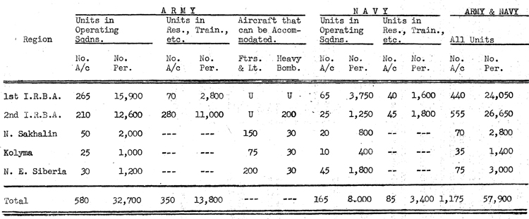
D. Naval Bases in the Arctlc.
The Soviet Arctic Fleet is principally based on Polyarnoe, it serves as the administrative center and headquarters of the Commander- in-Chief , Vice-Admiral Golovko, as well as the submarine base. Surface craft is usually based at various other points in Kola Inlet, such as Vaenga Bay, the shipyard at Rosta and at the Government Salvage Agency (E.P.R.Q.N.). There is a ininesweeping and anti-submarine base on Iokanga, on the Murman Coast.
The White Sea Flotilla, which comes under the jurisdiction of the Commander-in-Chief, Northern Fleet, is based on Archangel and to a small degree, Molotovsk. Various reports indicate that.construction is underway at the port of Belomorsk, on the southwestern coast of the White Sea; when completed, it will probably be employed partially for naval purposes.
I. Kola Inlet in General
Kola Inlet is the largest and most important gulf on the Murman coast, extending 32 miles southward from the sea to the junction of the Tuloma and Kola Rivers. The rise of Nazi Germany to a commanding naval position in the Baltic and the possibility of transferring men of war up to 3Qp£)^ton destroyers through the Baltic-White Sea Canal have all enhanced the value of Kola Inlet as a naval base of the U.S.S.R. The Soviet government visualizes Kola Inlet as the naval base of the north from which naval forces in the Far, East may be reinforced when needed via the Northern Sea Route. Until the beginning of the present war, extensive work was proceeding in the Kola Inlet and principally at Murmansk, with the object of building it up to the standards of a first-class naval dockyard and repair base; in addition, all the commercial facilities of the port were being improved.
The favorable ice conditions, coupled with the comparative inaccessibility of the area from the southward, makes Kola Inlet suitable for use as an advanced base at all times of the year. As the main Soviet northern base, however, geographical factors and exposed lines of communication make it very vulnerable to attack from combined sea and air forces.
The northerly part of Kola Inlet as far as Salni Island,very seldom freezes but from November to May land ice forms off the shores and, from time to time breaks up and is borne away to sea on the ebbtide. Only above Abram Pakhta has any ice been observed to form during the 2 winters of 1941-1942 and 1942-1943, and, owing to strong tides, it usually lasts only 2 or 3 days.
There is a naval teleprinter service between Murmansk, Polyarnoe/ Archangel, and Moscow, but it cannot handle the Roman Alphabet.
Naval hospitals are located at Vaenga Bay and Tuva Bay; the
civilian hospital is at Murmansk.
Anti-submarine and torpedo booms are laid across the northwestern and eastern entrances to Polyarnoe harbor.
Ships can enter and leave Polyarnoe Harbor only by the northwestern entrance and at least one hour's notice should be given for
opening the boom.
Anti-submarine nets are Sm in the Kola Inlet in the
following positions:
(a) From position 69°15'40" North, 33°29'10" East, in a direction 086° for 1500 yards.
(b) From position 69°14'33" North, 33°27'30" East, in a direction 115° for 1640 yards.
(c) Between positions 69°08'55" North, 33°27'25" East and
69°08'05" North, 33°28'10" East.
(d) Between lines drawn 117° from positions 69°07'30" North,
33°26'38" East and 69°07'13"North, 33°26'20" East and
the shore.
Obstructions consist of light single nets with explosive charges and are suspended five metres below the surface. The limits of the nets are not indicated by markers or buoys.
II. Polyarnoe (69°12'N.. 33°28'E.)
Polyarnoe is located at Longitude 33-28-00 East and Latitude 69-11-06 North. It was formerly known as PORT ALEXANDROVSK and was declared a prohibited zone in 1934.
The area around Polyarnoe is comprised, for the most part, of low hills made up of faulty granite and gneiss. The vegetation consists almost entirely of scrubby brush and moss with a few small birch trees and, as a result of the very short warm period, combined with the poor quality of the soil, no attempt has been made to cultivate this area, the hollows between the hills retain the melted snow so that, during the summer months, the terrain is reduced to a bog-like surface with occasional boulders. .
The harbor is small, being about two miles in length and varying from 100 to 600 yards in width, well protected by steep hills on all sides. Depths vary from 7 to 20 fathoms. The holding ground is considered poor and ships sometimes drag in the violent northwest winds which occasionally occur during the autumn and winter. The tidal range is from four to twelve feet. The harbor is generally entirely free from ice, and when the latter does form it is not thick enough to impede steam driven vessels. There is one large wharf about 600 feet long and ships up to 350 feet can lie alongside, the depth varying from 30 feet at the western end to 21 feet at the eastern end. In addition to this wharf, there are three jetties,alongside ' of which submarines moor,and on which are two motor driven travelling cranes on rails capable of lifting three tons. The harbor has two entrances between the mainland and EKATERINSKI ISLAND, the smaller entrance opening out directly to the eastward into KOLA INLET and the wider one to the northwest of the island. Both of these entrances are protected by submarine nets and torpedo booms.
The buildings housing the administrative offices and the barracks at the submarine base,are large brick structures, which, although constructed during the past ten years, are already in a bad state of deterioration. The CinC and his staff have auxiliary offices and living quarters in a bomb shelter blasted out in the rock directly below their building. Personnel attached to the station have flats in large brick buildings or live in typical log houses. Radio stations are likewise housed in log structures as are the warehouses and some of the workshops. Of late, considerable blasting has been in evidence, with a view to providing underground stowage for explosives, oil, and
valuable supplies.
A small hospital of 100 beds is considwered unsatisfactory and is used mainly for transient patients, the main hospital being located scross the Kola Inlet in TUVA BAY.
There was formerly a cable to Great Britain, but it no longer exists. Telephonic communication withMurmansk and the few neighboring cities is rather poor; it is understood that a direct line does exist with Moscow, since the Commander-in-Chief has several times stated that he has had telephonic conversations. For the most part, communication is effected by voice radio and regular wireless.
There is NO road or railroad connection with Polyarnoe, although some maps and charts erroneously show their existence.
The main center for recreation is the RED NAVY CLUB, a large structure housing a theatre, reading rooms, swimming pool, enlisted men's club and officer's club. During the winter, there are facilities for skiing and skating. In the spring and summer, football and volleyball are played. The station has a permanent theatrical company, a musical ensemble, and shows both Russian and foreign movies.
Shipyards and Repair facilities
(a) Floating workshop - a steel hulk, length 75 feet, containing two benches, three lathes about 8", 2 medium drilling
machines, 1 light drilling machine, 1 simple milling machine, 1 coppersmith forge. Can only do light work.
(b) Small workshop ashore - not yet fully equipped.
(c) Repair ship KRASNI GORN - 1982 tons, at present moored
in PALA BAY. It has power operated derricks and cable-
laying gallows in the bow which can be used for lifting
the sterns of large motor boats to shift propellers—
capacity 70 tons. Two diesel engines supply power to
workshops containing the following equipment:
8 lathes (6" and 8")
2 lathes 14"
1 planing machine
2 medium sized drilling machines
1 small marking off table
1 large horizontal boring machine
2 small vertical boring machines
2 horizontal grinding machines
1 milling machine, 1 metal cutting saw, 1 band saw
Foundry for brass and cast iron handling up to 100 lbs. Boiler and smith's shop with medium sized plane table. Small electric workshop capable of winding small armatures
and small repairs to wireless and echo sounding gear. Its shops do not include a periscope shop or torpedo shop,
and all the work beyond its capacity is sent to the yards
at Rosta.
(d) Periscope repairs - are carried out -in a shop ashore capable of handling periscopes up to 25 feet. Rangefinder repairs, etc., are also effected at this shop.
(e) Materials and Workmanship - Brass castings appear to be of
good quality, although the supply of this metal is very low.
Turning work is good. Welding is sometimes quite careless and not entirely reliable. Small bearings have been re-metaled and machined satisfactorily. Boiler-making work is good,
(f) Welding - Portable electric and oxi-acetylene sets are
available on the jetties. Oxygen and acetylene are available at the Submarine Base.
(g) Refrigerating Plant — not available and no C02 gas on hand
(h) High Pressure Air - up to 3000 lbs. per square inch available on the jetties.
(i) ELectricity Supply - 220 volts A/C and D/C is available at points along the jetties. The supply is 2400 amps at 220 volts to 2100 amps at 310 volts.
Supplies -
(a) Water - Boiler and drinking water connections are on all jetties, but from British analysis, the former is so unsatis
factory as not to be used on their ships and the latter must
be boiled and filtered.
(b) Fuel oil - Storage for 2000 tons and additional fuel can be
obtained from two Soviet tankera total carrying capacity
about 1700 tons.
(c) Diesel fuel - available at the submarine base and is supplied by gravity at the rate of ten tons per hour.
(d) Goal - Only a limited stock sufficient for domestic purposes.
(e) Distilled water - Available in rubber jars about 6 gallon
capacity.
(f) Provisions and ship chandler supplies - None available.
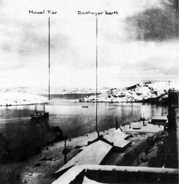
Polyarnoe Photograph taken September-October, 1941
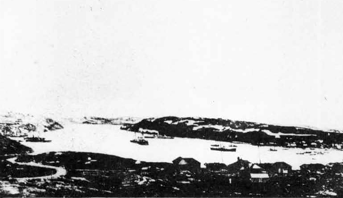
Polyamoe Harbor.
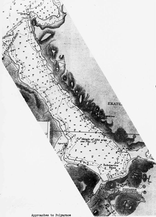
Approaches to Polyarnoe
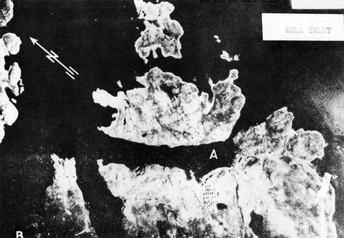
Polyarnoe
Photograph taken August, 1941.
A = Naval Base.
B = Seaplane Base.
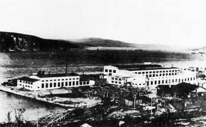
Polyarnoe Harbor.
III. Murmansk (68°58'N., 33°04'E.)
There are no permanent battery installations in the port area, but «taing the times when ships are alongside a formidable array ofmobile Bofors type AA guns and Oerlikons are brought in, also railroad cars, mounted with AA guns ass placed at various points in the port area.
AA guns of caliber up to 4.7" are spaced on the ridge of the hills which lie just east of the town, in addition to those located directly across the Inlet. The number of guns varies considerably, but it is estimated that during the winter of 1943 between 75 and 100 guns of 311 caliber or greater were disposed about the city. The barrage which these guns put up is well laid and, although few high altitude planes are brought down, the only low-flying planes which succeed in reaching the port area have been hedge-hopping Messerschmidt fighter-bombers. Russian fighting planes, for the most part Hurricanes, P 39 fs and P 40's, maintain a continuous patrol, and as soon as enemy planes are reported over Russian territory, additional fighters take off from the airdromes at Murmashei and Vaenga. This system is not entirely effective, since the interval of time between the alert and the arrival of enemy bombers is in the neighborhood of 7 to 10 minutes, which does not permit the fighters to reach the altitude required to intercept the enemy bombers before reaching their target. The great weakness in the AA defenses is in warding off night attacks- Despite claims that Russian night fighters are used, it is not believed that any Russian planes operate over Murmansk at night, and, as a result, during the long winter nights there have been continuous raids from dark until dawn for three and four nights in succession, during periods of moonlight. There are about 70 barrage balloons in the vicinity of Murmansk, but they are very seldom used. The Soviets state that sudden changes of wind may be expected, and the risk of losing the balloons is too great. Apparently, the fact that their presence is known to the enemy lias helped to the extent that the night attacks are now made from an altitude which is considerably greater than was employed before these balloons were brought in.
Until March, 1942, Murmansk had no bomb shelters as such. Cellars were reinforced and some caves dug in the sides of the surrounding hills. Since that time, 2 surface shelters have been constructed, roofed over by 17 feet of reinforced concrete, topped by gravel and sand. These are used by the naval, military, and civil authorities in running the business of the town during air raids. The designing architect claims that they will withstand a ton bomb, although he admits the people inside might feel indisposed. A really effective bomb shelter is a large one built into a rocky hill. Its main halls are 70 feet below the crest of the hill; it can accommodate 2,000 people, has a movie theatre, children1s creche, is gas proof, and has its own lighting, heat, and ventilation system. Although this shelter was blasted out of solid rock, it was built in less than 9 months, and work is now progressing on an extension to be fully as large. Along the road between Murmansk and. Rosta, excavations are being made into the rocky area along the shore, with the view towards underground bomb-proof storage for port supplies and possibly ammunition and fuel oil.
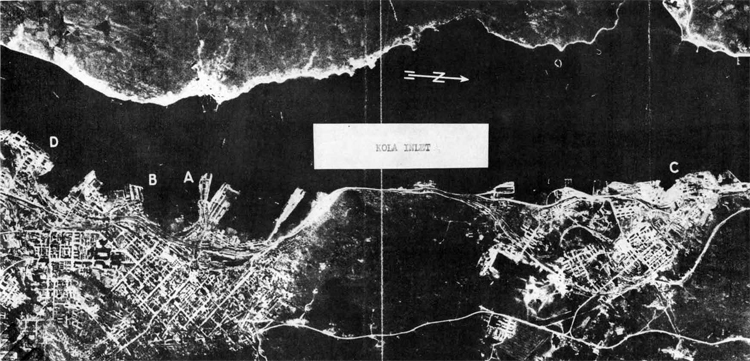
Murmansk Photograph taken August, 1941.
A = Port installations.
B = Khaldeev Point Shipyard with a floating dock 279 ft. long.
C = Rosta Shipyard with two drydocks.
D = Murman-Riba Trawler Base.
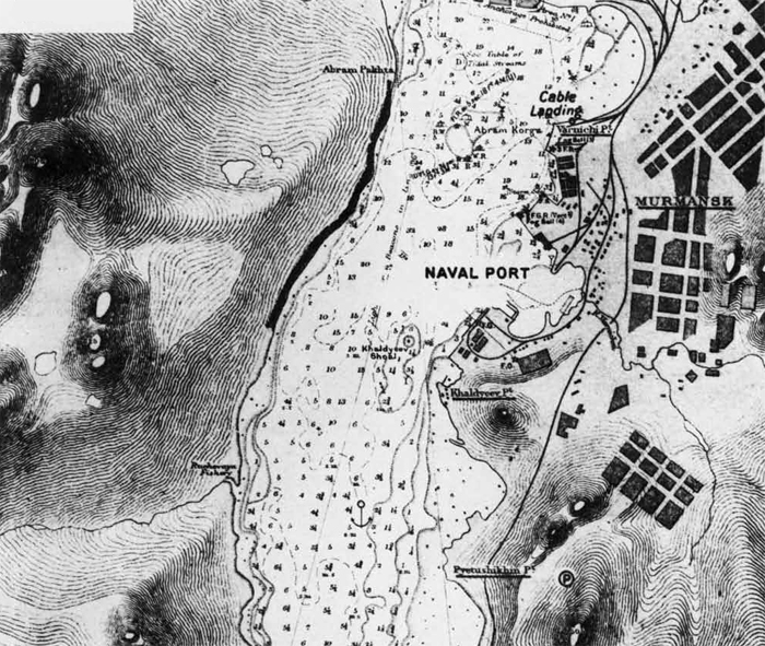
I7- Vaenga (69°10'N., 33°25'E.)
Vaenga is not in itself a town, but is the name given to the airfield and small naval base located about H. miles to the north of Murmansk. The number of planes operating from this airfield varies directly vd-th the number of German planes observed by reconnaissance flights over Finland and Norway, but it has handled up to 170 planes. There are no regular runways, the surface is dirt and gravel, and its best operating period is during the winter. Few shops and storehouses are located in the vicinity of the field, the vrork being don* and the personnel quartered in wooden buildings located about 1/2 mile from the airfield. Fuel dumps, ammunition dumps and storage dumps are scattered in the scrubby hills. The ready planes are kept in revettements around the edges of the field, the reserve planes and planes undergoing repairs being concealed in the brush. Work is progressing on underground storage for ammunition, fuel and supplies and on bomb shelters for the personnel.
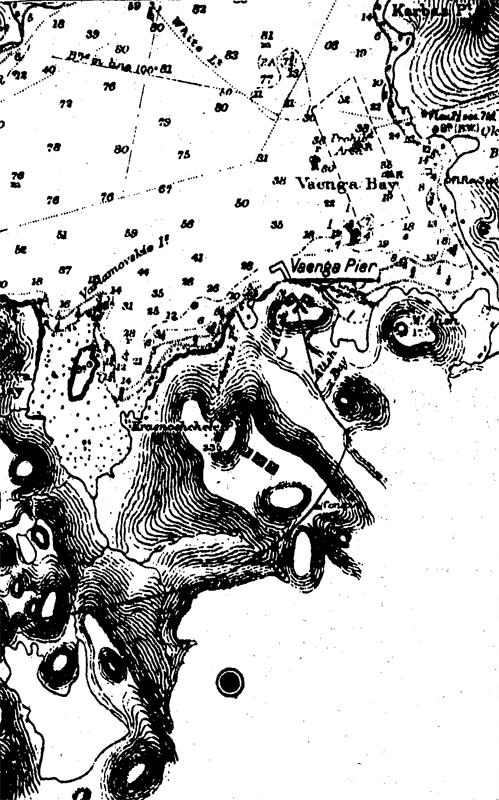
Due west from the airfield on the Kola Inlet lies a small
auxiliary naval base known as the Vaenga Naval Base. This is the
terminus of the railroad,and here are located about 8 large brick
buildings which contain a hospital, barracks, the British Naval Hospital, an optical shop, gyro v/orkshop, small electric workshops, and
quarters for personnel. An L-shapeo1 pier extends into Vaonga Bay,
length about 250 feet, depth alongside 18 feet, suitable for berthing
destroyers. Inboard of the base of the L,may be based trawlers and
tugs. This pier has been used as a discharge point for our A-20
bombers, which are taken down from Murmansk on a small lighter. Vaenga
Bay itself is normally used as an anchorage for Soviet men-of-war,
but during periods of convoys it is reserved for the escort vessels.
It is also used as a drill ground for training torpedo bomber crews,
during which period all ships are removed from the vicinity. From Vaenga to Polyarnoe,is a distance of 9 miles,and ,the quickest way to Polyarnoe from LluttnansI; is by road to Vaenga, thetice by motorboat to
Polyarnoe.
V. Rosta "(69°02'N., 33°03'E)
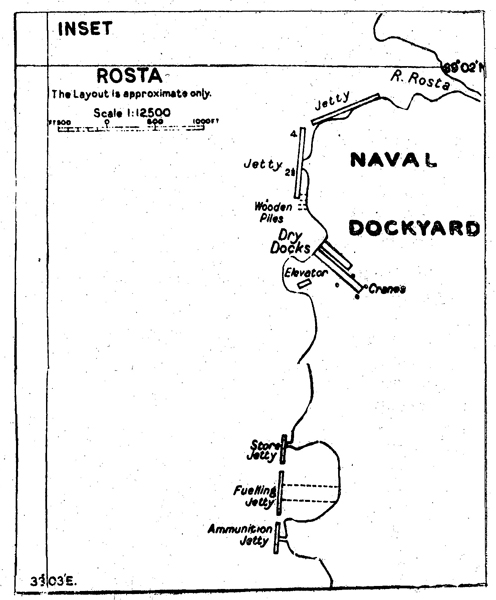
Rosta is a growing settlement 3 miles north of Murmansk, created for the purpose of housing the workers wnployed in the Rosta dockyards, fueling wharf and coaling wharf. It is connected by road and railroad to Murmansk. Owing to the proximity of the town to the dockyards, it has been damaged to the extent of about 25% by enemy air action, but most of its large new buildings are intact; no perma-ment damage has been suffered by the yards, however.
The only yard capable of undertaking major repairs to large vessels is located at Rosta. Two graving docks are located here; their dimensions are as follows:
No. 1 Length 350 ft. Breadth 85 ft. Depth over sill 35 ft.
at high water. No. 2 Length 650 ft. Breadth 85"ft. Depth over sill 35.ft.
at high water.
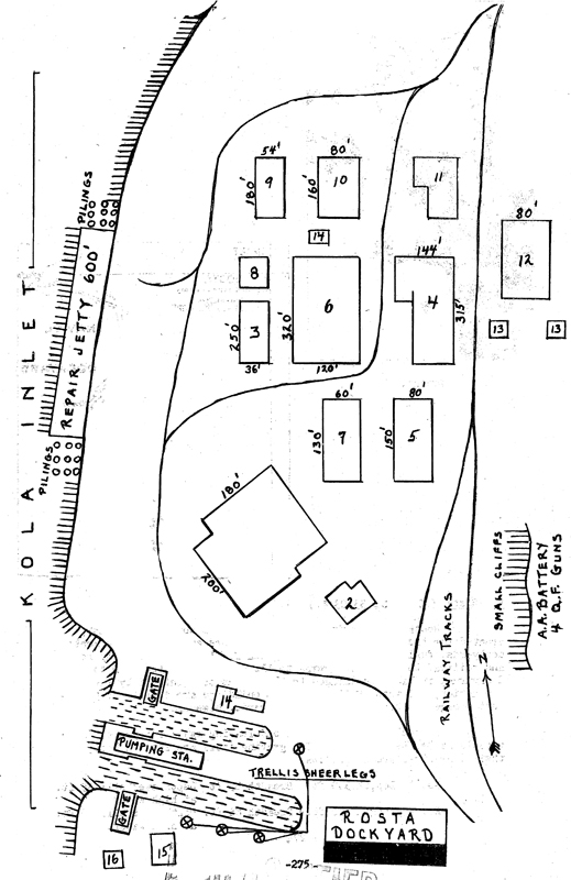
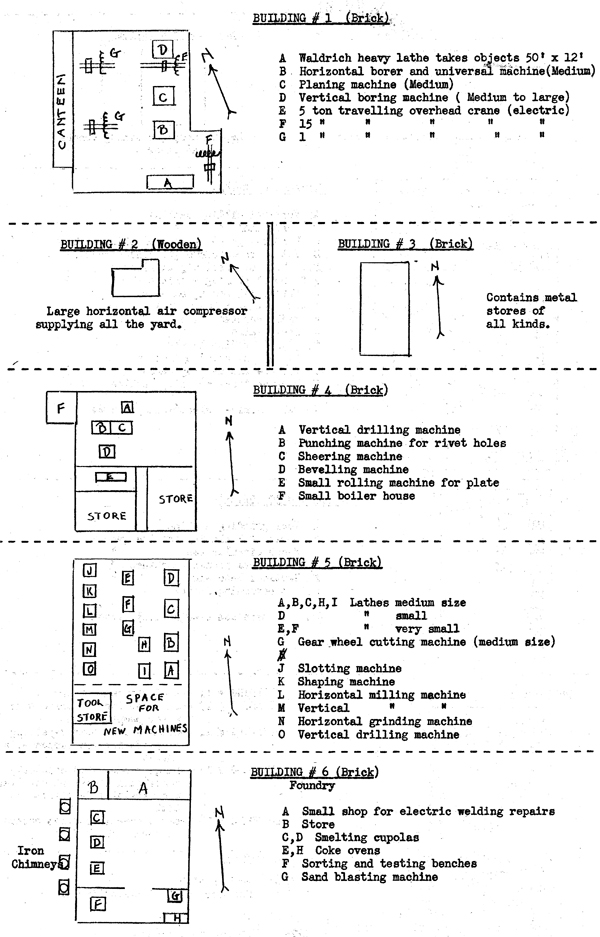
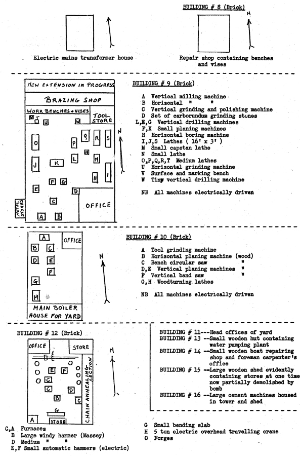
VI. Graznaya (69°04'N., 33°15'E)
Graznaya is the main seaplane base of the Soviet Northern Fleet. It is located about 8 miles north of' Murmansk and is connected by land to the latter and to Vaenga. Here are located hangars, small workshops, storehouses and barracks. Observed operating from this base and undergoing repairs were 7 MBR 2's. There is ample room in the vicinity for considerable enlargement of this base and some little work , seems to be .in progress, mainly blasting operations in the surrounding hills to provide underground storage of ammunition and fuel. Ammunition and fuel at the present time is scattered over the neighboring tundra.
VII. Epron (Government Salvage Agency) 68°54'N., 33°01'E
This yard is located on the western side of the Inlet just north of Yelovi Point. No opportunity was afforded to survey this establishment, but judging from the fact that large- submarines and destroyers undergo repairs at this base and from it's; appearance as seen from the Inlet, it can probably handle anything short of major repairs
VIII. Kunnan-Riba Trawler Base (68°58'N.« 33°04'E)
This base, located just south of Murmansk, contains a slip which can handle vessels up to 700 tons and small shops can cater to the maintenance of a fleet of 200 fishing trawlers, most of which are now engaged in minesweeping and patrol duties.
IX. Khaldeev Point (68°57'N., 33°04'E.)
This area is strictly guarded but as seen from the Inlet and surrounding hills, it gives the impression of being a naval dockyard under construction with many shops and foundries already completed. A 1200-ton destroyer, a trawler, and a medium-sized submarine were observed drawn up on the ways, all undergoing repairs. It is quite likely that this will eventually be the main naval building and repair yard in Kola Inlet$ a 279! floating drydock was reported here in August, 1941.
X. Abram Point (68°58'N., 33°02'E.)
There is a small boat building yard and a boat repair shop here.
XI. Iokanga (68°05'N., 39°30'E)
Iokanga, located on the northeastern shore of Kola Peninsula, is a restricted areaj permission to enter it must be granted by the Soviet authorities.
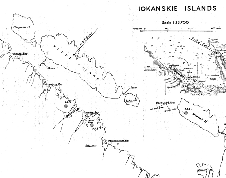
IOKANSKIE ISLANDS
Xll. White Sea
(a) In General - The 'Jhite Sea Flotilla consists mostly of
trawlers; from time to time a few submarines are attached to it.
This flotilla is based chiefly on Solombala, across the Kuznechikha River from Archangel; a few units are occasionally based on
Molotovsk.
(b) Molotovsk - The naval base at Iviolotovsk is located, to
the east of the commercial port, has been designated "restricted
area", and has been kept very closely guarded. Small submarines
are being constructed east of No. 3 pier (see chart) and are
launched broadside-to, from especially constructed railroad flat cars. In December, 194-2, there were 2 hulls, but on which work
had been very slow and at that time apparently stepped altogether.
Construction of roads, buildings, and improvements within this area is still going forward. One steel and brick building is large enough to be capable of housing 2 10,000-ton vessels, and at one end a launching basin appears to be under construction; however, no foreigners have ever seen anything under construction .within, this building nor observed anything in the basin.
It is reported that a huge graving dock is under construction across tha river from this restricted area, but this remains unconfirmed. The United States Assistant Naval Attache, Murmansk, believes that the construction of such a drydock would be impossible because of foundation difficulties,. This opinion is based upon the fact that construction of a rail and traffic bridge from Archangel Citjr toSolombala was started 2 years ago but was stopped because the foundation proved unsafe. Difficulties of the same sort were encountered in the I.Iolotovsk area, which is built entirely on a swamp and on reclaimed land. This restricted area is used as a base for ice breakers; yet all the major repairs rust be done in shipyards of allied countries, as Holotovsk does not have the facilities.
If the present plans for the port and restricted area are carried out, laolotovsk vrill undoubtedly be made into a fine port with an ample repair yard; yet all the construction labor used is convict labor, with the resultant poor construction, and, at the present rate of building, will take another 5-year plan to put the place in first-class shape.
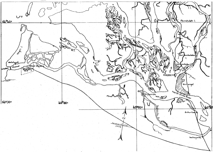
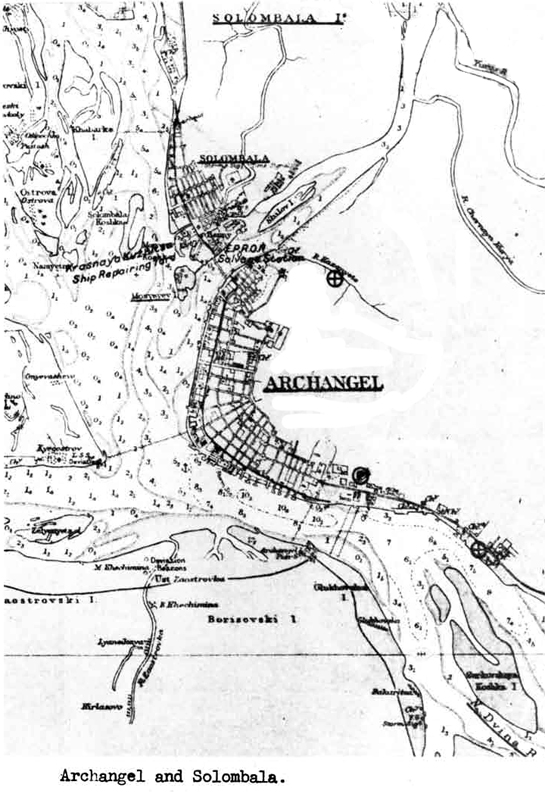
Archangel and Solombala.
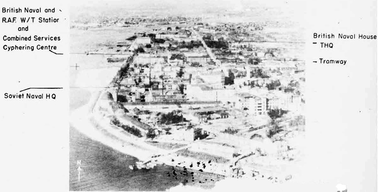
Archangel.
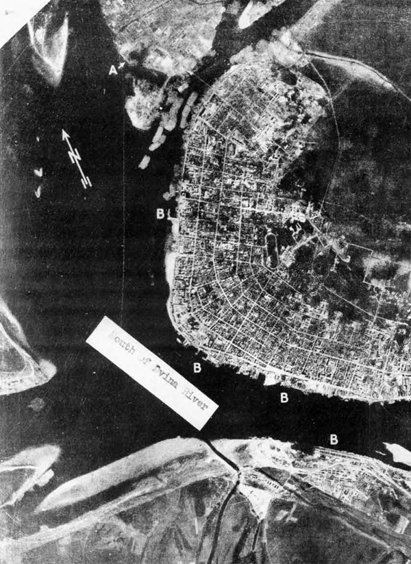
Archangel
Photograph taken July, 1941.
A = Ship repair yard.
B = Port installations.
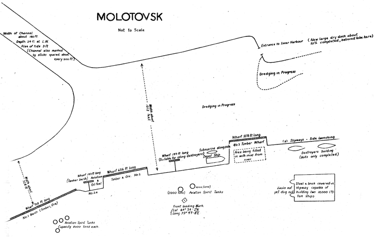
MOLOTOVSK
Not to Scale
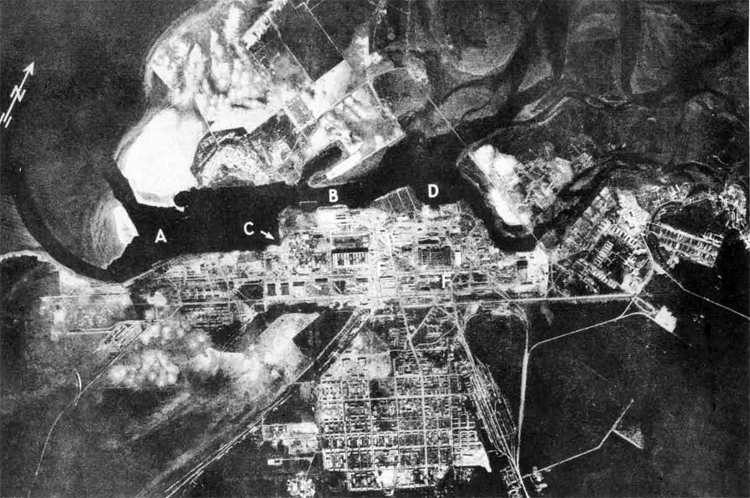
Molotovsk Photograph taken July, 1941
A = Naval Base.
B = Slips.
C = Fitting out basin with locks under
construction.
D = Wharves.
E = Shipbuilding Shop.
F = Metalworks.
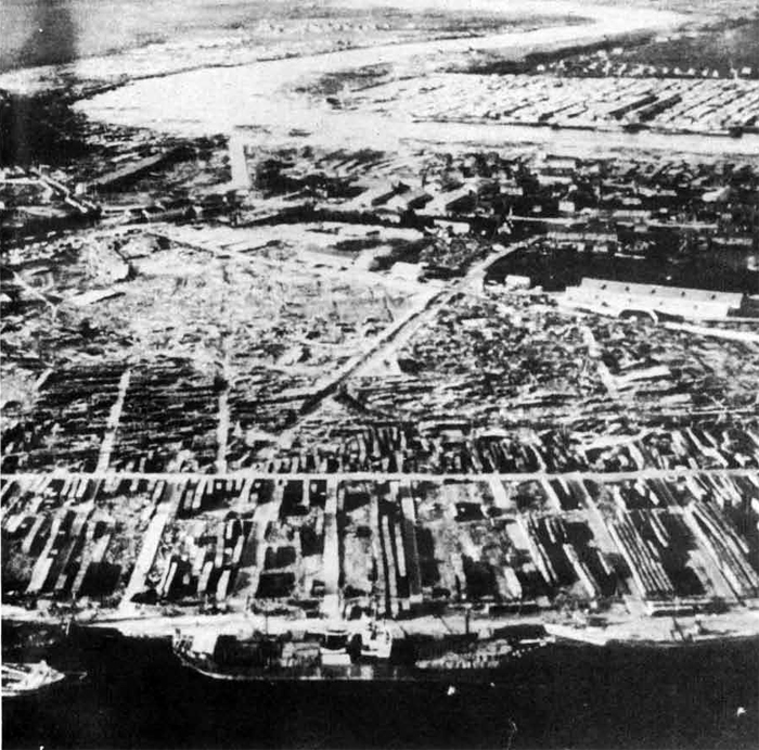
Archangel in the foreground - Solombala in the background.
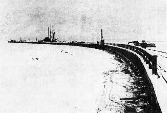
Belomorsk.
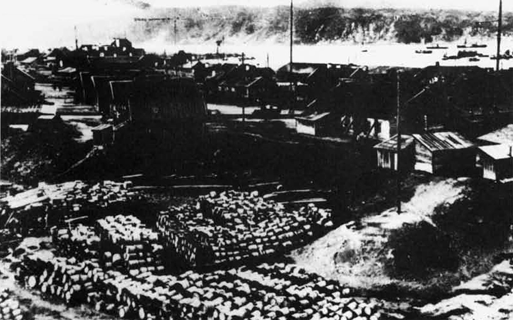
Kandalaksha
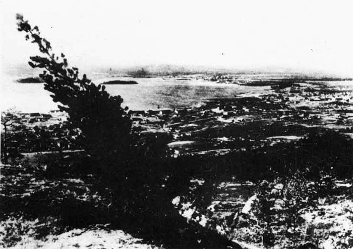
Kandalaksha. General view.
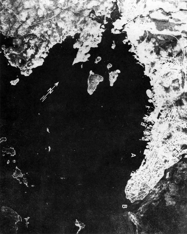
Kandalaksha
Photograph taken July, 1941
A = Harbor.
B = Mouth of the Niva River.
E. Naval Bases on the Amur River
I. In General. The Soviet Amur River Flotilla is responsible for the patrolling of the entire Amur Basin. This basin, including the Shilka and Argun Rivers, as well as the Amur. River, is navigable for 22,000 miles, although only 12,000-16,000 of it are now being used.
The Amur River, which is 1,800 miles long, is navigable at
Blagoveschensk for 160 days a year (.11 May to 20 October), at Khabarovsk for 190 days (2 May until 1 November), and at Nikolaevsk for
165 days (19 May to 30 November). At low water, from its mouth to
Komsomolsk, it has a least depth of 16 feet, which is maintained over
the bars by means of dredging. From Kotnsomolsk to Khabarovsk, it has
a least depth of nine feet, and from Khabarovsk to Pokrovka (the confluence of the Shilka River), five feet.
There are no buoys on the river. Navigation is by shore ranges, or by pilots with the aid of compass and bearings. Where the Amur River forms the frontier between the U.S.S«R. and Manchukuo, the middle of the navigational channel serves as the boundary. If the channel should change, which it often does, a border commission decides on the position of the new channel; the majority of the islands/ over which there could be disputes because of the shifting channel, are considered as neutral territory and are, in many cases, uninhabited, as they are low and swampy, and subject to complete flooding.
II. Nikolaevsk. a restricted defense area and naval base, is situated near the mouth of the Amur River. This port was officially opened in I9I6 for the purpose of relieving pressure on the railway to Vladivostok by transporting goods up the Amur River. Owing to ice packing in the Straits of Tartary, it is usually possible to enter the Amur River earlier from the Sea of Okhotsk than from the Sea of Japan.
In view of the shallowness of the water at the port, sea-going vessels anchor in the roadstead opposite Nikolaevsk, where they unload onto barges. To enable these vessels to approach the roadstead, marine canals have been cut in the direction of the Sea of Okhotsk and Gulf of Tartary. The canal in the former direction has a depth of 20 ft.; in the latter, a minimum depth of 16 ft. The minimum depth from the mouth of,the Amur to the roadsteads at Nikolaevsk is 36 ft. It may be that dredging has been accomplished which permits sea-going vessels to anchor at the new berths at Nikolaevsk, which have been reported to be under construction.
It is thought that Nikolaevsk, in case of war with Japan, would
be a naval operating and repair base for a detachment of the Pacific
Fleet, as well as an operations base for the naval air force, A wintering base for the Amur Flotilla is located in the Palvinski Channel,
24 miles above the town.
There are apparently ship-repairing shops of the Lower Mur River State Steamship Company at Nikolaevsk. In the spring of 1938, construction may have been begun on repair workshops for sea-going vessels.
There is a seaplane base at 53° 19' N, 140° 40' E, with a slipway and fuel stores, as well as an airdrome 1,100 yards square, 4. miles from the town.
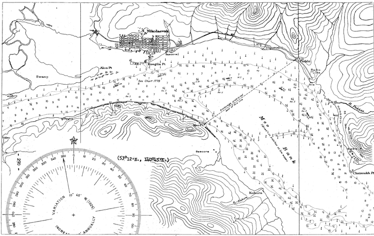
III. Komsomolsk. Although the primary naval importance of Konsomolsk i3 its shipbuilding yard, it is also probably used partially by the Amur Flotilla.
IV. Mariinsk. At Mariinsk, there is a seaplane base and airplane landing.
V. Khabarovsk is located at the confluence of the Amur and Ussuri riivers, and is of great military importance to the U.S.S.R. in the Far East as a focal point in the defense system of the Amur fiivor. Vessels drawing 12 ft. of water can reach this point from the mouth of the river, but only during the flood seasons of April to July.
The base of the Amur Flotilla is at Osipovka, 5 1/2 miles down river from Khabarovsk. There is a nell-equipped shipbuilding and ship repair yard here, and it has been reported that this yard has assembled one or two submarines, which were probably towed round for completion to Vladivostok. Khabarovsk is the river base for units of the Frontier Guard of the MVD.
There is a large and well-equipped airfield with underground hangars northeast of the town; its dimensions are 800 by 600 yards. There is also reported to be a military aviation school, as well as a seaplane base at Payenda, in the vicinity.
Khabarovsk is a highly fortified zone, but the degree and extent of its fortifications and defenses are not known, although it may be that the main fortified line is located about 2 miles from the east bank of the Ussuri River.
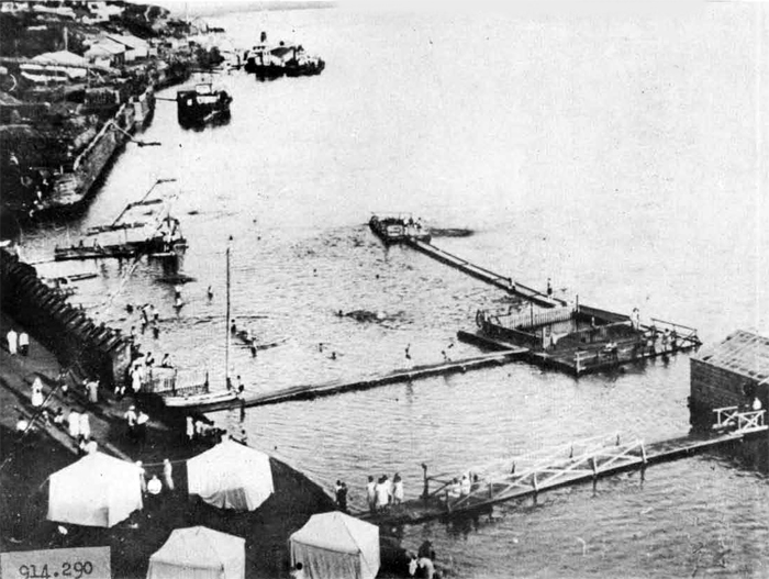
Khabarovsk - The Port.
Khabarovsk - Portion of the city.
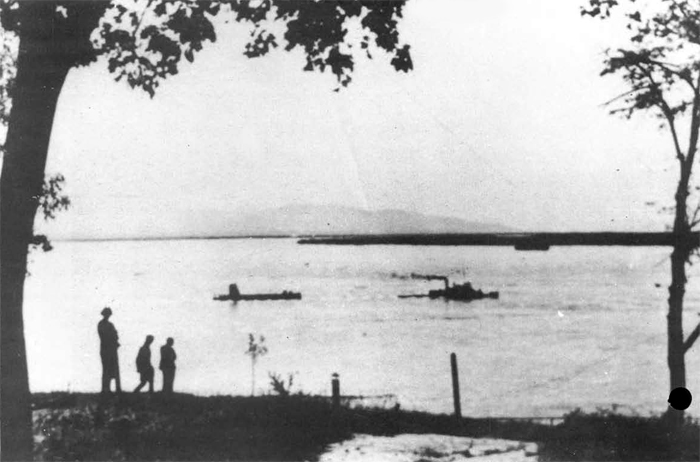
The Amur River near Khabarovsk.
VI. Mlkhailo-Semenovskaya. At this point, there is reported to be winter quarters for units of the Amur Flotilla.
VII. At Blagoveshchensk there is rer-orted to be two shipyards and a well -equipped naval detiot for the Amur Flotilla.
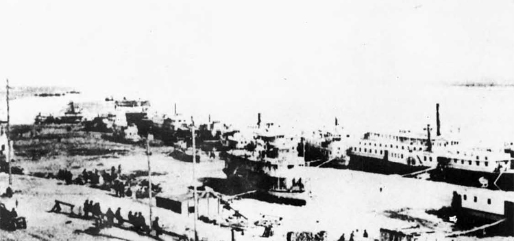
Blagoveschensk - the port.
F. Naval Bases in the Caspian Sea
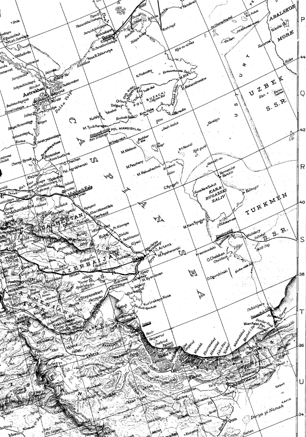
I. Baku, the principal tovjn and port on the Caspian Sea, as well as the export center of the rich Caucasus oil fields, is also the chief base of the naval flotilla and site of the naval academy, which was formerly located at Leningrad. Baku roadstead proper is tho portion of the bay contiguous to the town. .Anchorag* here is sheltered from all winds, but with a southeasterly wind blowing in the bay; there is a considerable swell, which may be felt even in the roadstead. An unconfirmed report states that a new channel is boing dredged, which will shorten the approach to Baku by 22 or 23 miles. Baku Bay is accessible to all ships. Depths alongside the newer wharves are thought to be sufficient for ships of 23 ft. draft, but at the older wharves, they are less. Wharves line the entire coast of Baku Day for a distance of about eight miles, there being about 3,720 yards of wharves for tankers and about 2,800 yards for general cargo vessels.
The navy yard is located in the western portion of Baku Bay at Bailov Point; it is protected from cast and west by a mole. It contains workshops equipped for carrying out current repairs and complete overhaul of units of the flotilla, as well as mechanical works and barracks for the Caspian Flotilla Naval Depot; perhaps it contains facilities for assembling and fitting out submarines, which are reportedly floated dorm the Volga Kiver from Gorki. It can easily serve all requirements of the flotilla. There are three ship repairing yards, two ship repairing workshops (one naval and one commercial), and one engineering workshop. Two of the ship repairing yards have complete shops for hull and boilers, copper tubing, painting, tackle welding engineering, forging, etc. Here, the chief drydock in the Caspian Sea is located, which can accommodate ships at least as large as 6,600 gross tons; there is also one small floating drydock. In April, 194-3, there was considerable shipbuilding activity going on at Baku; small naval craft were building and under repair, and at least two merchant ships were on the ways, nearing completion.
Baku appears to be under strict military control; foreigners are discouraged in remaining there any longer than is absolutely necessary. During the latter part of 1942, Baku was partially blacked out. Balloons close-hauled wore noted in a number of places in the town; they usually floated at a few hundred feet at night. In April, 1942, and again in December, a large floating contraption, resembling * large lift mounting several small anti-aircraft guns, was seen in "Baku Bay, about 1 1/2 miles offshore.
There are three airfields and perhaps two seaplane bases in the vicinity of Baku.
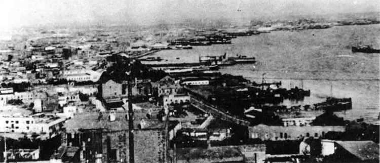
Baku - Commercial port - east of Naval Base.
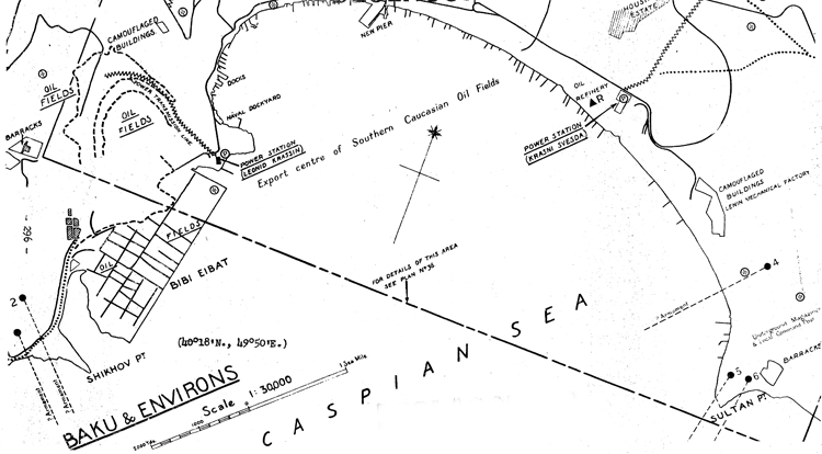
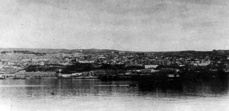
Baku - Port and City.
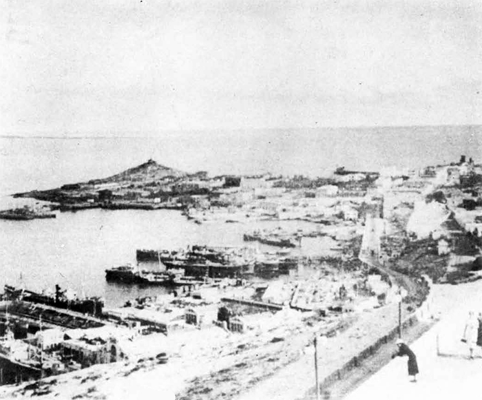
Baku - Naval Base.
II. Makhach Kala is a secondary base to Baku for the Caspian Sea Flotilla, and possesses shipbuilding and ship repair yards of minor importance; it is located on the western shore of the Caspian Sea, about 235 miles north of Baku. Commercially, it is important as a petroleum and grain port, and between Ofttober and April, when the mouth of the Volga River is frozen over, it replaces Astrakhan for shipment of goods to Krasnovodsk and Iranian ports.
Ships drawing up to 22 feet are believed able to reach the channel to the port, but dredging in the harbor is thought to maintain a depth not exceeding 16 feet. A shipbuilding yard was reported to have been under construction in 1941, and may have been since completed; there is one floating drydock, which can accommodate medium-sized ships.
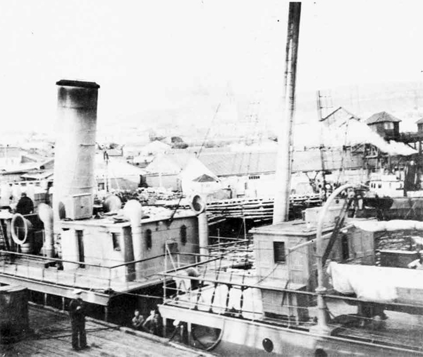
III. Krasnovodsk. the terminus of the Trans-Caspian Railroad, on the eastern coast of the Caspian Sea, is said to be a secondary base for the Soviet Flotilla, stationed on Baku. The port, which is sometimes frozen over for short periods during the winter, consists of two harbors. 'Western Harbor, ;vhich is located at the town, is approached by a channel two miles long; in this channel, there is a mean depth of IS feet. The second harbor, called Ufra Harbor, is the petroleum port, and is located on the eastern shore of Muraviev Bay; its approach channel, which is about three miles long, has a depth in its center of about 16 feet. Krasnovodsk has ship repair workshops, of not very great capacity.
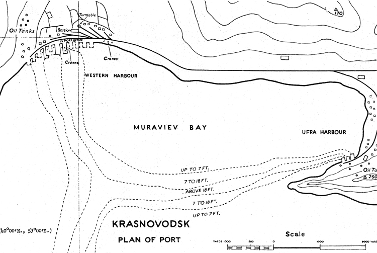
IV. Hasan Kuli is located on the small bar of the same name on the at the southeastern shore of the Caspian sea, at the Iranian frontier. In July 1942, it was reported that a new naval base had been equipped here. No further information is known regarding it. It cannot be of very great importance, however, as vessels drawing 11 feet of water cannot approach any closer than 3 1/2 miles from the port.
V. Minor naval operating bases. It is reported that in addition to the above mentioned bases, the ports of Astara, Aie..androvsk, Lenkoran, Guriev, and others are being employed as wartime naval bases; they possess little or no installations.
G. Shipbuilding Yards on the Volga River.
I. Gorki. Various reports indicate the construction of submarines at this point; no information is available on it, however.
II. Zelenoldolsk is located about 40 miles west of Kazan. The shipyard is located 1 1/2 miles from the town and extends approximately 1 1/2 miles along the river; it employs about 5,000 workmen.
The extent of activity is not known prior to USSR's entrance into the war, but it is known that considerable equipment was moved in and new shops built in the last 2 years.
In addition to the machine shops, wood working shops and electrical shops devoted to ship construction, an unknown number of shops are manufacturing various size and types of shells, repairing guns, and manufacturing valves.
All the shops and buildings are one story woodon structures. The lighting, both natural and artificial, is very bad. Due to this poor lighting,it is assumed that many accidents occur, as very little in the way of safety measures are evident. The personnel in the various shops is about 75$ female. The equipment is largely British and American make.
At the present time 8 - 210' steel subchasers, with 17'6" beam are under construction. Six hulls will have 3 - 1,200 HP General Motors Diesel engines each. 2 - 1,600 HP General Motors Diesel engines will be installed in the remaining 2 hulls. The construction throughout these vessels is of light weight steel. The thickness of hull plating is 5/32", keel 1 1/8" x 5 1/2" and reinforcing through-ait bilges with 5/32" plating and l/4w angle irons. Watertight doors are not used; entrance to compartments is through water tight hatches. Engine room ventilation is very poor. In aft engine room,a double bottom tank eight feet long is used for storing lubricating oil. The main fuel tanks are three separate double bottom tanks with small capacity. The electrical supply is furnished by 2 -25 KW General Motors Diesel engine generators. All wiring is lead covered. 2 l/2n spun glass is inserted or wrapped in tinfoil for insulation along the skin of the ship. 3/4" cork insulation is used throughout bulkheads and rooms.
In addition to the six subchasers, PT boats using Hall Scott and Packard engines, both Lend-Lease furnished, are being built. It has been impossible for technicians to see these boats to obtain additional information. 2 ice breaker type tugs and 3 oil barges are also under construction, but little progress is being made. At the present time 2 - 1,600 HP engines and 16 - 1200 HP engines with all accessory equipment are in storage. It is estimated by the U.S. Navy technicians that 2 years will be required to complete the 8 hulls now in the water.
"The yard equipment, such as shore handling apparatus overhead and traveling cranes is limited to two locomotive type crane of 10 ton capacity mounted on narrow guage railroad. The unloading and installation of the G.M.C. Diesel engines presented a problem, as the yard does hot have building ways and it was necessary to roll the engines onto the ship and then lower them into the hull with the use of chain falls and cribbing.
This yard is principally used for new construction, and, as far
as is known, no repair, conversion, or battle damage work is done
here.
The yard is not an efficient, well-operated yard where equipment is installed promptly. It is evident that a definite building schedule does not exist and it appears to be the Soviet policy of getting as much Lend-Lease equipment as possible at the various yards and place it in storage for future building.
Exclusive of the various shops unskilled workers form the large percentage of employees,and the technicians have noticed that there is a tremendous amount of supervision, but in spite of this supervision, the work on ship #337 is not done in an efficient manner. After working an hour or two in the engine room, all hands will go topsid© to smoke and talk and even the appearance of the director on board does not interfere with their many rest periods.
Prefabrication arrangements, such as practiced in U.S. Yards, do not exist. It has been impossible to see the ship drawings to determine the degree of complication or detail. Relationship between designers and shipbuilders is not known.
The yard is without fire-fighting equipment.
Large quantities of scrap iron, steel, bronze, etc., is being piled up here, although the yard does not have a foundry. It is understood that the scrap is being shipped here from Stalingrad.
III. Kazan. Another shipyard is located at Kazan, but no information is available concerning it, except that some 500 HP General Motors Diesel engines, which have been furnished by the U.S. Navy under the Lend-Lease Act are being installed.
CHAPTER IX. SOVIET NAVAL AIR FORCE
A. ORGANIZATION
The Military Air Force of the Navy is an integral part of the People's Commissariat of the Navy. Although the actual organization of the Soviet Naval Air Force remains a zealously guarded mystery, it is assumed that it follows the Army Air Force pattern,
1. The Supreme Military Council is presided over by the People's
Commissar of Defense (Stalin) and the Assistant Commissars. At
least three air Force generals serve on this Council. It exercises
complete control over the Air Force.
2. The Committee for Defense under the People's Commissariat for
Defense puts into effect the decisions of the Supreme Military
Council.
3. The Department.for Air at the Commissariat of the Navy is
charged with general control and administration of the Naxral Air
Forces.
4. The Naval Air Forces comprise of the Northern, Baltic, Black Sea, and Pacific Fleets. They consist of shore-based aircraft, seaplanes and flying boats; as far as is known none are shipborne. The area of the Air Force of the Northern Fleet includes Archangel, the Kola Peninsula and Murmansk. The Naval Air Force of the Baltic Fleet has probably merged to a great extent into that of the Army defending Leningrad. The main bases of the Air Zone of the Black Sea Fleet were in the Crimea, and have presumably withdrawn to the East. That of the Pacific Fleet stretches from Vladivostok to Kamchatka.
5. Each Naval District Air Force is under the command of the Senior Naval Officer through the Senior Air Officer in his staff.
A few naval air regiments have been re-named Guards Naval Air Regiment for distinguished service.
The division of the Russian Air Force between the Army Air Arm and the Navy Air Arm is in the proportion of about four-fifths to one-fifth.
B. STRENGTH AND DISPOSITION.OF-SOVIET NAVAL AIR FORCE - 1 October 1943
(Estimate):
I RUSSO-GERMAN FRONT
| In Operation | Reserve | Total | |
| Medium bombers | 100 | 50 | 150 |
| Fighters | 150 | 80 | 230 |
| Flying Boats | 100 | 50 | 150 |
| Special Purpose | 50 | 20 | 70 |
| Total | 400 | 200 | 600 |
II. FAR EAST
| In Operational Squads | Reserve | Total | |
| Medium bombers | 30 | 10 | 40 |
| Fighters | 50 | 30 | 80 |
| Flying Boats | 100 | 50 | 150 |
| Special Purpose | 20 | 10 | 30 |
| Total | 200 | 100 | 300 |
III. TOTAL NAVAL AIRFORCE OF USSR
| In Operational Squads | Reserve | Total | |
| Medium bombers | 130 | 60 | 190 |
| Fighters | 200 | 110 | 310 |
| Flying Boats | 200 | 100 | 300 |
| Special Purpose | 70 | 30 | 100 |
| Total | 600 | 300 | 900 |
C. PERSONNEL
The present personnel strength of the Soviet Naval Airforce is not known; however, prior to the outbreak of the Russo-German War in June 1C41, it was, estimated as being 600 flying and non-flying officers and 3,000 enlisted men. This number has undoubtedly expanded during the war.
D. NAVAL AIR SCHOOLS
The: following schools9 under the People's Commissariat of the Navy, are for the training of Naval Air personnel:
1. The Naval Air School of Nikolaev. (Present location unknown.)
For all citizens between the ages of 17 and 22; two-year course; prewar student body - 200. Graduates receive the rank of Voyentechnic
of 2nd rank.
2. The Naval Air School (Stalin) in Gisk. For all citizens
between the ages of 17 and 22; two-year course; pre-war student body -
200. Graduates receive the title of Voyentechnik of 2nd rank.
3. The Naval Technical Air School in Perm. For all citizens
between the ages of 17 and 22; two-year course; pre-war student body -
200. Graduates receive the title of Voyentechnik of 2nd rank.
The above are primarily Naval Air Schools. However, personnel of the Soviet Naval Air Force may attend other Naval technical schools and be assigned to the Naval Air Force.
E. NAVAL AIRCRAFT PRODUCTION
No information is available on naval aircraft production at the present time.
The bulk of material used by the Naval Air Force are Army land based planes which are manufactured under Army supervision and turned over to the Navy. Most light, single, and twin-motored aeroplanes are quickly adapted, to wheels, skiis or pontoons.
F. SEABORNE AIRCRAFT
The Red Navy has no aircraft carriers
Various aeroplane and seaplane depot ships carry aircraft for the purpose of repairs and supply; icebreakers sometimes- carry aircraft for meteorological reconnaissance, when escorting vessels through Arctic waters,
There are approximately 10 units (cruisers and destroyers) of the Soviet Combat Fleet capable of carrying aircraft. In all, they carry no more than 12 aircraft; usually 1 airplane on each unit.
G. ORGANIZATION OF NAVAL AIRCRAFT UNITS
I. Sea-Based Aircraftf (MBR Type)
| 3-ships | 1 flight | 3 ships |
| 2 flights | 1 squadron | 6 Ships |
| 3 squadrons | 1 regiment | 18 Ships |
| 6 groups | 1 division | 108 Ships |
II. Land-Based Aircraft. (Fighter and Medium Bomber)
| 3-ships | 1 flight | 3 ships |
| 3 flights | 1 squadron | 9 to 15 Ships |
| 4 to 6 squadrons | 1 regiment | 60 to 90 Ships |
| 4 regiments | 1 division | 160 ? Ships |
H. TACTICAL OPERATIONAL POLICIES
Independent naval air operations are carried on on a limited scale. Full cooperation between the Naval and Army sir forces is the rule.
Air operations of the North Sea Fleet consist, as a rule, of attacks on enemy occupied airfields carried out by bombers, often FE-2, and long-range fighter aircraft of the PE-3 type. Anti-submarine and shij^sing jDatrcls are flown whenever possible, by PE-3's, GST's and the MBR-2's. Successes are claimed from time to time in torpedo-attacks against shipping, by DE-3 bombers fitted for torpedoes.
The activities of the Air Forces of the Baltic Fleet fall under three main headss (a) Attacks on sMgging with bombers, torpedo-bombers, and fighter aircraft; (b) Attacks on enemy occupied ports and coastal towns; (c) Participation with the Army in the fighter defense of Leningrad.
The Naval Air Forces of the Black Sea Fleet-have been heavily engaged. Diiring the seige of Sevastopol, June and July 1942, the Naval Air Force played a notable part in the day and night operations in the defense of this fortress. As the war progressed the Naval Air Force bombed enemy-occupied ports; attacked shipping, with ever increasing intensity and efficiency. The spearhead of these attacks are usually DB-3rs fitted to carry torpedoes, operating with fighter protection.
Attacks are often launched by the Naval Air Force in cpjnjunj^ULon with torpedo attacks by submarines.
Aerial mine laying is practiced on a limited scale in the Baltic and Black Seas. Naval air operations are usually contemplated close to the shore only.
I. TYPES, CHARACTERISTICS OF SOVIET NAVAL AIRCRAFT
The following types are "standard" Soviet Naval Aircraft
GST - Russian replica of Consolidated. PBY-2, Flying Boat. Reconnaissance and Bombing. Often used in anti-submarine and shipping patrols. Probably the best of the Soviet narine aircraft.
MBR2 Reconnaissance and Bombing Flying boat. An old type which is in service in fair numbers-with the Black Sea and Northern Fleets. Anti-submarine and shipping patrols.
MDR-5 - Replica of Consolidated PBY-1, Flying Boat. Reconnaissance and Bombing. Obsolete and is being superceded by MDR-6.
MDR-6 - Reconnaissance and Bombing. Flying Boat. Russian designed, twin-engine.
KOR-1 - Reconnaissance. Float plane.
ARK-3 - Beconnaissance. Two-motor Flying Boat. Specially designed for Arctic operations.
E-59 - Reconnaissance. Lake and River Service.
Types listed below are essentially Army planes, which are also used by the Naval Air Forcess
IL-2 - "Ilyushin", inaccurately known as "Sturmovik". Used by the Naval Air Forces as a medium bomber and fighter.
YAK-1 - Single seat Fighter. One of the most popular of Russian military aircraft. Known to operate on a ski undercarriage in the winter.
Mig-3 - Standard Soviet Fighter. Until recently has shared the bulk of the fighting.
.
(the 1-15 biss, 1-16, and the 1-153, are all obsolete and are being replaced by the YAK-1, MIG-3, and LAGG-3, However, all three types have been used on the Russian-German front.)
I-15biss - Fighter. Used in the Spanish Civil War.
I-153 - Fighter. Widely used in the defense of Sevestopol.
1-16 - Fighter. One of the best known Russian fighter planes appearing in the Spanish Civil War. (then known as Rata) Has been recently noted at Murmansk.
PE-2. Dive Bomber. Probably the most widely used reconnaissance and dive bomber.
PE-2B - Long-range Fighter. Developed from PE-2 Dive Bomber. Used (PE-3) with the Air Forces of the North Sea Fleet.
DB-3 - Bomber. Widely used by the Soviet Naval Air Forces in all theaters of operations. Usually used for torpedo attacks. Fitted to carry torpedoes.
DB-3F - Later model of DB-3.
SB Series - Medium Bomber, All models are approaching absolescence.
LA-5 - Latest known fighter.
YAK-7 - Trainer-fighter.
Foreign Types - U.S. and British "Lend-Lease" aeroplanes.
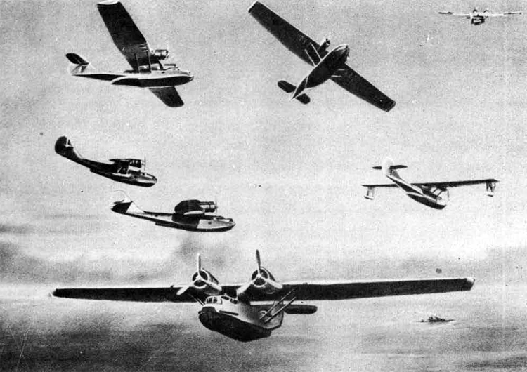
GST
History: - Consolidated Model 28 (PBY) ballt under licence in Russia. Generally similar to "Catalina." Until recently this flying boat was built at Taganrog, on the Sea of Azov,
Duty: - Reconnaissance. Bombing,
Type: - Twin-engiiie, parasol monoplane flying beat.
Crew: - 5 to 7.
Airframe characteristics: - Wing in 3 sections. Cenre-section Tcntrp-soilion is parallel in chord and is supported above hull on streamline superstructure. Outer panels have slight taper to square-cut tips. Centre-section braced to hull by parallel struts.Wing of stressed-skin constructionexcept for fabric-covered trailing edge. Lateral stabilising floats retract outwards to form end caps at wing tips. Hull of 2-step type with a semi-circular top. All-metal construction. Single fin and rudder. Cantilever tailplane carried high on fin.
Engine installation and propeller: - long-chord cowlings. Controllable inlets. 3-blade c.s. metal propellers (Hamilton type).
Armament installation: - Nose turret and midships mountings are probably manually operated.
Bomb, mine or torpedo installations: External bomb stowage under wing.
GENERAL DATA.
POWER PLANT: No. of engines: 2; Type: M-25; Characteristics: 9-cycls. Radial. Air-cooled; Max power: 850 h.p.; Height: 7,500 ft.;
DIMENSIONS: Span: 104 ft; Length: 65 ft.; Height: 18.5 ft.; Wing area: 1,400 sq.ft.
ARMAMENT: For'd fuselage: 1 x 7.6 mm (M) turret; Dorsal: 2 x 7.6 mm (M) (probable); Ventral: 1 x 7.6 mm (M) (probable)
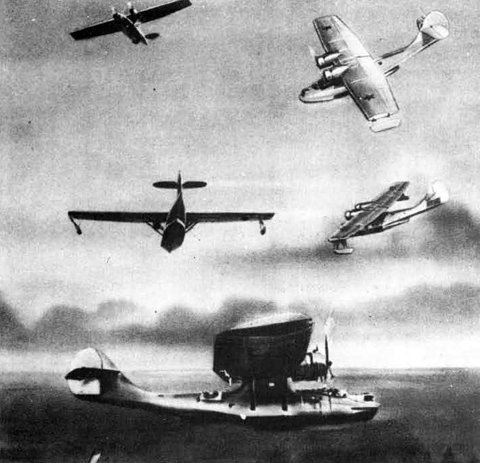
GST
PERFORMANCE
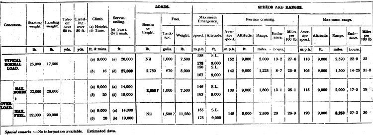
Note.—(1) Ranges ate ideal still-air ranges ; no reduction is made for operational tactics ; assessment of range is made on the following basis—
(a) An allowance is made for warming up and take-off, equivalent to 5 minutes at take-off power.
(b) A further allowance is made for the fuel used in climbing to the operational height at the maximum rate of climb; the horizontal distance covered in the climb is credited to the range,
(c) No credit is gives for glide-in at the end of the journey.
(2) Loading weight = Starting weight less fuel, bombs, ammunition and any jettisonable load.
(3) Conversion of mileage per WO Ib. of petrol into consumption in gallons per hour: Gallons per hour = (13-2 x Speed (m.p.n.))/Miles per 100 lb.
(a) SOME BETAILED NOTES FROM AN INSPECTION OF THE GST
Russian replicas of PBY-2 were built in Russla, moodeled exactly on our own PBY-2 with several minor changes.
The following differences between our own PBY-2 model and that of the Russians were noted:
Wings-Fuselage
(a) The wings appear to be slightly changed with a thicker center
section,
(b) There were no trimming tabs on any of the control surfaces.
Instead of these, there were fixed metal tabs on the trailing edge of
each control.
(c) The fabric was of a- light weight canvas which appeared to be
covered over with paint only. The fabric, where examined, was found to
be lifeless and loose.
(d) The manhole inspection plate on the topside of the wing was
located just abaft the leading edge as compared to our contemporary
model on which the same access was placed a few feet farther aft.
(e) The tail of the plane from the waist hatch aft appeared to be
longer.
(f) All inspection and access plates to Mk. XXXV bomb racks and out
let plugs for power to these racks were permanently sealed over.
Engines
(a) The engines were a copy of our R-1820-20 Wright Cyclone, nine
cylinder, air-cooled, radial type engine. Each had a rated horsepower of
920. According to the Russian engineer officer the engines were not
satisfactory.
(b) The oil sump drain led out of the nose section and was curved
down to project between the two bottom cylinders.
(c) The engines were secured to mountings similar to those of our
SOC-1 airplanes. Each mounting was made up of two detachable parts.
The aftermost part held the oil tank, and the forward part was secured
to it by a four way connection with tapered bolts.
(d) The air scoop of the carburetor was located between the two exhaust openings.
(e) The air scoop for the oil cooler lead straight aft from the
leading edge of the wings to an open exhaust.
(f) The safety wire used on the engine was of copper and was soft
and flexible. Safety wire was not used on the cylinder holding down
bolts.
(g) It is believed that the engines were provided with Stromberg
float type carburetors similar to those used on the R-1340-18 Engines.
The mixture control unit appeared to be on the top of the carburetor
and to the right of the air scoop. No preheat unit was evident.
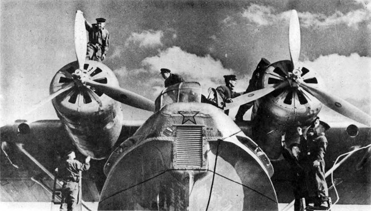
GST
Maximum bomb load: 3,850 (?) lb. Total tankage: Normal - Est. 1,000, Max. - Est. 1,500.
Propellers
(a) The propellers used on the Russian planes were similar to our Hamilton Standard, two-pitch propellers. The propeller and hub assembly were painted black. The hubs appeared to be in a neglected condition, which might have been part of the camouflage; but the counterbalance tracks and weights were definitely rusty.
Interior of planes
All compartments were stripped of unnecessary gear. No fire extinguishers, parachutes, life jackets, flares, or anything of that nature were in evidence. One of the planes carried a spare auxiliary motor in the waist hatch.
(a) Tunnel Compartment
The tunnel compartment was completely stripped. Looking aft from the hatch, the tunnel compartment appeared quite long. The tunnel hatch locking mechanism was dissimilar to that of ©ur own PBY-2 model.
(b) Waist Compartment
In the waist compartment there were decks made of plywood covered with linoleum. A gun mount was located on the starboard side, and a small work bench equipped with a vice was in the compartment.
(c) Living Compartment
Both sections of the living compartment were stripped except for two bunks in the after section.
(d) Navigator's Compartment
The radio equipment consisted of two receivers and one transmitter. There was a chair but no table for the radioman.
A navigatorfs table approximately 21 x 3* was built in between the transmitter and #2 bulkhead on the starboard side. No navigation equipment was in evidence, except for some charts which were rolled up and secured to the overhead.
(e) Pilots' Compartment
The planes were equipped with Sperry Gyro Pilots. The control box on the yoke was fitted with six switches.
(f) Bow Compartment
This compartment was stripped except for a gun mount, which was a circular movable mount encircling the gunner1s position. To the main mount two arms were connected, one on either side of the mount. These arms extended forward, outward at an angle of 45° to the mount. The open ends of the arms supported the guns. At the breach of the Mount was a compartment which held the ammunition, laid flat with the projectile ends facing outboard. The gun would be operated by the ammunition being drawn up the right arm, possibly by the action of the gun itself. The right arm was fitted with rollers to facilitate the travel of the ammunition to the gun. The empty cases and links were disposed of by being guided down the left arm into a canvas container. The complete mount was movable in train by the gunner. The magazine compartment was filled with cartridges, and it was estimated that its capacity was about 200 rounds.' The ammunition was similar to our 30 caliber ammunition, except that the rounds seemed to be of slightly greater diameter with a shorter projectile. The spacing between rounds in the link belt was about 3/8" which clearance appeared necessary to allow the ammunition to pass up the arm without jamming, also to allow it to lie horizontally in the circular magazine.
II. MBR-2 FLYING BOAT
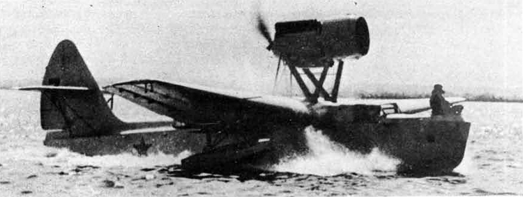
MBR-2
History: - Based on Italian Macchi design.
Duty - Reconnaissance. Probably bombing.
Type: - Single-engine, monoplane flying boat.
Crew: - Probably 4,
Airframe characteristics: - Details of construction urknown. Cantilever
wing has moderate taper to square-cut tips. Hull of 2-step type. Single fin and rudder. Strut-braced tailplene mounted on fin. Pilot's cockpit forward of wing. Engine nacelle carried above wing or a system of N struts. Lateral stabilising floats carried on struts under wing.
Engine installation and propeller: - Annular radiator forward of engine nacelle. Engine drives pusher propeller.
Armament installation: -Bow gun ring and midships turret are probably manually operated.
Normal bomb load: - 440? 1b.
Total fuel tankage estimate - normal: 220 galls.
GENERAL DATA.
POWER PLANT:
No. of engines : 1; Type: M-34 RN.;
Characteristics: 12-cyls.
'V.' Liquid-cooled;
Max. power : 1,200 h.p,;
Height: I3,000 ft.
DIMENSIONS:
Span ; Est. 58 ft.;
Est,
Wing area 538 sq. ft.
ARMAMENT:
For'd fuselage : 1 or 2 x 7.6 mm (M) (probable); Dorsal: 1 or 2 x 7.6 mm (M) (probable)
SOVIET FLYING BOAT, MBR-2
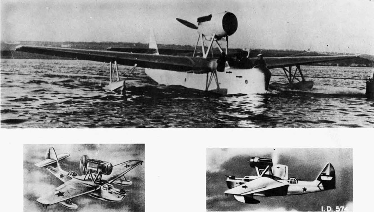
MBR-2
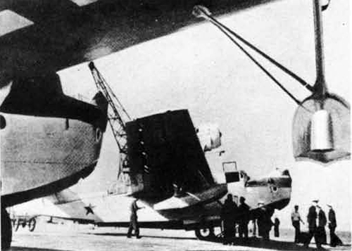
III. MLR-5
Manufacturer: U.S.S.R. Government.
Status- Standard: Obsolescent.
Monthly rate of production: 2
General design: Flying Boat (American Consolidated PBY-1) specification M-1249.
Nunber of engines: 2
Manufacturer and model engine used; Air cooled, M-17(?)
Location of engines: In wings.
Horsepower: 680 h.p.
Number in crew: 5
Armament: 3 m.g.
Service ceiling (ft.): 16,400 ft.
Range: 900 miles.
MDR-5
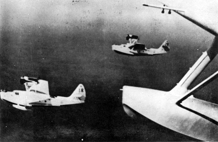
IV. MDR-6
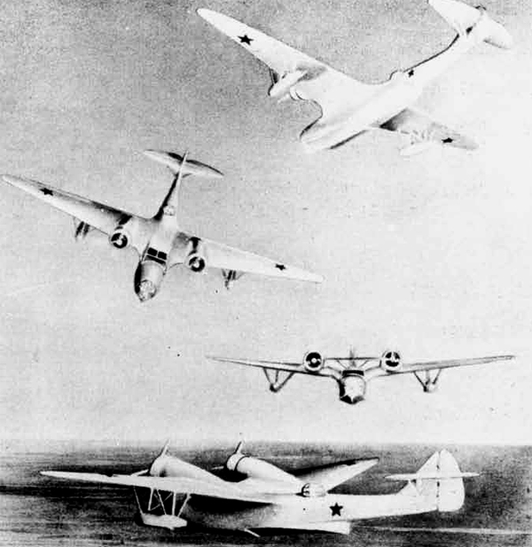
MDR-6
History: - Believed original design.
Duty: - Reconnaissance. Probably bombing.
Type: Twin-engine, "gull-wing" flying boat.
Crew: - Probably 5 to 7.
Airframe, characteristics: - Structural details unknown. Wing appears to have very sharp taper to elliptical tips. Inboard of ailerons win£ is "gulled" into hull. Nacelles mounted at junction of "gul]ed" portions and outer panels. Lateral stabilising floats braced with struts and wires and mounted outboard of nacelles. 2-step hull. Single fin and rudder. Braced tailplane mounted on fin. Enclosed pilot's cockpit forward of wing.
Engine installation and propeller: - Long-chord cowlings. 3-hlade metal propellers.
Armament installation: - Eow and midships turrets probably manually operated.
Total fuel tankage estimate - normal: 450 galls.
TYPICAL NORMAL-LOAD
Starting weight: - 15,500 (?) lb.
Landing weight: - 12,000 lb.
Climb - height: - 9,000 ft. time: - 6 mins.
Service ceiling - start: - 26,000 ft. - finish: - 31,000 ft.
Loads
Bombs or freight: - Nil lb.
Fuel tankage: - 450 (?) galls.
Fuel weight: -3,380 lb.
Maximum Emergency Speed: - 190 m.p.h. (a) 215 m.p.h. (b)
Altitude: - S.L. 9,000
Normal Cruising
Average speed: - 185 m.p.h.
Altitude; - 9,000 ft.
Range: - 1,080 miles.
Endurance: - 5.9" hours.
Miles per 100 lb.: -33.6
Maximum range
Average speed: - 115 m.p.h.
Altitude: - 9,000 ft.
Range: - 1,460 miles.
Endurance: -12.7 hours.
Miles per 100 lb.: - 4.5.6
Note:
—(1) Ranges are ideal still-air ranges; no reduction is made for operational tactics; assessment of range is made on the following basis: -
(a) An allowance is made for warming up and take-off, equivalent to
5 minutes at take-off power.
(b) A further allowance is made for the fuel used in climbing to the
operational height at the maximum rate of climb; the horizontal
distance covered in the clirab is credited to the range.
(c) No credit is given for glide-in at the end of the journey.
(2) Landing weight = Starting weight less fuel, bombs, ammunition and any jettisonable load,
(3) Conversion of mileage per 100 lb. of petrol into consumption in gallons per hour: Gallons per hour = (13.2 x Speed (m.p.h.))/
Miles per 100 lb.
GENERAL DATA
POWER PLANT: No. of engines: - 2.; Type: - M-25 (probable).; Characteristics: 9-cyls. Air-cooled. Radial.; Maxr power: - 850 h.p.; Height: - 7,500 ft.
DIMENSIONS: Span: -Est. 75 ft.; Wing areas - Est. 700 sq. ft.
ARMAMENT:
For'd fuselage: 1 x 7.6 mm. (M) Turret.;
Dorsal: - 1 or 2 x 7.6 mm. (M) Turret (probable,);
Ventral: - 1 x 7.6 mm. (M).;
Note: (F = Fixed. M ' Free.)
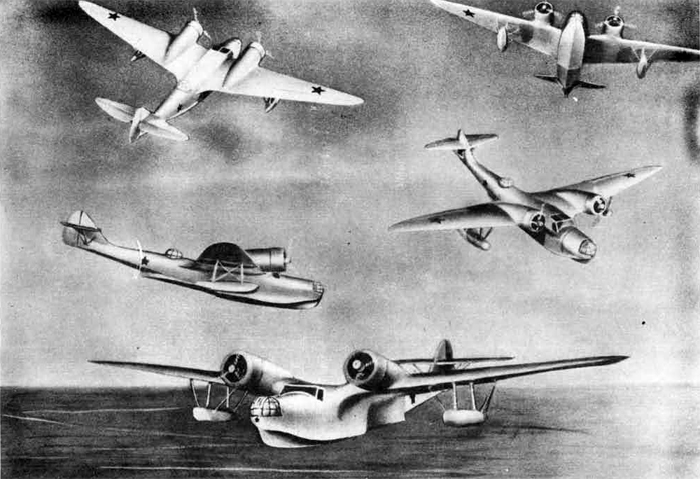
MDR-6
V. KOR-1
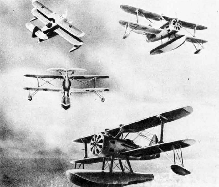
KOR-1
History; - Probably original design but inspired by American Vought.
Duty: - Reconnaissance. Possibly bombing.
Type: - Single-engine, biplane with central float.
Crew: - 2
Airframe characteristics: - Details of construction not available. Wings are of equal span and parallel chord. Rounded tips. Single-strut interplane bracing. Ailerons on both wings. "Cut-out" in centre-section. Open or semi-enclosed cockpits. Single fin and rudder. Braced tailplane mounted on fin. Central single-step float carried on L, struts. Wing-tip floats.
Engine installation and propeller: - Long-chord cowling with controllable frontal inlets. Exhaust outlets round periphery of cowling.
Total fuel tankage estimate - normal: - 160 galls.
KOR-1
PERFORMANCE
TYPICAL NORMAL LOAD
Sorting weight; - 7,000 lb.
Landing weights - 5,800 lb.
Climb - height: - 9.000 ft. time: - 7.25 rains.
Service ceiling - start: 21,500 ft, -finish: - 25,500 ft.
Loads
ffombs or freight: - Nil lb.
Fuel tankage: - 160 galls.
Fuel weight: - 1,200 lb.
Maximum emergency Speed: - 170 m.p.h, (a) 190 m.p.h. (b)
Altitude: - S.L. 9,000 ft.
Normal Cruising
Average speed: -. 160 m.p.h.
Altitude: - 9,000 ft.
Range: - 635 miles.
Endurance: - 4.0 hours.
Miles per 100 lb.: - 57.
Maximum Range: Average speed: - 120 m.p.h.
Altitude: - 9,000 ft.
Range: - 790 miles.
Endurance: - 6.6 hours.
Miles per 100 lb.i -71.3
Special remarks: —No information available. Performance estimated.
Note:
—(1) Ranges are ideal still-air ranges; no reduction is made for operational tactics; assessment of range is made on the following basis: -
(a) An allowance is made for warming up and take-off, equivalent to
5 minutes at take-off power.
(b) A further allowance 5s made for the fuel used in climbing to the
operational height at the maximum rate of climb; the horizontal
distance covered in the climb is credited to the range.
(c) No credit is given for glide-in at thejend of the journey.
(2) Landing weight =• Starting weight less fuel, bombs, ammunition and
any jettisonable load.
(3) Conversion of mileage per 100 lb. of petrol into consumption in gallons per hour: Gallons per hour = (13»2 x Speed (m.p.h.))/
Miles per 100 lb.
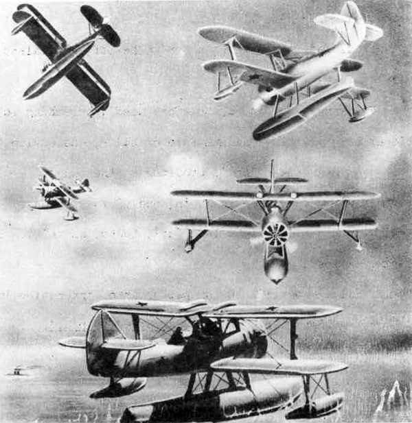
KOR-1
OEHERAL DATA.
POWER PLANT. No of engines: 1; Type: M-25 (probable); Characteristics: 9-cycls. Radial. Air-cooled.; Max. power: 850 h.p.; Height: 7500 ft.
DIMENSIONS: Span: Est. 35 ft.; Wing area: Est. 315 sq.ft.
ARMAMENT: For'd fuselage: 1 x 7.6 mm (F)(probable); Dorsal: 1 x 7.6 mm (M)(probable)
VI. ARK-3
Manufacturer: - U.S.S.R, Government.
Status: - Produced about 1938.
Monthly rate or production: - Unknown.
Engine: - 2. Development from the t'ACCHI license-M-25,
General design: - Twin-engined monoplane flying boat. All metal hlgh-wing. Single fin and rudder, high-braced tailplane, and strut-braced wing tip floats. Specially designed for operating in Arctic conditions. (Designer I. Tchetverikov)
Wing apace: - 65 ft. 6 in.
Length: - 47 ft. 5 in.
Maximum speed: - 200 m.p.h.
Loaded weight: - 13,286 lb.
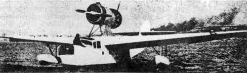
ARK-3
Characteristics; - The hull of this flying boat reveals Italian influence, but the general design, and in particular the tandem installation of the M-25 engines, is original. This plane is generally similar to the MBR-2.
VII. E-59
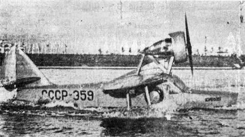
Manufacturer; -.U.S.5.R. Government.
Status: - First manufactured in 1940. Number unknown.
Duty: -Service in river and lake districts.
General desipn: - Four passenger cabin amphibian. Shavrov designed construction. A monoplane with the free wing fastened to the carcass of the boat.
Cruisinf speed: - 175 km. p.h.
Maximum speed: - 220 ton, p.h.
Range: - 1200 km.
Engine: MG-31 air cooled.
Ceiling: - 4£000 meters.
Length: 9.4 meters
Span: 13 meters.
VIII. IL-2 "Ilyushin" (Sturmovik)
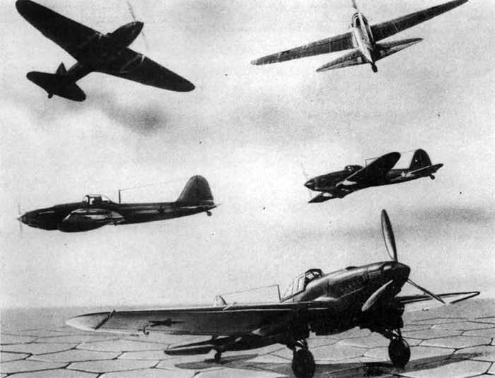
IL-2 "Ilyushln" (Sturmovik)
History; - Relieved original design. The IL-2, knovm generally and inaccurately as the "Sturmovik" (Russian for any assault aircraft), is primarily a low-level attack aeroplane used by the Armv However the IL-2 or "Ilyusha" or "Ilyushin" (as it Is actually called hy the Red Airforce), is also widely used by the Naval Air Forces. It has been particularly active in the recent Naval air activities.
Duty: - Ground-attack. Bombing. Type: - Single-engine, low-wing monoplane. Crew; - 1 (occasionally 2).
Alrframe characteristics: - Cantilever wine is of deep chord at root and has shart taper to rounded tips. Split flaps between ailerons and h wing root fillets, fling believed largely, or entirely of metal con-struction. Fuselage of small cross-section behind pilot's cockpit (over wing). Single fin and rudder. Cantilever tailplane with sharp sweep-back on leading edge. Undercarriage retracts rearwards into large fairings beneath wing. Tail wheel not retractable. Pilot's cockpit has short transparent enclosure. Pneumatic operation used for flaps and undercarriage.
Engine Installation and propeller: - Armoured cowling. Rearward facing exhausts. Radiator beneath fuselage to rear of engine. Oil cooler V apparently above engine, as on Ju37. 3-blade metal c.s. propeller.
Bomb, mine or torpedo Installations: - Carriers for 8 rocket bombs can be fitted beneath wing.
Remarks: - Engine cowling made of armour-plate (6 to 8 mm.)- Additional plating protects radiator, oil cooler and petrol tanks. Cockpit hood and windscreen of bullet-proof glass. Two pieces of 8-mm. armour-plate cover frame on both sides of pilot's head. Additional armour for back of pilot*s seat, sides and bottom of cockpit and parts of engine.
General Data No. of engines; - 1.
Type: - M-38.
Characteristics: - 12-cyls. "V." Liquid-cooled.
Max. power: - 1,600 h.p.
Height: - 6,500 ft.
Span: - 47.9 ft.
Length: - 38 ft.
Wing area: - 365(?) sq. ft.
For'd wings: - 2 x 20 mm. (F) + 2 x 7.6 mm. (F). Normal bomb load: - 1,000 lb. Typical bomb stowage: - 4 x 100 kg.
Alternative stowages: - 2 x 250 kg.
Anti-personnel 400 x 1 kg.
8 rocket bombs x 12 or 4 x 20 kg. (10 kg. and 16 kg. are also reported).
Frontal, Windscreen, Pilot's seat, Dorsal, lateral, Ventral: Whole nose and cockpit 6 to 8 mm.
Total fuel tankage estimate - normal: - 100 galls.
PERFORMANCE
TYPICAL NORMAL LOAD
Starting weight: - 12,500? lb.
Landing weight: - 10,200 lb.
Climb: - 10,000 ft. (height) 6.5 mins. (time)
Service celling: - 24,500 ft. (start),
28,000 ft. (finish)
Loads
Bombs or freight: - 1,100 lb.
Fuel tankage: - 100(?) galls.
Fuel weight - 720 lb.
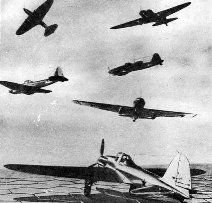
IL-2 Ilyushln," (Sturmovik)
Maximum emergency speed: - 250 m.p.h., 275 m.p.h.
Maximum emergency altitude; - S.L., 8,000 ft.
Normal cruising
Average speed: - 235 m.p.h.
Altitude: - 10,000 ft.
Range: - 260 miles.
Endurance: - 1.16 hours.
Miles per 100 lb. - 47
Maximum range
Averape speed: - 170 m.p.h.
Altitude: - 10,000 ft.
Range; - 330 miles.
Endurance: - 1.96 hours;
Miles per 100 lb.: - 59.6
Special remarks: - Estimated data: no information to give more than approximate performance.
Note.—
(1) Ranges are ideal still-air ranges; no reduction is made for operational tactics; assessment of range is made on the following basis:
(a) An allowance is made for wanning up and take-off, equivalent to 5 minutes at take-off power.
(b) A further allowance is made for the fuel used in climbing to the operational height at the maximum rate of climb; the horizontal distance covered in the climb is credited to the range.
(c) No credit is given for glide-in at the end of the journey.
(2) Landing weight = Startingweight less fuel, bombs, ammunition and any jettisonable load.
(3) Conversion of mileage per 100 lb. of petrol into consumption in gallons per hour: Gallons per hour = (13.2 x Speed (m.p.h.))/ Miles per 100 lb.
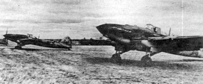
IL-2 "Ilyushin" (Sturmovik)
IX. YAK-1
History; - Probably original design. "YAK" indicates that the machine was designed by Yakolev.
Duty: - Fighting. Ground-attack.
Type: - Single-engine, low-wing monoplane.
Crew; - 1.
Airframe characteristics; - Cantilever wing has moderate taper to rounded tips. Internal construction unknovn, but covering is 3-ply. Fabric-covered ailerons. Flaps fitted. Fuselage of welded steel-tube construction covered on top with 3-ply; sides and bottom covered with fabric on stringers. Enclosed pilot's cockpit over wing. Single fin and rudder. Cantilever tailplane. Undercarriage retracts inwards Into wing. Fixed tail wheel. This plane is of composite constructltm, but the spar flanges of the YAK-1 are of multiple bonded pine veneer stripes,. From the production aspect it is interesting to note that the fuselage is a shell structure, built up in two halves by "wrapping" sheets of birch veneer of about 0.5 m.m. thickness and 180-200 m.n. width, on a suitable jig; the skin thickness depends on the number of layers of veneer used.
Engine installation and propeller; - Ventral coolant radiator aft of pilot's cockpit. Oil cooler apparently under engine. Rearward-facing stub exhausts. 3-blade metal c.s. propeller.
Armament installation; - It is believed that two additional 12.7 mm. fixed guns can be installed in the wing. These are not part of the normal load.
Remarks: - It is reported that this aircraft is fitted with M-100, M-102, M-105 or M-107 engine.
General Data No. of engines: - 1.
Type: - M-105
Characteristics; - 12-cyls. "V" Liquid cooled.
Max. power; - 1,050 h.p.
Height: - 12,000 ft.
Span: - 32.8 ft.
Length: - 27.9 ft.
Wing area: - 150? sq. ft.
For'd fuselages - 2 x 7.6 mm. (F).
For'd engine: - 1 x 2.7 mm. (F).
Total fuel tankage - normal: - 70 galls. (Est.)
PERFORMANCE
TYPICAL NORMAL LOAD
Startipg weight; - 5,500 lb.
Landing weight; - 5,500 lb.
Climb; - 14,000 (height) (ft.)
5.25 (time) (mins.)
Service ceiling; - 30,500 ft. (start), 32,000 ft. (finish)
Loads
Bombs or freight; - nil lb.
Fuel tankage; - 70 galls.
Fuel weight; - 504 lb.
Speeds and Ranges
Maximum emergency speed; - 280 m.p.h., 315 m.p.h.
Maximum emergency altitude; - S.L. 14,000 ft.
Average normal cruising speed; - 270 m.p.h.
Normal cruising altitude; - 14,000 ft.
Normal cruising range; - 315 miles.
Normal cruising endurance; - 1.21 hours
Normal cruising miles per 100 lb.: - 80
Maximum range
Average speed; - 180 m.p.h.
Altitude; - 14,000 ft.
Range; - 430 miles
Endurance; - 2.41 hours
Miles per 100 lb.; - 110
Special remarks: - Estimated data: no information to give more than approximate performance. Fuel allowance for half-hour combat = 45 gallons (325 lb.).
Note.—
(1) Ranges are ideal still-air ranges; no reduction is made for operational tactics; assessment of range is made on the following basis:
(a) An allowance is made for warming up and take-off, equivalent to 5 minutes at take-off power.
(b) A further allowance ia made,for the fuel used in climbing to the
operational height at the maximum rate of climb; the horizontal
distance covered in the climb is credited to the range.
(c) No credit is given for glide-in at the end of the journey.
(2) Landing weight = Starting weight less fuel, bombs, ammunition and any jettisonable load.
(3) Conversion of mileage per 100 1b. of petrol into consumption in gallons per hour: Gallons per hour = (13.2 x Speed fm.p.h.))/Miles per 100 lb.
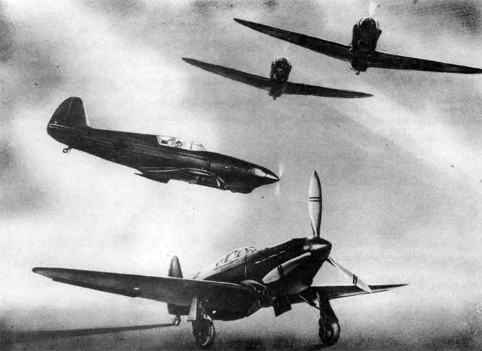
YAK-1
X. MIG-3
History: - Probably developed from MIG-1. "MIG" indicated that machine was designed "by Mikoyan in conjunction with Gurevich.
Duty: - Fighting. Ground attack.
Type: - Single-engine, low wing monoplane.
Crew: - 1.
Airframe characteristics: - Cantilever wing Las moderate taper to rounded tips. Centre-section of metal construction with two spars. Outer panels have three spars, of which centre spar is of box type. Rear and front spar apparently solid. Wing tips of spruce. Whole of outer panels fabric-covered. Metal leading-edge slots incline outwards toward tips when open. Split flaps inboard of ailerons. Pneumatic operation. Fabric-covered ailerons. Front portion of fuselage of welded-steel-tube construction. Rear portion, including fin, made in two parts, joined along top and bottom. Four longerons. 3-ply covering. Cantilever tailplane with sharp sweep-back on leading-edge. Undercarriage retracts inwards into wing. Pneumatic operation. Retractable rail wheel.
Engine installation and propeller: - Rearward-facing exhausts. Ventral radiator under cockpit. Oil cooler apparently in side of cowling. 3-blade c.s. metal propeller.
Armament installation: - Two additional 12.7 mm. fixed guns can be fitted in the wing but are not part of the normal load.
No. of engines: 1.
Type: - U-35A.
Characteristics: - 12 cyls. "V" Liquid-cooled.
Max. power: - 1,200 h.p.
Height: -19,500 ft.
Span: - 34.5 ft.
Length: - 26.7 ft.
Wing area: -140(?) sq. ft.
For'd fuselage: - 1 x 12.7 mm. (F) + 2 x 7.6am. (F)
Maximum bomb load: - 440(?) lb.
Typical bomb stowage: - 2 x 100 kg.
Total fuel tankage - normal: - 88 galls.
(a) SOME DETAILED NOTES
General
The aeroplane is a low wing monoplane of composite construction, the front of the fuselage and the centre section being made of metal, and the wings and the rear end of the fuselage of wood.
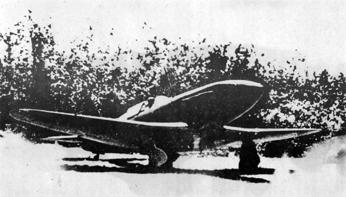
MIG-3
Fuselage
The front of the fuselage is made up of metal tubes, all joints being welded. Tho skin is secured around this in a similar manner to the fabric around the metal structure of Hart type aircraft.
Two petrol tanks are carried here, one behind the pilot and the other under the pilot's feet.
The rear end of the fuselage, including the fin, is made in two parts and joined along the top and bottom. It is built up on U rather thin longerons and the skin secured to 5 equally spaced eliptical rings and 2 bulkheads, the latter being at- the extreme rear end. The two halves of the skin are made from single sheets of approx. one-eighth of an inch three-ply, and are steamed and pressed roughly to shape before !->eiR£ secured to the eliptical rings.
The sequence of erection is as follows:-
the eliptical rings and bulkheads are mounted in the jig,
the longerons are then fitted,
the skin is secured by glueing and tacking,
the seams along the top and bottom are scarffed,
and finally, the whole is fabric-covered and doped.
The front and rear halves of the fuselage are joined by four strong metal fittings attached to the longerons.
The centre section is of metal and is built up on two stout metal spars. The skin is flush rivetted on to the ribs. Two petrol tanks are carried in the centre section, on either side of the fuselage.
The Wings.
The wings are built up on three spars. The nmain or centre spar is very stout and of box construction. The rear spar appeared to be solid and carried fittings for the ailerons and flaps, and the front spar, which also appeared solid, but not quite so strong as the rear spar, carried fittings for the slots. The wing-tip is made up of 7 laminations of about 1/4" spruce. The skin is of three-ply and is secured by glueing and tscking. The top and bottom skins are put on in two separate processes during manufacture. The whole wing is then fabric-covered and doped.
Slots are metal and do not open straight forward as do ours, but swing forwards and outwards towards the wing tip.
Ailerons are fabric-covered and are aerodynamically balanced by having the hinges well set back. No trace of mass balancing could Vie seen. Lateral trimming cannot be controlled by the pilot but can be adjusted on the ground by mean3 cf a piece of sheet metal attached to the starboard aileron.
Flaps are of metal construction- the full movement being 50 degrees. They are operated pneumatically and seemod to extend and retract very quickly. The flaps are of the split trailing-edge type.
The Rudder and Elevators
The rudder and elevators are fabric-covered. They were not, so far as could be seen, balanced in any nay; the starboard elevator and the rudder had trimmers controlled by the pilot.
The Undercarriage
The undercarriage is of very stout construction and retracts inwards and upwards inwards the fuselage. When retracted no trace of the undercarriage can be seen. Retraction is pneumatic and the chassis takes 6 seconds to raise and L seconds to lower (this was with the aircraft on jacks and the air supplied from bottles).
The Tyres
The tyres were treaded and seem to be of medium pressure.
The Engine
The engine is of the "V" type fitted with a 3-bladed constant-speed airscrew. It is known as the M.35 and is developed from the line of 11.17 and M.34 series. We were told it develops 1200 horse power at 6000 metres at 2050 r.p.m. The reduction gear ration is .73 to 1. As far as could be seen only a single stage blower was fitted. The radiator is slung under the fuselage behind the engine mounting.
Petrol capacity is 400 litres, all A tanks being self-sealing.
Armament
Three fixed guns are mounted on top of the engine, the centre gun being 12.7 m.m.s and the others 7.5 m.m.s.
Two others of heavier calibre can be fitted externally, one under each wing, or bombs can be carried; I would estimate these to be of the 100-k.g. type.
Ammunition for the fuselage guns is carried in tanks situated between the pilot and the engine.
The Pilot's Cockpit
The pilot's cockpit seemed to be well laid out. The seat (bucket type) is adjustable up and down over a range of about 6 inches. The rudder bar is adjustable. The control column has a spade grip on top of which is the brake lever. At the base of the spade grip are two triggers placed very close together so that all guns can be fired, or the two 7.5 m.m. and the 12.7 m.m. guns separately. Immediately below the triggers is a safety catch.
The Instrument Panel does not appear to be as well laid out as ours. The flying instruments are on the left-hand side of the panel. They are comprised of A.S.I., Altimeter, Turn and Bank Indicator, Rate of Climb and Descent Meter, and a Compass similar to the one fitted in the roof of the Boston. The directional gyro or an artiflolal beris** were not noted. The engine instruments were well grouped on the right-hand side of the dash. Above the centre of the dashboard is a very neat reflector sight.
Miscellaneous
NHo armour-plate wes seen, and the windscreen ras not bulletproof.
The pilot head is mounted about 6 inches below and about. 18 inches in front of the leading edf;e of the starboard wing.
All guns are mounted, aligned, and tested before the aeroplane leaves the factoiy.
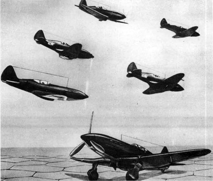
MIG-3
MIG-3
PERFORMANCE
TYPICAL NORMAL LOAD
Starting weight; - 6,700 lb.
Landing weight; - 6,000 lb.
Climb; - 20,000 (height) (ft.) 8.5 (time) (mins.)
Service ceiling; - 33,000 ft. (start), 34,000 ft. (finish)
Loads
Bombs or freight; - nil lb.
Fuel tankage; - 88 galls.
Fuel weight; - 635 lb.
Speeds and Ranges
Maximum emergency speed; - 310 m.p.h., 375 m.p.h.
Maximum emergency altitude; - S.L. 22,000 ft.
Average normal cruising speed; - 310 m.p.h.
Normal cruising altitude; - 20,000 ft.
Normal cruising range; - 390 miles
Normal cruising endurance; - 1.33 hours
Normal cruising miles per 100 lb.; - 80.5
Maximum range
Average speed: - 230 m.p.h.
Altitude; - 20,000 ft.
Range; - 470 miles.
Endurance; - 2.09 hours.
Miles per 100 lb.: - 98
Special remarks; - Estimated data; no information to give more than approximate performance. Fuel allowance for half-hour combat = 54 gallons (390 lb).
Note.—
(1) Ranges are ideal still-air ranges; no reduction is made for
operational tactics; assessment of range is made on the following basis;—
(a) An allowance is made for warning np and take-off, equivalent to 5
minutes at take-off power.
(b) A further allowance Is made for the fuel uitd in cllnbing to the operational height at the maximum rate of climb; the horizontal distance covered In the climb la credited to the range.
(c) No credit is given for glide-In at th« end of the journey.
(2) Landing weight = Starting weight lees fuel, bombs, ammunition and any jettisonable load.
(3) Conversion of mileage per 100 lb. of petrol Into consumption in gallons per hour = (13.2 x Speed fm.p.h.))/Miles per 100 lb,
XI. I-15 biss
History - Developed from I-15 fighter as used in Spanish War.
Duty: - Fighting. Ground attack. Bombing.
Type: - Single-engine, biplane.
Crew: - 1.
I1-15 biss
Airframe characteristicsi - Winga of unequal span and parallel chord. Rounded tips. Cut-out In traillng-edge of top centre-section. Uain bracing by single interplane struts. Centre-section struts of "N" formation. Short fuselage of welded steel-tube construction. Fabric covering of wooden subsidiary structure. Single fin and rudder. Braced tailplane. Single-leg cantilever fixed under carriage. "Spats" over wheels.
Engine Installation and propeller: - Long-chord cowling with adjustable inlet. 2-blade metal propeller. Exhaust stubs project round perimeter of cowling.
Bomb, mine or torpedo installations: - Carriers for light bombs or rocket bombs can be fitted under wings.
Maximum bomb loadi - 105 lb.
Typical bomb stowage! - 4 X 12 kg.
Total fuel tankage - normal: 68 galls.
I-15 biss
Modified 1-15 appeared in the Spanish Civil War. How approaching absolescence.
Note.—(I) Ranges are ideal still-air ranges; no redaction is made for operational tactics ; assessment of range is made on the following basis : —
(a) An allowance is made for warming up and take-off, equivalent to 5 minutes at take-off power.
(b) A farther allowance is made for the fuel used in climbing to the operational height at the maximum rate of climb; the horizontal distance covered in the climb is credited to the range.
{c) Xo credit is given for glide-in at the end of the journey.
(2) landing weight = Starting weight less fuel, bombs, ammunition and any jettisonable load.
(3) Conversion of mileage per 100 lb. of petrol into consumption in gallons per hour : Gallons per hour (13.2 x Speed (m.p.h.))/Miles per 100 lb.
GENERAL DATA.
POWER PLANT.
No. of engines: 1.;
Type : M-63.;
Characteristics:
9-cycls. Radial. Air-cooled;
Max. Power : 1,000 h.p.; Height: 13.500 ft.
DIMENSIONS:
Span : 33.4 it.;
Length : 20.8 ft.;
Height : 10.2 ft.;
Wing area: 225 sq. ft.
ARMAMENT.
(P - Fixed. M - free.)
For'd fuselage: 4 X 7.6 mm (F).
III. I-153
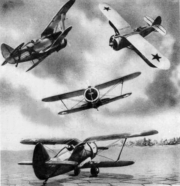
I-153
History: - Developed .from 1-15 and 1-15 bis.
Duty; - Fighting. Ground-attack. Bombing.
Type: - Single-engine, biplane.
Crew: - 1.
Airframe characteristics: - Wings of unequal span and parallel chord. Rounded tips. Roots of top wings are sharply pulled into fuselage, Main bracing by single interplane struts. Short, fuselage of welded titael-tube construction. Fabric covering over wooden subsidiary structure. Single fin and rudder. Braced tailplane. A rearward twisting motion brings wheels of undercarrJaj-e into recesses partly in fuselage and partly in roots of lower wing. Retractable skis can be fitted.
Engine installation and propeller: - Long-chord cowling with adjustable inlet. 2-blade v.p. metal propeller. Exhaust stubs project round perimeter of cowling.
Bomb, mine or torpecto installations: - Carriers for light boirbs can be fitted under wings.
Remarks: - Improved version with H-63 engine has a maximum speed of about 285 ra.p.h. at 14,000 to 16,000 ft.
I-153 PERFORMACE
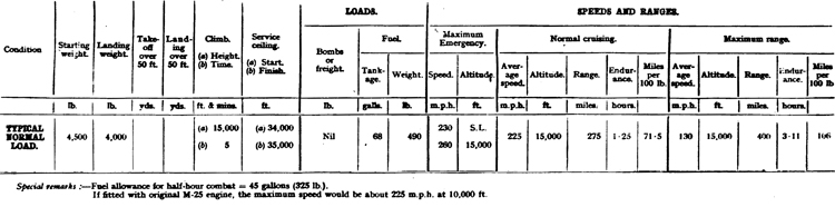
Note.—
(1) Ranges are ideal still-air ranges; no redaction is made for operational tactics; if mrnt dl range is made on the following basis:—
(a) An allowance is made (or warming op and take-off, equivalent to 5 minutes at take-off power.
(b) A farther allowance is made (or the fad used in climbing to the operational height at the maximum rate of climb; the horizontal distance covered in the climb is credited to the range.
(c) No credit is given for glide-in at the end of the journey.
(2) Landing weight — Starting weight leas fad. bombs, ammunition and any jettisonable load.
(3) Conversion of mileage per 100 1b. of petrol into consumption in gallons per hour.
I-153
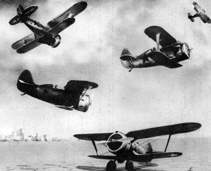
GENERAL DATA.
POWER PLANT: No of engines: 1; Type: M-63;
Characteristics: 9-cyls.Air-cooled. radial;
Max. power : 1,000 h.p.;
Height: 13,500 ft.
DIMENSION:
Span : 32-8 ft.;
Length : 20-8 ft.;
Height: 8-9 ft.;
Wing area : 240 sq. ft.
ARMAMENT:
For'd fuselage: 4 x 76 mm (Fixed)
XIII. I-16
History; - Original design.
Duty: - Fighting. Ground-attack.
Type; - Single-engine, low wing monoplane.
Crew; - 1.
Airframe characteristics: - Cantilever wing of very low aspect ratio. Made in 3 sections. Large fillets extend rearwards alrcost to tailplane. Centre-section of welded steel tubular construction with light-metal covering. Outer panels of welded construction with fabric covering, (An all-metal wing has been reported.) Split flaps extend across centre section. Squat fuselage of wooden construction. Sorre machines have open cockpits, otheis enclosed. (An all-metal fuselape has been reported.) Single fin and rudder. Cantilever tailplane. Undercarrisge retracts inwards into wing.
Engine installation and propeller: - Long-chord cowling with 9 frontal openings which can do screened by shutters. Exhausts round periphery of cowling.
Bomb, mine or torpedo installations: - Carriers for light bombs or rocket bombs can be fitted under wings.
Remarks: - Improved version with M-63 engine has a maximum speed of about 300 m.p.h. at 14.000 to 16,000 ft.
Alternative stowages: - Rocket bombs?
Total fuel tankage - normal: - 56 galls.
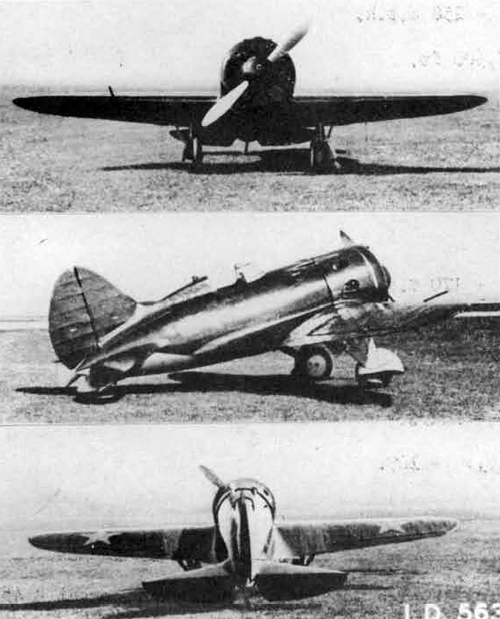
I-16
PERFORMANCE
TYPICAL NORMAL LOAD
Starting weight; - 5,000 lb.
Landing weight: - 4,600 lb.
Climb - height: - 15,000 ft. time: 5 mins.
Service ceiling - start: - 31,000 ft. - finish: - 32,000 ft.
Loads
Bombs or freight: - Nil lb.
Fuel tankage: - 56 galls.
Fuel weight: - 405 lb. Maximum Emergency
Speed: - (a) 270 m.p.h. (b) 300 m.p.h.
Altitude: - S.L. 15,000 ft.
Normal Cruising
Average speed: - 258 m.p.h.
Altitude: - 15,500 ft.
Range: - 245 miles.
Endurance-: - 0.98 hours.
Miles per 100 lb.: - 82. Maximum Range
Average speed: - 170 m.p.h.
Altitude: - 15,000 ft.
Range: - 320 miles.
Endurance: - 1,9 hours.
Miles per 100 lb.: - 109.
Special remarks: - Fuel allowance for half-hour combat = 45 gallons
(325 lb.)
Note: —
(1) Ranges are ideal still-air ranges; no reduction is made for operational tactics; assessment of range is made on the following basis: -
(a) An allowance is made for warming up and take-off, equivalent to
5 minutes at take-off power,
(b) A further allowance is made for the fuel used in climbing to the operational height at the maximum rate of climb; the horizontal distance covered in the climb is credited to the range.
(c) No credit is given for glide-in at the end of tto journey.
(2) Landing weight = Starting weight less fuel, bombs, ammunition and any jettisonable load.
(3) Conversion of mileage per 100 lb# of petrol into consumption in gallons per hour: Gallons per hour « (13.2 x Speed (m.p.h).)/ Miles per 100 lb.
GENERAL DATA
POWER PLANT
No. of engines: - 1.
Type: - M-63.
Characteristics: - 9-cyls. Air-cooled. Radial.
Max. power: - 1,000 h.p.
Height: - 13,500 ft.
DIMENSIONS
Span: - 29.2 ft.
Length: - 20.3 ft.
Wing Areat - 125 sq. ft.
ARMAMENT
For'd fuselage; - 2 x 7.6 mm. (F).
For'd wings: - 2 x 7.6 mm. (F).
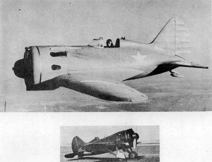
1-16
XIV. PE-2
PE-2
History: - Believed original design. "PE" indicates that machine was designed by Petlyakov, Probably the most widely used reconnaissance and dive bomber in service with the Soviet Air Force, This bomber has been utilized by the Naval Forces of the- North Sea Fleet.
Duty: - Dive-bomber.
Type: - Twin-engine, low-wing monoplane.
Crew: - 2.
Airframe characteristics: - Cantilever winp has parallel centre-section and sharp taper to elliptical tips, Metal stressed-skin construction. Split flaps apparently inboard of ailerons. "Venetian blind "dive-brakes attached to main spar lie smi£ against Tinder-surface of wing when retracted. Electrical operation. Slim fuselage of netal stressed-skin construction with transparent cockpit enclosure mainly forward of leadinf-edre of winf. Transparent panellinj- in bottom of nose. Pronounced dihedral on tftilplane. Twin fins and rudders at extremities. All control surfaces fabric-covered and aerodynamically balanced. Trim tabs on all movable surfaces except port aileron. Engine nacelles extend aft of trailinf-edpe. Main wheels of undercarriage retract into nacelles. Retractable tail wreel.
Engine installation and propeller; - Radiators under nacelles. Adjustable flaps rear of each radiator housing. Oil coolers in leading-edge inboard of nacelles, huffs over exhaust pipes. Exhausts apparently discharge over wing.
Armament installation: - Dorsal gun on "rocking'-piHar11 mounting.
Bomb, mine or torpedo installations: - All heavy bombs carried.externally. Stowage in tails of engines nacelles for two 100 kg.
NHo. of engines: - 2.
Type: - M-105,
Characteristics: - 12 cyls. "V" Liquid-colled.
Max. power: - 1,050 h.p.
Height: - 12,000 ft.
Span: -56.1(est.) ft.
Length - 41.4
Wing area,: 355? sq. ft.
For'dl fuselage: 2 x 7.6 mm. (F).
Dorsal: 1 x 7.6 mm. (M)
Ventral: 1 x 12.7 mm. (M)
Normal bomb load: 1,540? lb.
Maximum bomb load: - 2200? lb.
TNypical bomb stowage: - 2 x 500 kg.
Total f£uel tankage. estimate-normal: - 215 galls.
Total fuel tankage estimate - maximum: - 300 galls.
PE-2
PE-2 PERFORMANCE
TYPICAL NORMAL LOAD
Starting weight; 16,500 (?) lb. Landing weight; - 12,750 lb.
Climb - height: - 14,000 ft. time; - 10 mins.
Service ceiling - start: - 26,000 ft. - finish: - 31,000 ft.
Loads
Bombs or freight; - (a) 1,540 lb. (b) 2,200 lb.
Fuel tankage: - (a) 300 (?) galls, (b) 215 (?) galls.
Fuel weight: - (a) 2,160 lb. (b) 1,550 lb.
Maximum emergency speed: - (a) 275 m.p.h. 310 m.p.h. (b) 265 m.p.h. 295 m.p.h.
Maximum emergency altitude: - (a) S.L. 14,000 ft. (b) S.L. 14,000 ft.
Normal Cruising
Average speed: -(a) 265 m.p.h. (b) 255 m.p.h.
Altitude: - 14,000 ft.
Range: - (a) 740 miles, (b) 485 miles.
Endurance: - (a) 2.87 hours, (b) 1.96 hours.
Miles per 100 lb.: - (a) 39.5, (b) 38
Maximum Range
Average speed: (a) 195 m.p.h. (b) 185 m.p.h.
Altitude: - 14,000 ft.
Range: - (a) 910 miles, (b) 580 miles.
Endurance; -(a) 4.7 hours. (b) 3.17 hours.
Miles per 100 lb.; - (a) 48.7, (b) 46.2
Special remarks: - Estimated data - no information to give more than approximate performance.
Note: —(l) Ranges are ideal still-air ranges; no reduction is made for operational tactics; assessment of range is made on the following basis:
(a) An allowance is made for warming up and take-off, equivalent to 5 -minutes at take-off power.
(b) A further allowance is made for the fuel used in climbing to the
operational height at the maximum rate of climb; the horizontal dis
tance covered in the climb is credited to the range.
(c) No credit is given for glide ir at the end of the journey.
(2) Landing weight = Starting weight less fuel,bombs, ammunition and any jettisonable load.
(3) Conversion of mileage per ICO lb. of petrol into consumption in gallons per hour. Gallons per hour = (13.2 x Speed (m.p.h.))/
Miles per 100 pounds.
XV.
PE-2B (PE-3)
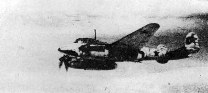
Known to be used In operations by the Air Forces of the North Sea Fleet
PE-2E (PE-3)
History: - Developed from PE-2 dive bomber, "PE" indicates that machine was designed by Petlyekov,
Duty: - Fighting.
Type: - Twin-engine, low-wing monoplane.
Crew: - 2.
Airframe characteristics: - Probably: -Cantilever wing has parallel centre-section and sharp taper to elliptical tips. Metal stressed-skin construction. Split flaps apparently inboard of ailerons. Slim fuselage of metal stressed-skin construction with transparent cockpit enclosure mainly forward of leading-edge of wing. Pronounced dihedral on tailplane. Twin fins and rudders at extremities. All control surfaces fabric-covered and aerodynamically balanced. Trim tabs on all movable surfaces except port aileron. Main wheels of undercarriage retract to nacelles. Retractable tail wheel.
Engine installation and propeller! - Radiators under nacelles. Adjustable flaps rear of each radiator housing. Oil coolers in leading-edge inboard of nacelles. Muffs over exhaust pipes. Exhausts apparently discharge over wing.
Bomb, mine or torpedo Installations: - 50 kg. bomb carrier between each engine nacelle and fuselage; an incendiary bomb carrier in each nacel]ej four rocket-bomb carriers outside each nacelle.
General Date
Nor of engines: -2
Type: - M-107?
Characteristics: - Probably 12-cyls. "V." Liquid cooled.
Max, power: - 1,000 Est. h.p.
Height - 20,000 ft.
Span: - 56.1 ft.
Length: - 41.3 ft.
Wing area: - 355? sq. ft.
For'd fuselage: - 2 x 12.7 mm. (F)
Dorsal; - 1 x ? mm. (M)
Typical stowage: - 2 x 50 kg. and 8 x 12 kg. rocket-bombs.
Total fuel tankage: - 228 galls. (Eat.)
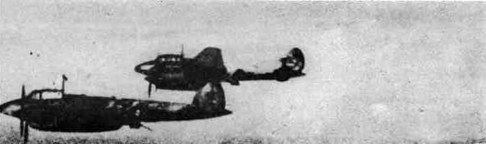
PE-2B (PE-3)
FERFORMANCE
TYPICAL NORMAL LOAD
Starting weight; - 15,000? lb.
Landing weight; 13,250 lb.
Climb: - 21,000 ft. (height) 12 mins, (time)
Service celling; - 32,000 ft. (start), 34,000 ft. (finish)
Loads
Bombs or freight: - nil lb.
Fuel tankage; - 228? galls.
Fuel weighti - 1,650 lb.
Maximum emergency speed: - 270 m.p.h, 335 m.p.h.
Maximum emergency altitude; - S.L, 23,000 ft.
Normal cruising
Average speed: - 278 m.p.h.
Altitude: - 21,000 ft.
Range: - 580 miles.
Endurance: -2.17 hours.
Miles per 100 lb.: - 43.5
Maximum range
Average speed; - 215 m.p.h.
Altitude: - 21,000 ft.
Range: - 680 miles.
Endurance: - 3.2 hours.
Miles per 100 lb.: -51.2
Special remarks: - Estimated data: no information to give more than approximate performance.
Fuel allowance for half-hour combat 45 gallons (325 lb.).
Note.—
(1) Ranges are ideal still-air ranges; no reduction is made for operational tactics; assessment of range is made on the following basis:
(a) An allowance is made for warming up and take-off, equivalent to 5 minutes at take-off power.
(b) A further allowance is made for the fuel used in climbing to the operational height at the maximum rate of climb; the horizontal distance covered in the climb is credited to the range.
(c) No credit is given for glide-in at the end of the journey.
(2) Landing weight • Starting weight less fuel, bombs, ammunition and any jettisonable load.
(3) Conversion of mileage per 100 lb. of petrol into consumption in gallons per hour: Gallons per hour = (13.2 x Speed (m.p.h))/Miles per 100 lb.
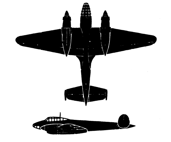
PE-2E (PE-3)
XVI. DB-3
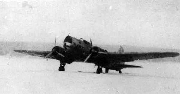
DB-3
History: - Believedi original design. A specially adapted machine of the type flew 4,000 miles non-stop in April, 1939. Alternative designation nay be TsKB-26, It was first seen outside the USSR in its bomber form when it was used in the first Russo-Finnish War. The DB-3F is superseding this type.
Type: - Twin-engine, low-wing monoplane.
Crew: 3 to 4.
Duty: - Bombing. Probably reconnaissance.
Airframe characteristics: - Whings have moderate taper to rounded tips. Sweep-forward on trailing edge much more pronounced than sweep-back on leading edge, Wing is of metal construction with flush riveting. Ailerons metal-covered. Large fillets fair wing roots into fuselage. Split flaps fitted. Fuselage is of comparatively deep oval section. Stressed-skin metal construction. Blunt nose with small amount of transparent pannelling in the lower section. Pilot has faired cockpit enclosure over leading-edge. Undercarriage retracts rearwards into engine nacelles. Fixed tail wheel.
Englne installation and propeller: - Long-chord cowlings. 3-blade metal propellers (probably c.s.).
Armament installation: - Dorsal turret is manually operated.
Bomb. mine or torpedo installation; -
Total fuel tankage - normal: - 350 galls.
Total fuel tankage - maximum: - 880 galls.
Normal bomb load: - 2,200 lb.
Maximum bomb load: - 5,500 lb.
Alternative atowages: - 10 x 50 kg. or 100 kg. internal, and I. x 25 kg. or 50 kg. and 3 x 50 kg. or 500kg. external
DB-3
GENERAL DATA.
POWER PLANT: No of engines: 2;
Type: M 87;
Characteristics 14-cyls.
2-row radial. Air-cooled;
Max.power; 950 h.p. Height: 15,400 ft.
DIMENSIONS:
Span: 70.2 ft.;
length 46.8 ft.;
Height: 14.1 ft.; Wing area: 705 sq. ft.
ARMAMENT: For'd fuselage: 1 x 7.6 mm (M);
Dorsal: 1 x 7-6 mm. (M) Turret.; Ventral: 1 x 7.5 mm (M)
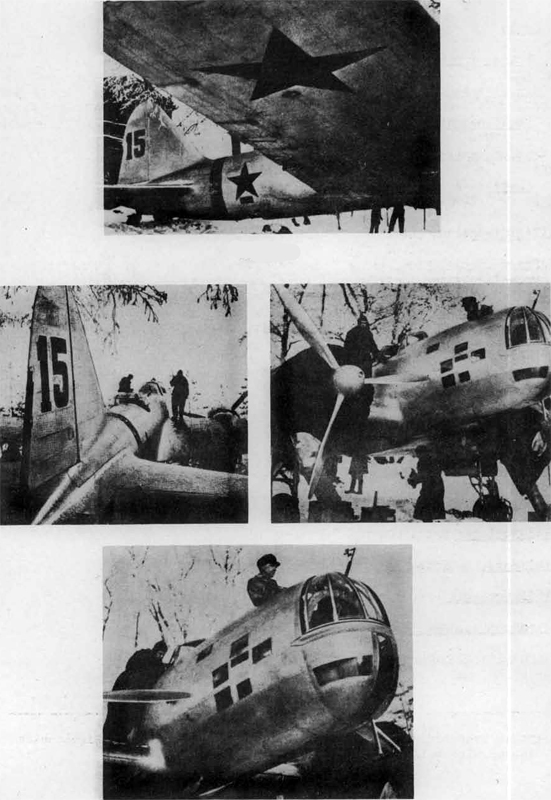
DB-3
DB-3 PERFORMANCE
TYPICAL NORMAL LOAD
Starting weight; - 19,500 lb. Landing weight: - 14,500 lb.
Climb - height: - 16,000 ft. time: - 15 mins.
Service ceiling - start: - 28,500 ft. - finish: - 34,000 ft.
Loads
Bombs or freight: - 2,200 lb.
Fuel tankage: - 350 galls.
Fuel weight: - 2,520 lb. Maximum emergency
Speed: -(a) 220 m.p.h. (b) 260 m.p.h.
Altitude: - S.L. 16,000 ft.
Normal Cruising
Average speed: - 222 m.p.h.
Altitude: - 16,000 ft.
Range: - 815 miles
Endurance: - 3.78 hours.
Miles per 100 lb.: - 37.
Maximum Range
Average speed: - 160 m.p.h.
Altitude: - 16,000 ft.
Range: - 975 miles.
Endurance: - 6.15 hours.
Miles per 100 lb.: - 44.5.
Special remarks: - Performance based on an engine-rated height which appears to be high.
OVER-LOAD
Max. Bombs - Starting weight: - 22,500 lb.
Max. Fuel -"- 22,500 lb
Max. Bombs - Landing weight: - 14,500 lb.
Max. fuel -"- 14,500 lb.
Max. Bombs - Climb (height): - 16,000 ft, (time) : - 17.5 tos.
Max. Fuel - Climb (height): - 16,000 ft. (time) : - 17.5 mins.
Max. Bombs - Service ceiling: - 25,500 ft. (start); 34,000 ft. (finish)
Max. Fuel - Service ceiling; - 26,000 ft. (start); 34,000 ft. (finish)
Loads
Max. Bombs - Bombs or freight: - 5,500 lb.
Max. Fuel - Bombs or freight: - 1,100 lb.
Max. Bombs - Fuel Tankage: - 350 galls. Max. Fuel - Fuel Tankage: - 880 galls.
Max. Bombs - Weight: - 2,520 lb. Max. Fuel - " - 6,350 lb.
Maximum Emergency:
Max. Bombs - Speed: - (a) 210 m.p.h., (b) 245 m.p.h.
Max. Fuel - Speed: - (a) 220 m.p.h.; (b) 260 m.p.h.
Max. Bombs - Alt.: - S.L. 16,000 ft.
Max. Fuel - Alt.: - S.L. 16,000 ft.
Normal Cruising
Max. Bombs - Average speed: - 210 m.p.h.
Max. Fuel - 221 m.p.h.
Max. Bombs - Altitude: - 16,000 ft.
Max. Fuel - " - 16,000 ft.
Max Bombs - Range: - 765 miles.
Max. Fuel - Range; - 2200 miles.
Max. Bombs - Endurance: - 3.75 hours.
Max. Fuel - Endurance: - 9.14 hours.
Max. Bombs - Miles per 100 lb.: - 35.
Max. Fuel - Miles per 100 lb.: - 37.
Maximum Range
Max. Bombs - Average speed: - 165 m.p.h.
Max. Fuel - Averare speed: - 170 m.p.h.
Max. Bombs - Altitude: 16,000 ft.
Fuel -Altitude: - 16,000 -ft.
Max. Bombs - Range: - 850 miles.
Max. Fuel - Range: - 2,520 miles.
Max. Bombs - Endurance: - 5.23 hours.
Max. Fuel - Endurance: - 14.9 hours.
Max. Bombs - Miles per 100 lb.: - 39.3
Max. Fuel - Miles per 100 lb.: - 42.
Special remarks: —Performance based on an engine-rated height which appears high.
Note: —
(1) Ranges are ideal still-air ranges; no reduction is made for operational tactics; assessment of range is made on the following basis:
(a) An allowance is made for warming up and take-off, equivalent to 5
minutes at take-off power.
(b) A further allowance is made for the fuel used in climbing to the operational height at the maximum rate of climb; the horizontal distance covered in the climb is credited to the range.
(c) No credit is given for glide-in at the end of the journey.
(2) Landing weight = Starting weight less fuel, bombs, ammunition and any
jettisonable load.
(3) Conversion of mileage per 100 lb. of petrol into consumption in gallons per hour: Gallons per hour = (13.2 x Speed (m.p.h.))/
Miles per 100 lb.
(a) REPORT ON TEST FLIGHT OF DB-3
1. ENTRY.
Is not too easy at first owing to the distance from the ground to the first step, but once on the wing it is not bad as a hand rail is provided. A hand grip is provided for the pilot to lower himseIf into the seat.
2. COCKPIT
The cockpit is large and very comfortable. I do not consider it very well laid-out, as the ancillary controls are scattered; the instruments are well grouped, the engine instruments on the left and the flying instruments (including blind approach instruments and Sperry automatic pilot) on the right of the dashboard. At the top of the dashboard are two mixture analysers and a radio compass.
The throttles and mixture controls are well placed on the left of the cockpit; the airscrew controls are two wheels well down on the left of the pilot's seat just behind the boost over-ride and the 2-stage blower control. To increase R.P.M. the wheels have to be turned towards the rear of the cockpit. The undercarriage control is fairly well forward on the left of the cockpit and has two positions, and the flap control is on the bulkhead behind and to the left of the pilot's seat. This also has only two positions. The main air cock is just above the flap control. The gill controls are two cranks on the right of the cockpit floor, the rearmost one operating the gills on the port engine. The oil cooler shutter controls consist of 2 wheels behind and to the right of the pilot's seat. The tail wheel lock cannot be seen at all as it is behind the pilot's seat. The patrol cocks and a balance cock are on the left hand side of the cockpit fairly well down; the one marked 'I' is the main and the others marker1 '2' are the wing tank cocks. They are on when in the forward position. The balance cock has a mushroom shaped head and has to be pulled up to open. An electric petrol gauge serves for all tanks, the required reading being obtained by means of a switch.
The undercarriage warning lights are situated on the left hand bottom comer of the dashboard. The red lights are permanently on while the chassis is up. Two visual indicators are also provided, one in each engine nacelle.
The elevator control is rather heavy on the ground but tne rudder and aileron are reasonably light; the aileron control is a roughly made 3/4 wheel and the rudder control is of the pedal type with toe-operated pneumatic brakes.
Three trimmers are provided, the elevator to the left of the dashboard, the rudder on the floor to the left of the pilot's seat and the aileron on the right hand side of the cockpit below the dashboard. The neutral positions of all trimmers are marked by red paint on the cable.
Emergency undercarriage operation is mechanical and is done by a winch situated midway along the right hand side of the cockpit underneath the ignition switches.
The undercarriage and flaps are pneumatically operated and care must be taken to ensure the main air cock is turned off after each operation or else all air pressure would be lost.
3. TAXYING
Taxying is fairly easy and straight forward. A very good view ahead is afforded by means of a 8 - 10" slot running from the top to the bottom of the dashboard.
4. TAKE-OFF
The take-off is quite easy. The tail wheel must be locked after turning into wind, the tail trimmer set to neutral and the throttles opened fully giving 2400 R.P.M. and 80 Boost. No flap is used. The tail comes up reasonably quickly, provided a good push is given on the CC.
There is no swing and the aeroplane flies itself off at 110 k.p.h.
The undercarriage comes up quickly and there is a very slight tail-heavy change of trim.
5. CLIMB
Climbing speed: 220 k.p.h.
6. LEVEL FLIGHT
A level speed was attempted in bumpy conditions at 700 metres with gills closed (closing the gills produces slight tail heaviness). Engine conditions were 2400 r.p.m., 8O boost and an indicated speen of 380-390 k.p.h. was obtained. All controls are very heavy throughout the speed range.
7. APPROACH AND LANDING
After reducing speed to 250 k.p.h. the air cock is turned on and the chassis lowered. This produces a very slight nose heaviness. A comfortable speed for gliding "flaps-up" seemed to be 220-230 k.p.h. After the final turn in to the aerodrome the flaps were lowered. These extend very quickly and produce a considerable nose heaviness, the aeroplane having to be retrimmed. Speed is now reduced to 170 k.p.h. for the final approach. To make a good gail down landing a good pull is needed on the C.C. The touch-down speed was about 110 k.p.h. The shock-abaorbing qualities of the undercarriage are considered excellent, tut the brakes are not up to the standard of British pneumatic brakes.
8. SINGLE-ENGINE
The aeroplane was flown for 5 minutes with the port engine windmilling. It was quite easy to fly, all foot load being removed by the trimner. Height was maintained and turns could be made both with and against the working engine.
9. CREW POSITIONS
The navigator is also the bomb aimer; he is separated from the pilot but can converse with him or pass him notes through the slot in the dashboard. A system of a red, white or a green light operated from the bomb aimer's position informs the pilot which way he should alter the course.
The wireless operator and rear gunner are completely shut off from the pilot by a bulk-head and the only means of communication must be intercom.
The aeroplane is fitted with a D/F loop and radio compass and also blind approach equipment.
Once the pilot and navicator are in positicn they cannot move or be relieved and I would prefer the Hampden as an operational aircraft, where the pilot can leave his scat for a few moments with the automatic pilot, in operation.
There were no D.V. Panels provided, but 2 small windows could be slid open, one on earh side of the Pilot's hood, a spray is fitted ir front of the windscreen to prevent icing. The anti-icing arrangements for the leading edpes of the wings and tail plane consisted of a strip of thin oil impregnated leather securely fastened to the leading edges. We were told it was very effective.
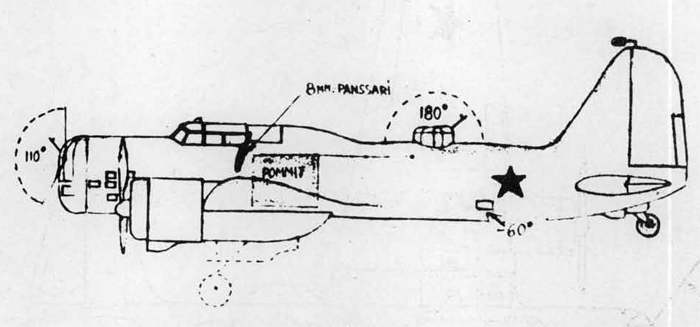
DB-3
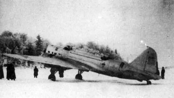
DB-3
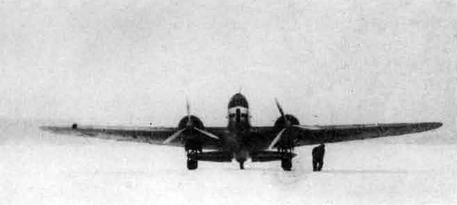
DB-3
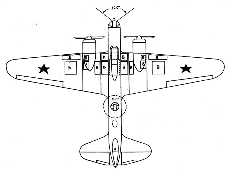
DB-3
XVII. DB-3F
This aeroplane is the latest development of the DB-3, and is In service in large numbers. It has been adopted for torpedo carrying by the Naval Airforce.
DB-3F
History: - Developed from DB-3. Alternative designation may be TaKB-3O, widely used by the Navy as a torpedo bomber.
Duty: - Bombing. Probably reconnaissance and ground-attack.
Type: - Twin-engine, low-wing monoplane.
Crew - 3 to 4.
Airframe characterstics - Wings have moderate taper to rounded tips. Sweep forward on trailing edge more pronounced than sweep-back on leading-edge. King ia of metal construction with flush riveting. Ailerons metal-covered. Large fillets fair wing roots into fuselage. Split flaps fitted. Fuselage is of a comparatively deep oval section. Stressed-skin metal construction. Nose is longer and more tapering than that of the DB-3, containing a large number of small transparent panels. Pilot has faired cockpit enclosure over leading-edge. Undercarriage retracts rearwards into engine nacelles. Fixed tail wheel.
Engine installation and propeller: - Long-chord cowlings are of different design from those on DB-3 and have smaller frontal inlets. 3-blade metal propellers (probably c.s.). Oil coolers under nacelles.
Armament installation: - Dorsal turret is manually operated. Nose gun mounting is not in a turret as on the DB-3 but is of simple ring type mounted in vertical (instead of horizontal) plane (as on He-111).
DB-3F
Hormal bomb load: - 2,200 lb. Maximum bomb load: - 5,500? lb. Total fuel tankage - normal: - 350 galls. Total fuel tankage -. maximum: - 880 galls.
DB-3F
General Data
No. of engines: - 2.
Type: - M-87B.
Characteristics: - 14 cyls., 2 row radial, air-cooled.
Max. power! - 1,000 h.p.
Height: - 19,700 ft.
Span: - 70.2 ft.
Length! - 47.6 ft.
Height: - 14.1 ft.
Wing area: - 705 eq. ft.
For'd fuselage: - 1 x 7.6 mm. (M).
Dorsali - 1 x 7.6 mm. (M) Turret.
Ventral: - 1 x 7.6 ran. (M).
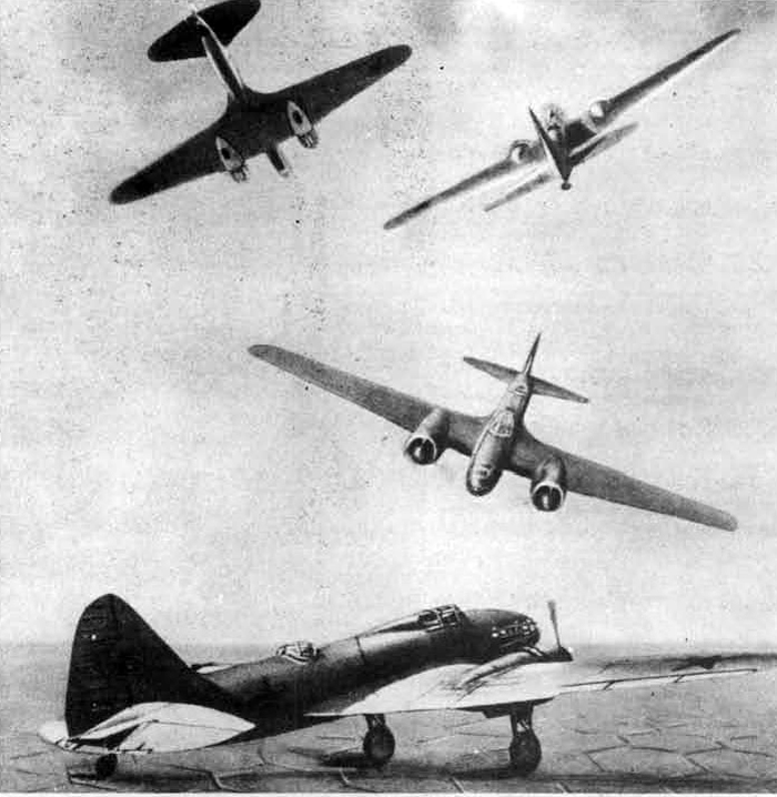
DB-3F
DB-3P PERFORMANCE
TYPICAL NORMAL LOAD
Starting weight: - 20,000? lb.
Landing weight: - 15,000 lb
Service ceiling: - 31,500 ft. (start), 35,500 ft. (finish)
Climb: - 21,000 ft. (height) 15.5 mins. (time)
Loads
Bombs or freight: - 2,200 lb.
Fuel tankage: - 350 galls.
Fuel weight: - 2,520 lb.
Maximum emergency speedi - 240 m.p.h., 295 m.p.h.
Maximum emergency altitude: - S.L. 21,000 ft.
Speeds and Ranges
Normal cruising average speed: 853 m.p.h.
Normal cruising altitude: - 21,000 ft.
Normal cruising range: 775 miles.
Normal cruising endurance: - 3.18 hours.
Normal cruising miles per 100 lb.: - 36.2
Maximum range
Average speed: - 180 m.p.h.
Altitude: - 21,000 ft.
Range: - 975 miles.
Endurance: - 5.5 hours.
Miles per 100 lb,: - 46.
OVERLOAD
Max. bombs - starting weight: - 23,000? lb.
" fuel " - 23,000? lb.
" bombs - landing weight: - 15,000 lb,
" fuel " : - 15,000 lb.
Special remarks: - Estimated data: no information to give more than
approximate performance, based on an engine-rated height which appears high.
Max. bombs - climb: 21,000 ft. (height)
Max. fuel - " 21,000 ft. (height)
Max. bombs - climb: - 18. min.
Max. fuel - " : 18. min.
Max. bombs - service ceiling; -29,000 ft. (start), 35,500 ft. (finish)
Max fuel - service ceiling: - 29,000 -ft. (start), 35,500 ft. (finish)
Max. bombs - bombs or freight; - 5,500 lb.
" fuel - " - 1,100 lb.
Max. bombs - fuel tankage: - 350 galls.
" fuel " - 880 galls.
Max.bombs - fuel weight: - 2,520 lb.
" fuel " : 6,350 lb.
Max. bombs - maximum emergency speed: - 225 m.p.h., 275 m.p.h.
" fuel - maximum emergency speed: - 240 m.p.h., 295 m.p.h.
Max. bombs -, maximum emergency altitude; - S.L. 21,000
Max. fuel - S.L. 21,000
Max. bombs - normal cruising average speed: - 240 m.p.h.
" fuel - " : - 252 m.p.h.
Max. bombs - normal cruising altitude: - 21,000 ft.
" fuel " - 21,000 ft.
Max. bombs - normal cruising range: - 720 miles.
" fuel - " : - 2,130 miles.
Max. bombs - normal cruising endurance: - 3.13 hours.
" fuel "; - 8.6 hours.
Max. bombs - normal cruising miles per 100 lb.; -34.3
"fuel " - 36
Maximum Range
Max. bombs - average speed; - 180 m.p.h.
" fuel " - 185 m.p.h.
Max. bombs - altitude: - 21,000 ft.
Max. fuel - altitude; - 21,000 ft.
Max. bombs - range; - 850 miles.
Max. fuel - " : - 2,570 miles
Max. bombs - endurance: - 4.8 hours
" fuel - " : - 14 hours
Max. bombs - miles per 100 lb.: - 40.9
" fuel " - 43.5
Note.—
(1) Ranges are Ideal still-air ranges; no reduction is made «, for operational tactics; assessment of range is made on the following basis: —
(a) An allowance is made for warming up and take-off, equivalent to 5
minutes at take-off power,
(b) A further allowance is made for the fuel used in climbing to the
operational height at the maximum rate of climb; the horizontal
distance eovered in the climb is credited to the range.
(c) No credit is given for glide-in at the end of the journey.
(2) Landing weight = Storting weight less fuel, bombs, ammunition and
any jettisonable load.
(3) Conversion of mileage per 100 lb. of petrol into consumption in gallons per hour: Gallons per hour = (13.2 x Speed (m.p.h.))/Miles per 100 lb.
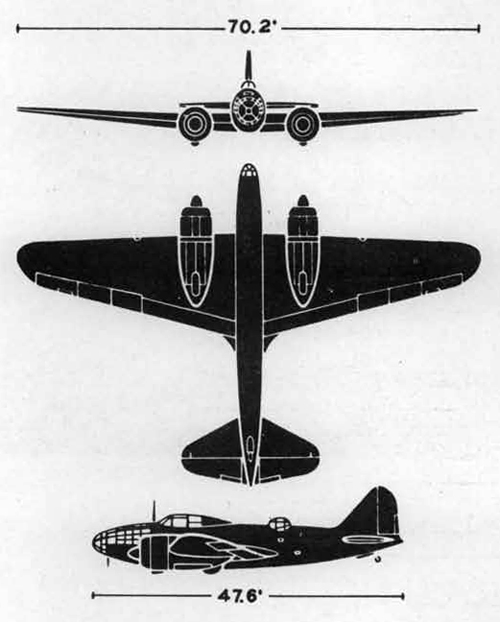
DB-3F
Usually fitted to carry torpedoes, by the Naval alrforce.
DE-3F
XVIII. SB SERIES
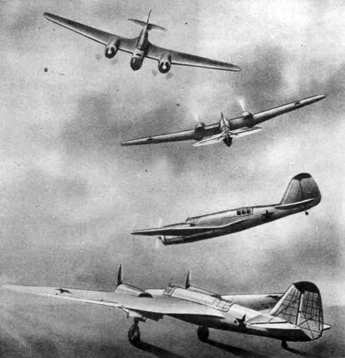
SB SERIES
History: - Original design apparently inspired by American Martin B-10.
Duty: - Bombing. Reconnaissance. Possibly ground-attack.
Type: - Twin-engine, mid-wing monoplane.
Crew: - 3.
Airframe characteristics: - Cantilever wing has pronounced taper to rounded tips. No sweep-back on leading-edge between nacelles. Wing of stressed-skin metal construction. Large fillets at roots. Flaps inboard and outboard of nacelles. Fuselage of stressed-skin metal construction. Single fin and rudder. Wire-braced tailplane. Pilot's cockpit over leading-edge of wing. Rear gunner's position over trailing-edge, Main wheels of undercarriage retract rear-ward into engine nacelles.
Engine installation and propeller: - Earlier machines with M-1CO engines had frontal radiators. Later machines with M-103 engines appear to have ventral radiators under nacelles. Exhausts discharge over wing. 3 blade c.s. metal propellers.
Armament installation: - Early machines had one gun in nose; later versions have two. Hose puns have little or no traverse. Dorsal turret (believed manual) often fitted.
Bomb, mine or torpedo installations: - internal stowage.
Remarks: - "SB-1" believed to have M-25 or M-100 enginee; "SB-2" is thought to have M-100's s or M-102's; "S.B-3's" have M-103. With M-100 engines the maximum speed would be about 250 m.p.h. at 15,000 feet.
Total fuel tankage - normal: - 350 galls.
Normal bomb load; - 1,540 lb.
Maximum bomb load: - 2,64.0 lb.
Typical bomb stowage - 6 x 100 kg.
Alternative stowages: - 2 x 250 and 2 x 50 kg.
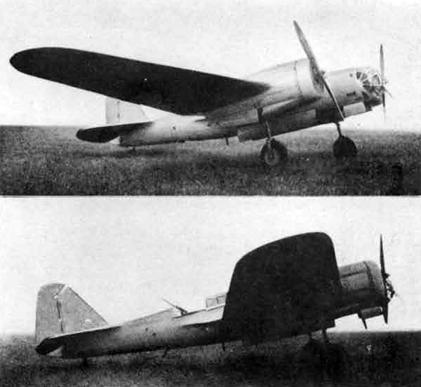
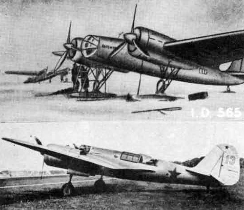
PERFORMANCE
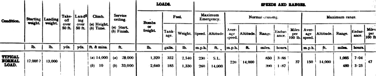
Note.—
(1) Ranges are ideal still-air ranges ; no reduction is made for operational tactics ; assessment of range is made on the following basis :—
(a) An allowance is made for warming op and take-off, equivalent to 5 minutes at take-off power.
(b) A further allowance is made for the fuel used in climbing to the operational height at the maximum rate of climb ; the horizontal distance covered in the climb is credited to the range.
(c) No credit is given for glide-in at the end of the journey. (2) Landing weight = Starting weight less fuel, bombs, ammunition and any jettisonable load.
(d) Conversion of mileage per 100 lb. of petrol into consumption in gallons per hour : Gallons per hour = (13-2 x Speed (m.p.h.))/
Miles per 100 lb.
GENERAL DATA
Power Plant:
No. of engines: 2; Type: M-103.; Characteristics: 12-cyls."V" Liquid-cooled; Max. power: 950 h.p.; Height: 11,800 ft.
Dimensions:
Span: 66.9 ft.;
Length: 41.0 ft.;
Height:
Wing Area: 615 sq. ft.
Armament:
For'd fuselage: 2 x 7.6 mm (M);
Dorsal: 1 x 7.6 mm. (M);
Ventral: 1 x 7.6 mm. (M)
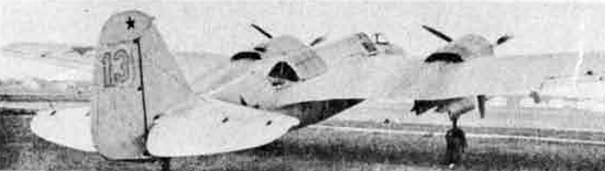
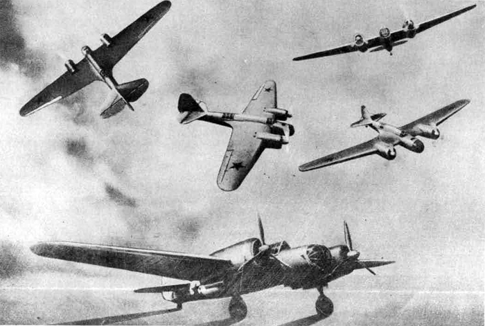
SB series
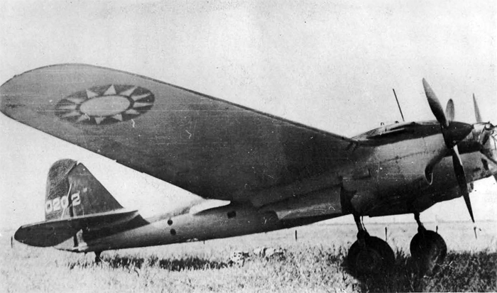
SB-3
XIX. LA-5 ((LAVOCHKIN)
It is reported that the LA-5 is the latest Soviet fighter. Reports indicate that it has teen employed by the Naval Airforces in the Black Sea area.
No other information is available as to this latest fighter. It may be assumed that it is a later model of the Lagg-3.
XX. YAK-7
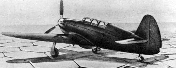
YAK-7
The YAK-7 is listed by official Soviet sources as e "training plane". However, it has also been mentioned as a fighter, supporting IL-2 in operations with the Baltic Sea Fleet.
It is not believed that the YAK-7 is in general use by the Naval air arm.
XXI. FOREIGN TYPES
Through the Lend-Lease arrangement the Soviet Air Force has been supplied with a large number of American and British aircraft. The Naval Air Forces have received a number of these planes. Formations of P-40's have been identified patrolling in the Black Sea area. Hurricanes and P-39 Alracobraa are a comnon sight in the Murmansk-Archangel area.
The following are some of the "foreign" types used by the Soviet
Air Forces:
P-39 Airecobra
Hurricanes
P-40
P-51
A-20
B-25
DC-3
C-47
C-53
AT-6
K. GUNS USED IN AIRCRAFT
Guna in current use in Soviet aircraft are generally of calibres accepted by other air forces, but show many original features In design.
SHKAS 7.6 mm.
I. Shkas 7.62 mm.
This is the standard calibre gun used In the Soviet Air Forces. It is used both as a fixed and as a free gun.
The SHKAS is of original Russian design and has a number of unique features of which the two most outstanding are:
(a) Feed.
By cylindrical feed cage which is rotated by a feed arm; a helical groove situated in a drum draws the rounds from the belt as the belt is progressed, by engaging the rims. The rounds are fed into the underside of the body, the gas cylinder and piston being on the top side of the barrel. The feed cage holds 10 cartridges.
(b) Ejection.
The ejection openinn comprises a tube which is situated on the top left side of the body. The ejector consists of a cam operated rod with an arm which sweeps the empty case off the face of the breechblock. The case comes forward, propelled by the piston in its forward travel, and ejects from the tube. Thia results in outside clearance of cases which do not fill the cockpit.
The SHKAS 7.62 mm. gun is carried in the following aircraft:
Fixed: 1-15 biss, 1-16, LAGG-3, MIG-3, YAK-1, IL-2, PE-2, SU-2, YAK-4, KOR-1, I-153.
Free: DB-3, DB-3F, PE-2, SB Series, SU-2, TBE-3, TB-7, YAK-4, GST, KOR-1, MBR-2, MBR-6.
II. 12.7 mm. gun - U.B.C., U.B.K.. and U.B.T.
There are three versions of the 12.7 mm. gun, as designated above. The U.B.C. is fixed, synchronized, the U.B.K. is fixed and not synchronized, the U.B.T. is a free gun.
These guns are gas-operated, and fed by disintegrating metal link belt. A rate of fire between 800 and 1,000 rounds per minute is achieved. Tracer, A.P.I, and H.E. ammunition is provided.
The following aircraft are fitted with this gun: Fixed: LAGG-3, MIG-3, YAK-1. Free: PE-2, TB-7.
III. Shvak 20 mm. Fixed and free puns of thii designation are in use. The design is entirely Russian. The gun is very compact. Feed ejection and operation follow the same principle as on the 7.62 mm. gun. The rate of fire is 950 rounds per minute. Shvak 20 mm. is carried in the following aircraft: Fixed: IL-2. Free: TB-7.
IV. 37 mm, gun
No information is available on this gun. However, Soviet planes have been recently observed to be in the process of being equipped with the 37mm. gun.
The rate of fire is believed to be 250 to 300 rounds per minute.
Chapter X. COAST DEFENSE
A. Organization
The Coast Defense Administration of the Peopled Commissariat of the Navy is in charge of coast defenses of the USSR, which include coast artillery defense, fortresses and batteries, coastal antiaircraft defense, fortresses and batteries, mine barrages, the marine corps, the coast guard, military ports and naval depots. It should not be confused with the Coast Guard Division of the Border Guard Administration of the N.K.V.D.' (Secret Police), which is completely independent of the Navy.
B. Coastal and Anti-Aircraft Defense
The Soviet Navy is responsible for coastal and port defenses, including anti-aircraft defense. Most of the coastal forts (of which there were 104 in 1939), include AA guns in their equipment, and, in a great many cases dual purpose guns are used.
The Red Army is responsible for AA protection of military equipment. A council of AA Defense, said to have been formed several years ago, is charged with the AA defense of areas not included in Army or Navy defenses.
C. Marine Corps
Little information is available on the Soviet Marine Corps; in August 1943, official Russian sources 3tated that there was no Marine Corps in the strict sense of the word, but that personnel from the various branches of the Navy are organized into emergency units along Army lines; the reason for this is said to be simply to make use of personnel not otherwise engaged. There are believed to be about 125,000 officers and men thus organized and fighting on the front; there may be additional units back of the lines* This force is divided into a-bout thirty-one brigades, which are composed of about 4,000 officers and men each* Twelve of these brigades are stationed on the Finnish front, two at Leningrad, three along the Volkhov River, one below the Volkhov River, one at Voronezh, and five in the North Caucasus; seven of these brigades, although believed to be stationed at the front, have not been located as yet.
D. Coast Guard
The Soviet "Coast Guard", a part of the Coast Defense Administration, is not at all similar to the U.S. Coast Guard but is rather a highly developed information service, responsible to the Naval High Command for information regarding all happenings in the coastal zone. It is also responsible for naval telegraph and telephone lines and radio stations along the coast. All the more important ports are provided with apparatus for taking simple meteorological observations.